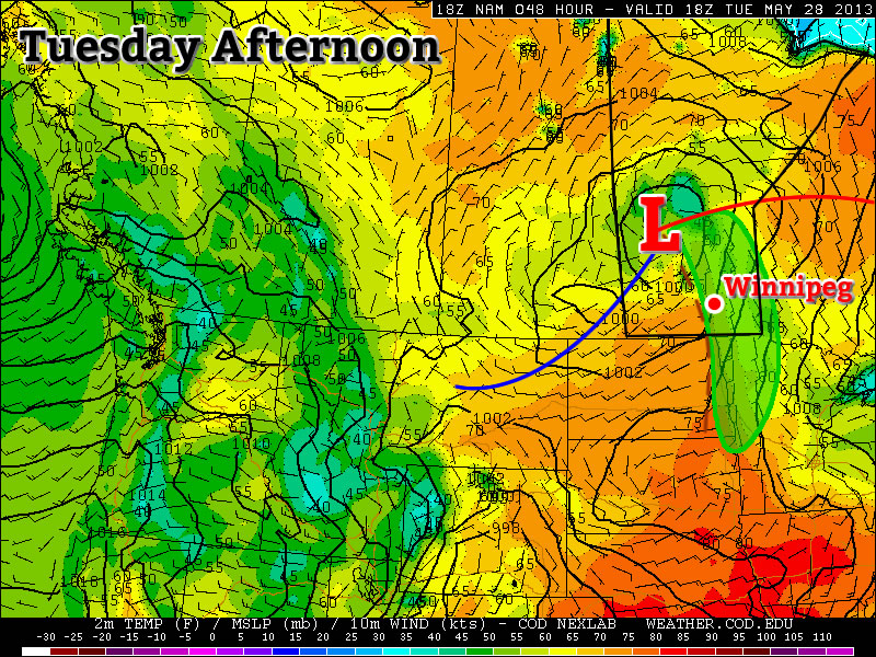
One of our first risks for thunderstorms will come early this week.

Monday
Mainly cloudy. Chance of showers.
21°C / 15°C
Today should be a generally dry day in Southern Manitoba with only a chance of showers. There is also a slight risk of a thunderstorm, but any storms that develop will be relatively weak. Temperatures will be in the upper teens or lower twenties in most areas under mainly cloudy skies. The wind will be from the south-east.
Our next reasonable chance for rain will likely come tonight night as a powerful impulse generates an area of rain. This rain is currently expected to be heaviest over Western Manitoba, but may affect the Red River Valley as well, albeit with lesser amounts. It is entirely possible that this rain could miss us completely, but it is too early to say exactly what will happen.
Tuesday
Risk of a Thunderstorm
23°C / 10°C
Tuesday should feature our best chance of thunderstorms this week. A low pressure system and its associated cold front will pass through Southern Manitoba at some point during the day – likely through midday – and may trigger some storms. These storms are expected to be non-severe, but if there is a bit more instability than currently expected, there is a very slight chance that one of two may become marginally severe. The main risks with any storms that develop will be hail, perhaps up to nickel size, and gusty winds. The storms should be fairly fast moving so heavy rain is a lesser concern. Other than this chance of thunderstorms, there will also be a general chance of showers through the day. Temperatures will be in the low, or maybe mid twenties (depending on how the weather features setup), with a southerly flow switching to a westerly flow after the frontal passage.
Wednesday
Mainly Sunny
23°C / 8°C
No significant precipitation is expected in Southern Manitoba on Wednesday, except again for the odd shower. Temperatures will be in the upper teens or lower twenties with mainly sunny skies.
Long Range
At this point the long range forecast is fairly ambiguous, as it often is at this time of year. In the nearer term, it appears we may experience another significant rainfall event later this week as a powerful low pressure system develops to our south. This system may trigger severe storms in the US Plains, while bringing us a bought of rainfall. In fact, this system is looking quite similar to the one that brought parts of Southern Manitoba 200mm of rain and triggered severe storms, including the Moore, OK tornado, in the US a week ago. There is still significant uncertainty in terms of how this next system will play out and at this time it isn’t expected to produce the massive rainfall amounts that the last one did. We’ll have more details on this system on Wednesday. What happens beyond the end of this week is too uncertain to discuss right now.
