After a major temperature setback on the weekend, we’ll see summer gradually return this week.
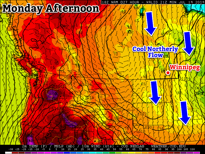
Monday
Today will be cool, with temperatures remaining well below normal values. High temperatures will be in the upper teens or lower twenties, with a breezy north-west wind. We may also see some light shower activity during the day as pop-up showers develop with daytime heating.
Tuesday
Tuesday will be a pleasant day, but it will still be on the cool side. Temperatures will be in the low twenties and winds will be relatively light. Some convective cloud cover will develop by the afternoon, and perhaps a stray shower here and there as well, but it won’t amount to anything of significance.
Wednesday
Wednesday will see temperatures recover further, with values in the low to mid twenties. Cloud cover should be less than earlier in the week and winds will remain light.
Long Range
The long range forecast is looking more summer like. Some models suggest we’ll see temperatures climb into the thirties either late this week or on the weekend. As temperatures begin to climb, the humidity likely will as well. That additional humidity means that the thunderstorm risk will begin to increase again. It’s too early to say if we’re looking at more severe storms, but that potential is usually present under humid conditions.