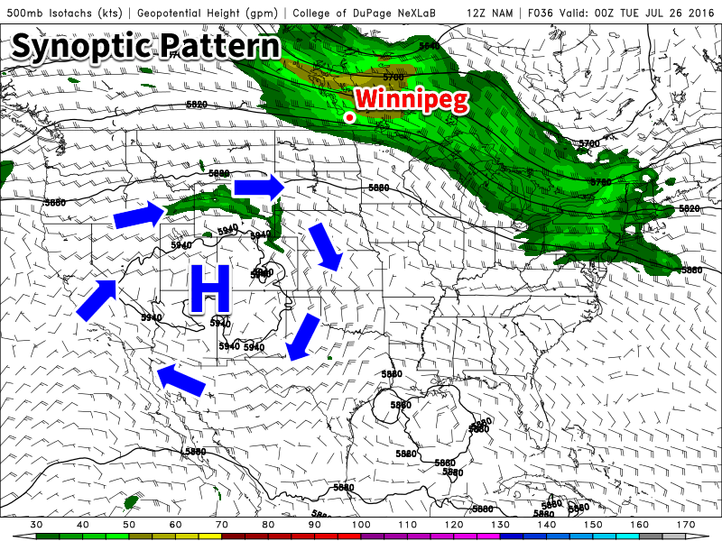
We will be in a much drier and calmer pattern early this week as an upper ridge of high pressure build over western North America. This should provide many areas an opportunity to dry out after what has been an exceptionally wet pattern over the past two months.
This Week
Today will be a nice day in southern Manitoba. High temperatures will climb up near the 30C mark in most areas under mainly sunny skies. Winds will be westerly near 20 km/h, offering a bit of natural air conditioning from the heat of the day.
Tuesday will see a bit of a cool-down from today as a cold front brings a cooler air mass to the region. However, it won’t be a significant cool-down, as high temperatures will remain in the mid twenties. Winds will shift to northerly at around 20 km/h. Skies will be a mixture of sun and cloud as some high-level cloud moves through the region.
Wednesday will see temperatures once again in the mid twenties under a mixture of sun and cloud. Winds will be light as we sit within a slack surface pressure regime.
Long Range
The long range forecast shows us remaining under the influence of high pressure aloft until at least the end of the week. This should generally mean warm and dry conditions, although the odd thunderstorm cannot be ruled out. It doesn’t appear that an organized precipitation should be expected until next week, although some models hint at perhaps a semi-organized convective system affecting border regions midweek. However, it’s too early to say if such a system may transpire.