
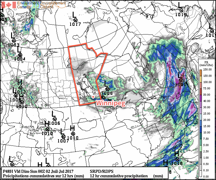
Conditions are set to gradually settle as the upper low responsible for the stormy weather of late begins working on an exit from Manitoba. There will be a couple more chances for showers, but conditions will begin improving on Canada Day and lead into a stretch of hot and dry weather.
This morning will start with slight chance of a shower or two through Winnipeg and the Red River Valley as a cold front swings across, but then the chance for any rain quickly drops off and then skies will begin to clear out for the afternoon. Winds will be persistent out of the northwest at 20-30 km/h as temperatures climb to a high of just 19°C. Expect a low near 10°C under partly cloudy skies.
Canada Day
Canada Day will start off with cloud cover moving through the region and a chance of showers as the upper low that has been responsible for the showery and stormy weather the past few days finally moves through. Once the low is past, it should be mainly dry, however an isolated afternoon pop-up shower or two will be possible. The cloud cover should clear out towards the evening. Temperatures will continue below seasonal, with highs only around 19 or 20°C.
| Time | Temperature | Cloud Cover |
|---|---|---|
| 7:00 AM | 14°C | 40% |
| 10:00 AM | 17°C | 80% |
| 1:00 PM | 19°C | 80% |
| 4:00 PM | 19°C | 60% |
| 7:00 PM | 19°C | 40% |
| 10:00 PM | 16°C | 20% |
| 1:00 AM | 13°C | 10% |
Heading into the evening, temperatures will gradually fall towards the mid-teens for fireworks at 11PM. The clearing skies combined with lowest mosquito counts in 40 years should make for very pleasant viewing conditions! Just remember to bring a sweater! Temperatures will fall to a low near 11°C overnight.
Sunday & Beyond
Sunday will be a positively pleasant day compared to the last while. A sunny morning will give way to mixed skies in the afternoon as temperatures climb to a high near 23 or 24°C. No rain! Temperatures will then dip to a low near 14°C under partly cloudy skies.
All indications are that the heat is on next week! Temperatures are set to climb into the upper 20’s by midweek with increasing humidity as well. By the second half of next week, daytime highs near 30°C combined with dew point values near 17°C will make for days that feel like the mid-30’s. It also appears that it will be fairly dry, although Tuesday may bring the potential for some thunderstorm activity.
It’s worth noting that in addition to the warm daytime highs, the higher dew points expected to move into the region will also keep overnight lows mild — likely in the 17-19°C range — so it would be good to ensure that if you have air conditioning that it’s ready for the summer! It looks like the first blast of hot, muggy weather is on the horizon.
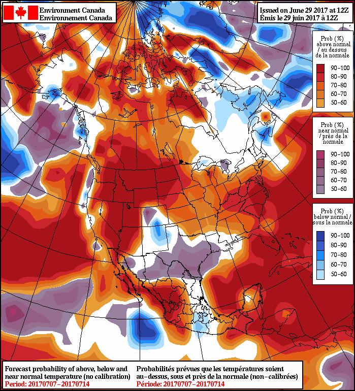
Heading into the longer-range, ensemble guidance continues to suggest that southern Manitoba will continue to see above-seasonal temperatures. It appears that the cooler temperatures of June will be left in the dust by the first significant stretch of summer warmth.
Winnipeg’s seasonal daytime high is currently 25°C while the seasonal overnight low is 13°C.