Temperatures will continue well above-seasonal in Winnipeg and the Red River Valley for a couple more days before a cold front sweeps through, shifting conditions back to a near-seasonal pattern.
A warm front that moved across the province yesterday afternoon and overnight has brought even warmer air into the province that will send temperatures soaring to highs in the low 30’s today. Winds will remain light and morning sun will develop into partly cloudy skies this afternoon. All in all, a beautiful summer day is in store for Winnipeg & the Red River Valley. Expect temperatures to dip to a low near 17°C tonight with just a few clouds and a light south wind at around 15 km/h.
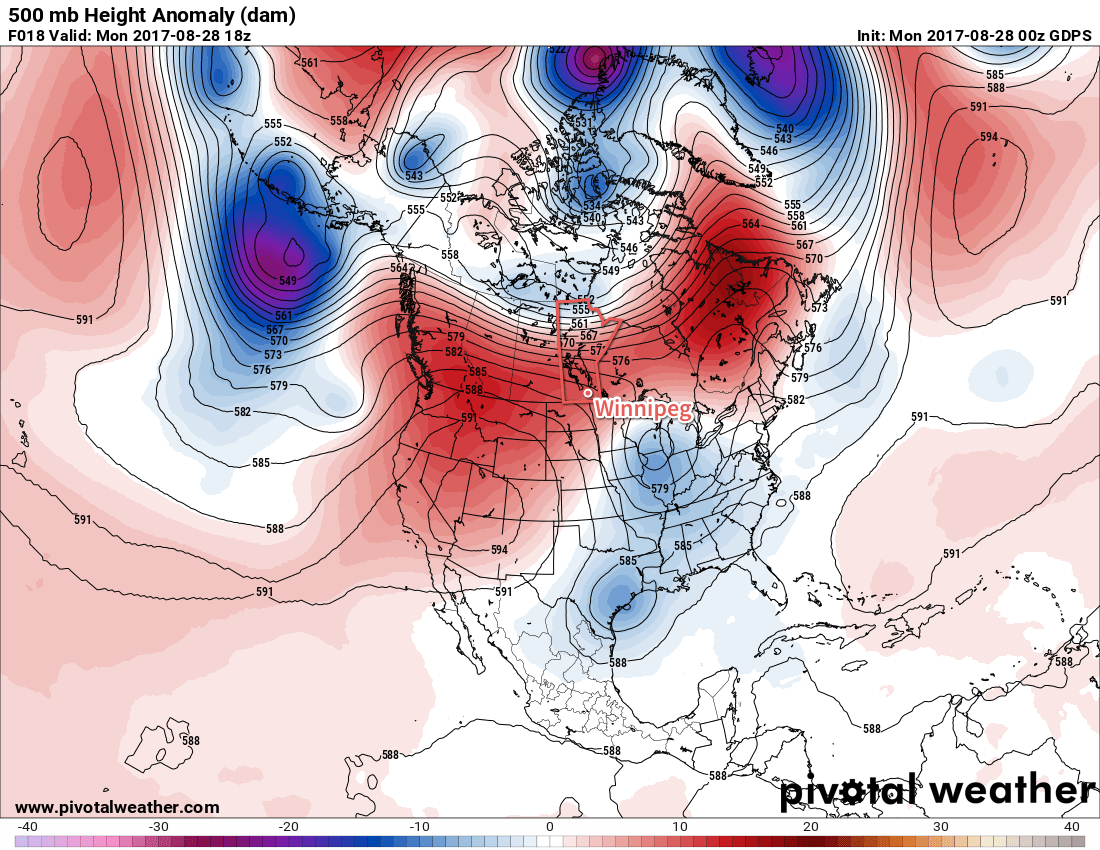
Tuesday will see temperatures once again climb towards the 30°C mark, but highs will be a bit cooler than Monday — around 29°C in Winnipeg, but possibly in the low 30’s closer to the US border — as the warmest air is shunted out by a cold front sweeping southwards through the province. Winds in Winnipeg will shift to westerly at around 15-20 km/h midday and then to northwesterly at around 30 km/h in the afternoon as the cold front moves through. Little rain is expected with the front in Winnipeg, but east into the Whiteshell and south and southwestwards into Sprague and portions of the southern Red River Valley, some thunderstorm activity will be possible in the afternoon. The cloud will clear out for the evening as temperatures head to a low near 13°C and winds diminish.
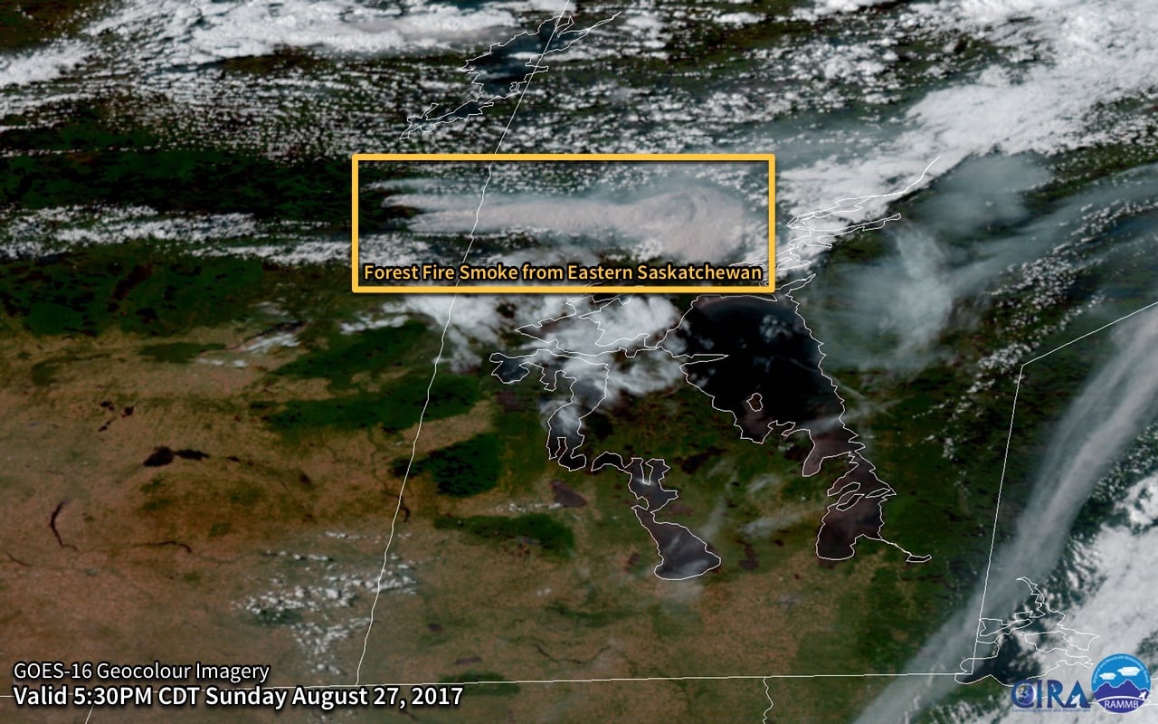
One thing to note is that when the cold front passes through on Tuesday, it’s possible that there will be some amount of smoke that moves into the region behind it from a large fire burning in eastern Saskatchewan. By the time it reaches here it will likely be fairly diffuse, but it may be thick enough to be noticeable.
Wednesday will be a pleasant day with plenty of sun, a high near 24°C and winds out of the east at 15-25 km/h. Temperatures will dip down to around 13°C on Wednesday night.
Long Range
The remainder of the work week looks quite nice with highs in the 25 to 28°C range. Thursday will bring sunny skies, but with an increasing southerly wind ahead of the next low pressure system crossing the Prairies. Friday will bring continued breezy southerly winds, more cloud, and the potential for showers or thunderstorms as the low crosses the province. Winds shift to the northwest for Friday night and then after scattered showers on Saturday, several days of below-seasonal temperatures look to move into the region.
Winnipeg’s seasonal daytime high is currently 23°C while the seasonal overnight low is 10°C.