Winnipeg may have managed to dodge the snow on Wednesday, but another disturbance moving through Saturday will blanket the city in snow, then be followed up by the first winter-like cold snap of the season.
Today will be a fairly benign day in Winnipeg as the disturbance that will bring snow to the region tomorrow develops over Montana and Saskatchewan. Before that arrives, the region will see a mix of sun and cloud with temperatures climbing back to a high near -2°C and light winds.
Clouds thicken up tonight as the inverted trough1 that will bring snow to the region advances across Saskatchewan. Expect temperatures to dip to a low near -5°C early before climbing back towards around -3°C by morning with winds picking up out of the east to around 20 km/h. Some light snow may move into the Red River Valley late overnight, but if this system ends up a bit slower then the snow may hold off until Saturday morning.
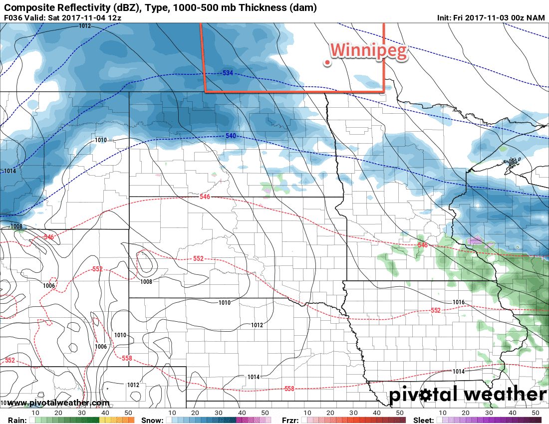
Saturday will bring snow to much of southern Manitoba as an inverted trough moves across the province. The snow will spread from southwest of northeast through the day, with the heaviest snow in the Red River Valley expected midday into the afternoon. The snow will taper off from west to east, beginning in the late afternoon over the southwest, then through the evening in the Red River Valley, and after midnight in the southeast. Between 5 and 10 cm of snow will likely accumulate across much of southern Manitoba, with the chance for localized pockets of slightly higher amounts, by the time the snow tapers off.2
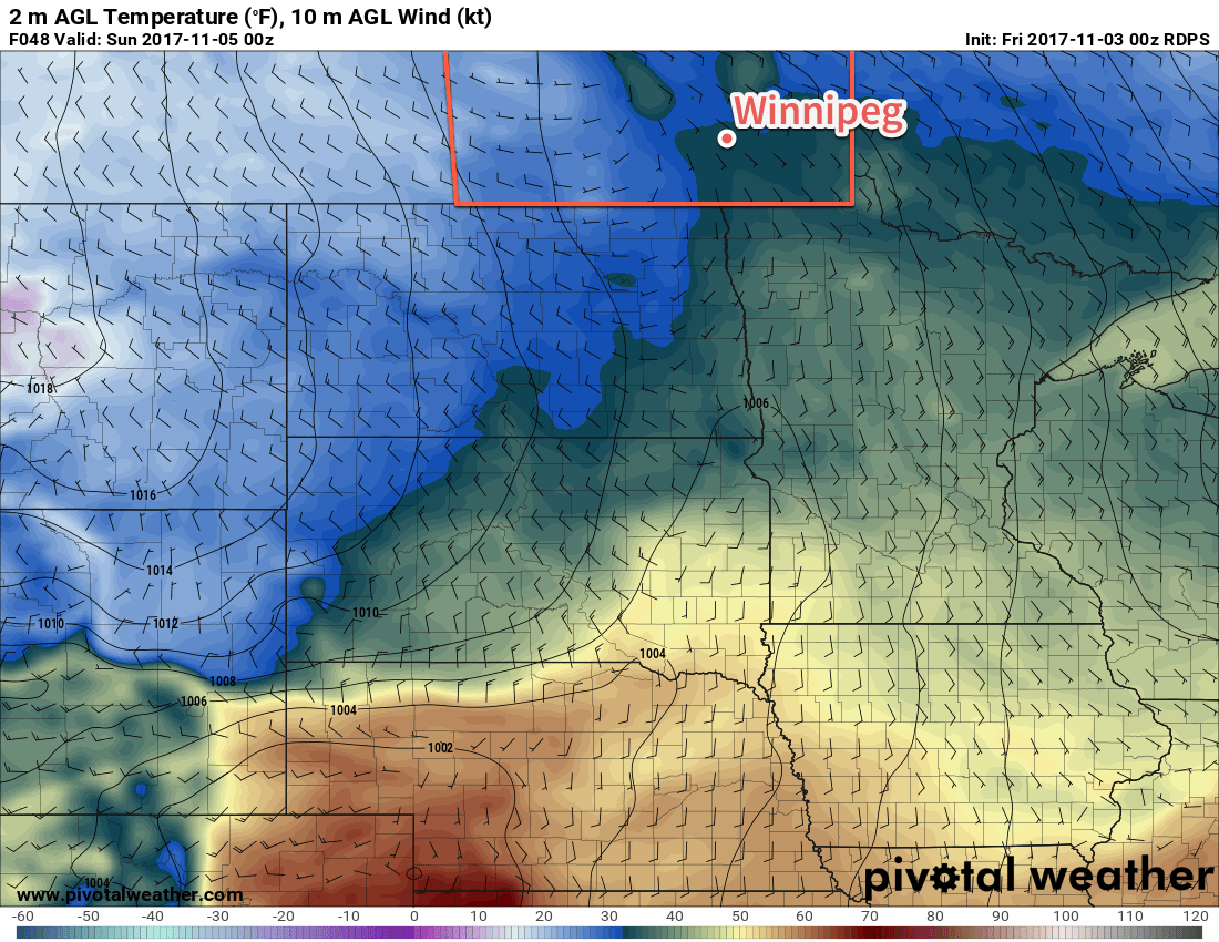
Aside from the snow, Saturday will bring more mild temperatures to Winnipeg with highs climbing to or just above 0°C. Winds will gradually ease through the day, but then pick up to 20 to 30 km/h out of the northwest overnight, making some blowing snow possible in open areas. Temperatures will dip down to a low near -4°C on Saturday night.
Sunday will bring mainly cloudy skies to Winnipeg, but temperatures will barely recover from the overnight low, reaching a high of just -2 or -3°C as northwesterly winds usher cooler air into the region ahead of an approaching Arctic high. Sunday night will be quite cool with lows sinking to near -13°C as skies clear out.
Long Range Outlook
In the wake of Saturday’s disturbance, cooler temperatures will flood into the Prairies as a persistent northwesterly flow aloft taps into Arctic air. Temperatures will remain well below-normal for much of next week, save for a brief reprieve in the latter half of the week when another low pressure system moves through, but then the cold temperatures surge back into the region. So bundle up and get your winter clothes out, you’ll be needing them!
Winnipeg’s seasonal daytime high is currently 3°C while the seasonal overnight low is -6°C.