Winnipeg will see a fair amount of cloud alongside some chances for snow or rain over the next few days, but it’s all in service of bringing in an unseasonably warm air mass that will remain in place for the entire week, making above-freezing high temperatures a common site into the weekend!
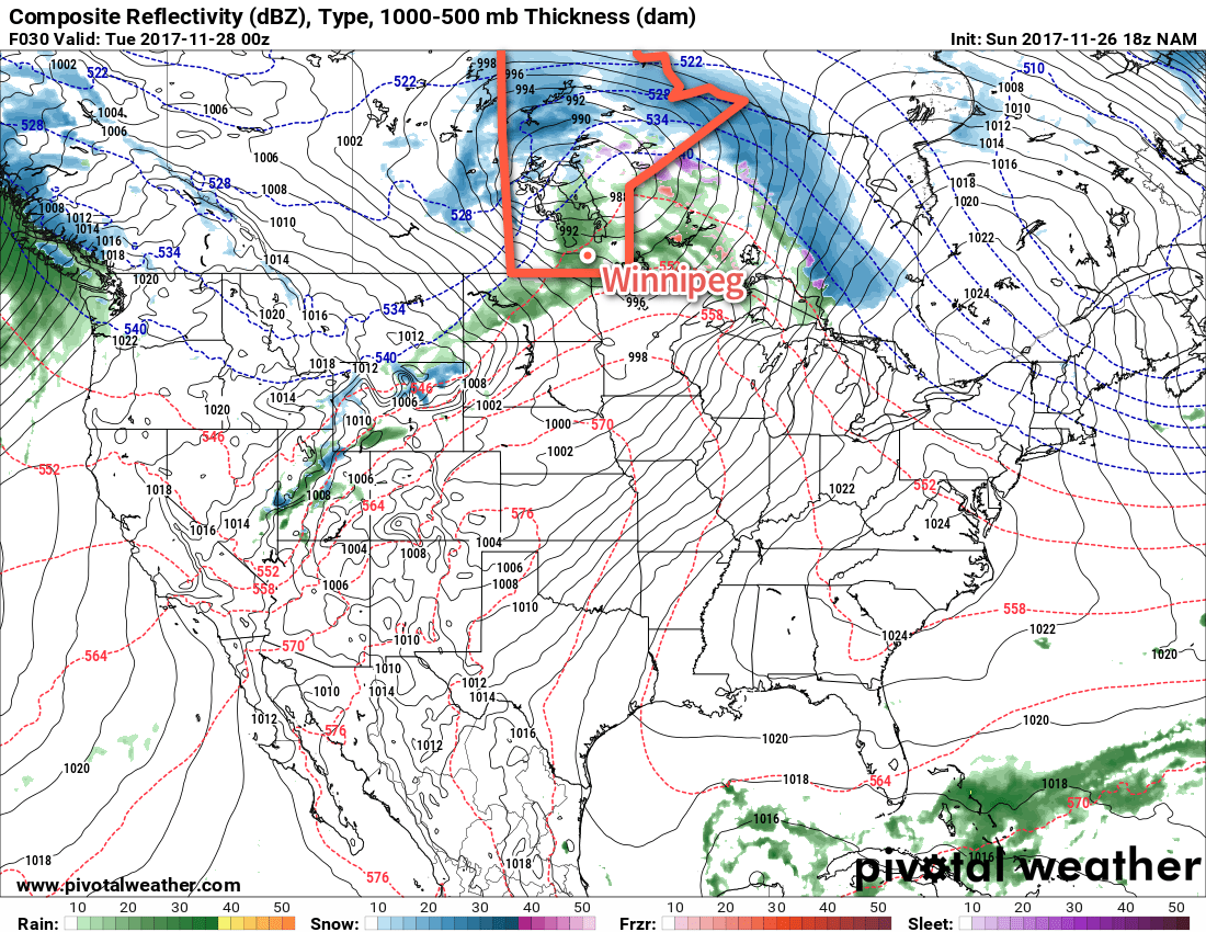
Today will bring cloudy skies to Winnipeg as a low pressure system passes through central Manitoba. As the warm front pushes through this morning, there will be a chance of some light rain or, if temperatures haven’t climbed above 0°C yet, some freezing rain – wouldn’t that be wonderful for the morning commute. Unfortunately, as of writing this on Sunday evening, there’s still significant disagreement in the models as to whether or not it will happen and any of the typical signals won’t show up until overnight, making it more of a last-minute forecast. If your plans are sensitive to freezing rain, I suggest you check the Environment Canada forecast for Winnipeg which was updated early this morning. After the warm front moves through, temperatures will reach a high near +4°C in the warm sector with calm winds as a trough of low pressure moves through. A few rain showers will roll through later this afternoon then a cold front will swing through, ushering in moderate west-northwest winds of 40 gusting to 60 km/h. These winds will persist through the night as temperatures head to a low near -3°C.
On Tuesday, a ridge of high pressure will work into the province from the west. As it approaches, winds will taper off and skies will become mixed as temperatures remain roughly near -4°C for much of the day. Skies will clear through the afternoon, and as the sun sets the light winds and clear skies will allow temperatures to drop quite quickly to a low near -7°C, but another warm front approaching will quickly move into the region after midnight, spreading cloud and milder air that will raise temperatures close to -2°C by Wednesday morning.
Wednesday will once again be a cloudy day in Winnipeg as yet another low pressure system tracks through central Manitoba. Temperatures will climb to a high near +2°C with breezy southerlies of 20-30 km/h. A trough will move through in the afternoon, bringing a chance of rain or snow with it. Any remaining precipitation will exit the region by late evening, but don’t expect the weather to get too cold: no big cold push seems evident behind this low! Expect a low near -5°C on Wednesday night with skies becoming mixed.
Long Range Outlook
The remainder of the week continues to look mild, with daytime highs in the 0 to +3°C range and overnight lows near in the -4 to -8°C range. Skies will be variably cloudy, and chances for rain or snow seem minimized until the end of the weekend into the beginning of next week, where a few more systems may move through that bring some precipitation to the region. Enjoy the unseasonal end of November warmth! Perhaps an earned break after the record cold that started off the month!1
Winnipeg’s seasonal daytime high is currently -6°C while the seasonal overnight low is -14°C.
- November 9th set new daily record for minimum daily maximum and minimum daily minimum temperatures. Yikes! ↩