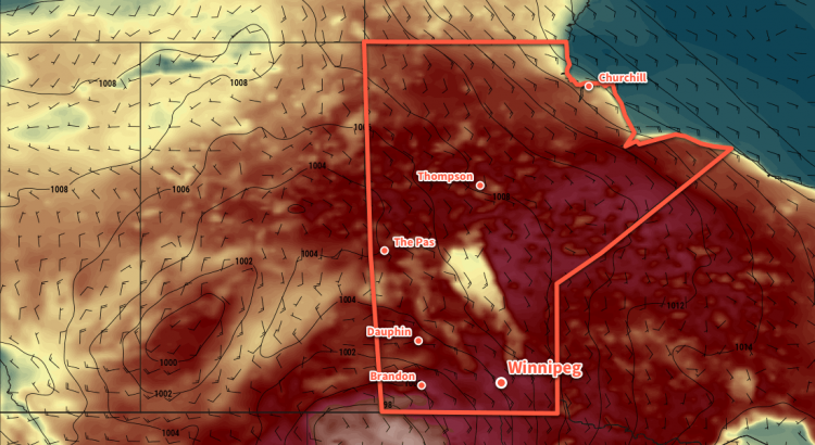
A potent low pressure system developing in Alberta today will bring southerly winds to the Red River Valley that will bring heat and humidity back into the region.
Today will be a beautiful day in Winnipeg. Morning sun will give way to some afternoon cloud as temperatures head towards a high near 26°C. Humidity will be low today, and winds will continue out of the southwest at around 20 km/h. Skies should clear out in the evening, then a relatively mild night is forecast with a low in Winnipeg near 16°C. After midnight there will be a slight chance of a shower or thunderstorm as a warm front lifts through North Dakota.
Thursday will bring mixed skies to Winnipeg with southeasterly winds increasing to 30 to 40 km/h. Temperatures will climb to a high near 28°C with humidity gradually increasing through the day. Attention then turns to southeastern Saskatchewan and southwestern Manitoba. By mid- to late Thursday afternoon, the potential for a severe thunderstorm outbreak exists. All of the ingredients are there for potent storms, however whether or not the storms develop as forecast will depend significantly on the region seeing enough sunshine and heating through the day.
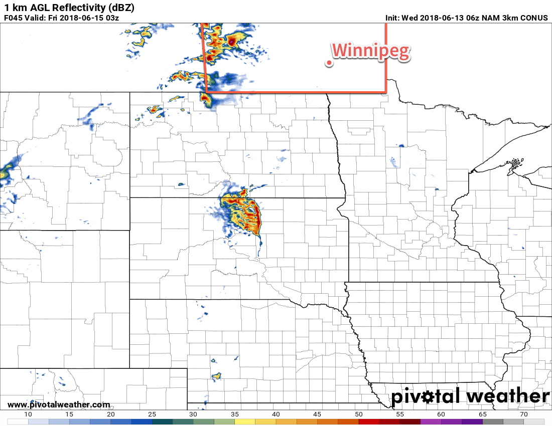
If all goes as currently forecast, then thunderstorms would develop and move onto western and southwestern Manitoba in the evening. Depending on how the thunderstorms evolve, the risk for severe thunderstorms with large hail and damaging winds may develop in the Red River Valley overnight. There is the chance that it misses the region, though. Some models suggest the best dynamics lift north of the region and the greatest energy collapses south. For now, know that there’s a chance of thunderstorms Thursday night, with a slight risk they’ll be severe.
Otherwise, Thursday night will a warm one with southerly winds of 15-25 km/h and a low near 19°C.
Friday will bring clearing skies to Winnipeg as a cold front sweeps through the region. It will still be warm with a high near 28°C, but the humidity should drop off markedly with the passage of the front. Winds will shift out of the west midday at around 20 to 30 km/h Winnipeg should see a few clouds on Friday night with a low near 14°C and calm winds.
Long Range Outlook
The weekend will likely bring a fair amount of cloud cover to Winnipeg as a significant storm system moves through the northern United States. At this point it looks like most of the precipitation will remain south of the border, but the Red River Valley may see some rain on Sunday afternoon into the evening. Temperatures will return to seasonal with highs of 23 or 24°C forecast for both Saturday and Sunday.
Winnipeg’s seasonal daytime high is currently 23°C while the seasonal overnight low is 11°C.
Brad how come SE SK/SW MB is always a focal point for all the storms all the time and why does everything fall apart when it comes to the RRV all the time? Storm systems from the west seem to always favour that area while systems from the south always favor everything south of the border, leaving us in a perpetual no mans weather land.
Hey Al,
Sorry for the long delay in getting back to you. I’ve been quite busy lately!
If you look at long-term lighting climatologies, they reveal two areas with the highest concentration of lightning strikes on the Prairies: the Alberta foothills and southeastern SK and southwestern MB. So you’re spot on with your observation.
The exact reason is a little hand wave-y, but generally speaking they’re far enough west to tap into slightly cooler air aloft as it exits Alberta and the Rocky Mountains, and also in a favourable location tap into the moisture and low-level dynamics that develop over the US’ Northern Plains, giving them a propensity to see thunderstorms that transition to nocturnal thunderstorms in the evening. If you look at when thunderstorms are most frequent from a climatological basis, you’ll see a general trend across the southern Prairies that goes from the afternoon on the Alberta foothills to late afternoon and evening near the SK/MB border, to overnight across southern Manitoba. Obviously there are thunderstorms outside these times, but those are generally the most likely times to see thunderstorms.
So that area you highlighted just happens to be in a sweet spot. It’s a confluence of many factors that gives the region a neutral preference to daytime vs. nocturnal convection on top of a relatively high number of thunderstorm days.
Thanks for the reply brad. If that’s the case does it make these areas climatologically wetter? I always thought that area to be more semi arid with its steppe landscape, being in that palisters triangle region