Winnipeg’s hottest, most humid day of the year is on the way with humidex values forecast to climb over 40 on Saturday. A cold front will push across the province Saturday evening, bringing the risk of severe thunderstorms to the region.
An upper-level ridge building over the Prairies will spread a southerly flow over Manitoba today. Tapping into Gulf of Mexico moisture over the American Plains, this southerly flow will draw very humid conditions northwards into the Red River Valley for Saturday.
Before that happens, though, Winnipeg will see a breezy and warm summer day today. Under sunny skies, temperatures in Winnipeg will climb to a high near 29°C with a southerly wind increasing to around 30 km/h midday then closer to 40 km/h by the evening. Those winds will keep the boundary layer well mixed through the night and keep the overnight low mild; Winnipeg should see a low near 21°C.
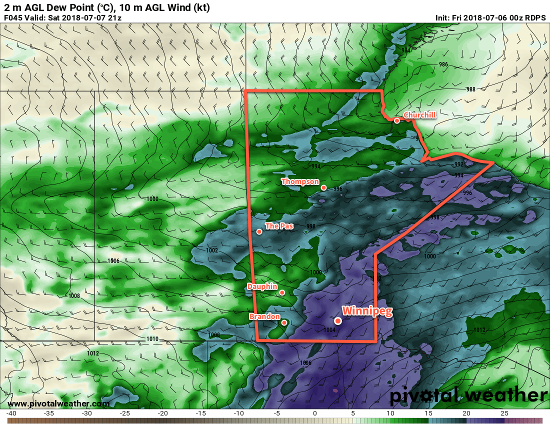
If you have a sensitivity to heat, then Saturday will be bringing dangerously hot weather into the region. A strong southerly wind near 40 gusting 60 km/h will continue to tap into the humid air mass to the south, pushing dew points into the low 20s across southern Manitoba. The humid weather will combine with daytime highs in the mid-30s – Winnipeg should see a high near 34°C – to produce humidex near or over 40. Humidex values are forecast to be most stressful1 between around 1PM and 8PM.
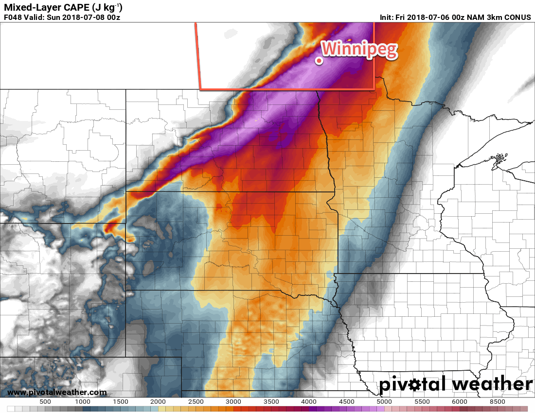
Skies will remain fairly sunny until a cold front arrives in the afternoon, bringing with it the threat of [severe] thunderstorms. While it’s a bit early to say too much with regard to the overall threat posed to the region, it goes without saying that a cold front pushing through that hot and humid air mass will pose the threat for severe weather. With over 4000 J/kg of MLCAPE forecast alongside 35 to 45 kt of 0-6 km bulk shear, the cold front would favour the development of discrete supercell thunderstorms capable of all modes of severe weather (very large hail, damaging wind gusts, and tornadoes).
The biggest unknown at this point is where exactly the thunderstorms will develop. A strong capping inversion should keep things quiet for most of the day, but thunderstorms will likely fire along the cold front early in the evening. Current forecasts place the cold front near or just east of the Red River near 6PM, making the threat conditional for the Red River Valley. Eastwards, towards the Whiteshell and the rest of southeastern Manitoba, the threat will be much greater.
Behind the cold front, westerly winds will begin to ease the humidity as the temperature heads to another mild low near 19°C.
Sunday will bring another sunny day to Winnipeg with northwesterly winds at 20 to 30 km/h and a high near 29°C. The dew point will continue to drop into the low teens, making for a much more comfortable day. Temperatures will drop to a low near 16°C on Sunday night under mainly clear skies.
Long Range Outlook
Next week looks like a prototypical July week: a fair amount of sunshine, plenty of warm days with daytime highs in the upper 20s, mild lows in the upper teens, and a chance for some showers or thunderstorms. The week looks great, but there is a chance that Winnipeg will see thunderstorms late Tuesday through the overnight.
Winnipeg’s seasonal daytime high is currently 26°C while the seasonal overnight low is 13°C.
- We identify stressful humidex values as those which exceed the body’s normal temperature of 37°C. ↩