Cloudy conditions return to Winnipeg as temperatures finally climb back towards seasonal values for a couple days.
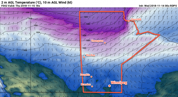
Seasonal temperatures will finally return to Winnipeg today as warmer air spreads eastwards across southern Manitoba. The city will see temperatures climb to a high near 0°C with southerly winds near 30 km/h. Some sunshine may appear through the morning hours, but the cloud cover should thicken up this afternoon. Skies will remain mixed to mostly cloudy overnight with temperatures dipping to a low near -4°C.
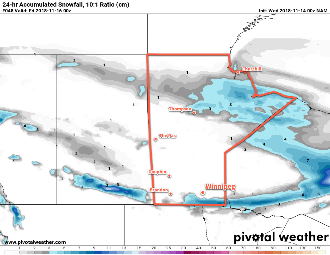
Thursday will be a slightly more active day as an upper-level disturbance ripples southeastwards through the province. As it moves into the region in the morning, it will spread light snow with a risk of freezing rain across the Red River Valley. Temperatures will be climbing towards a high near 0°C, so if freezing rain materializes there may be a few hours in the morning where untreated surfaces become quite slippery. The risk for freezing rain should end by lunchtime as cooler air begins pushing in from the north. Light snow will continue through much of the afternoon, then taper off in the evening. This band of precipitation will likely leave behind 2 to 4 cm of snow in its wake.
Where exactly this activity moves through is uncertain, though. Forecast models have been varying the position of the band of snow from Winnipeg to as far south as North Dakota. The general consensus at this point is that most of the precipitation will likely pass south of Winnipeg, closer to the American border. This outcome would leave Winnipeg with just mostly cloudy skies for the day.
Winds will start off calm in the morning and slowly pick up out of the northwest to around 20 km/h. Expect a mostly cloudy night with a continued chance of flurries and a low near -9°C.
Friday will bring much cooler temperatures back to the region as an Arctic air mass plunges southwards behind Thursday’s system. Winnipeg’s temperature will barely recover, reaching just -6°C. Winds will persist out of the northwest at 20 to 30 km/h and skies will remain mostly cloudy. There will be a continued chance for flurries through the day. Temperatures will head to a cold overnight low near -15°C on Friday night with mixed skies.
Long Range Outlook
Generally dry conditions are forecast through the weekend into the first half of next week, but temperatures will remain well below seasonal values. Some indications are that temperatures may moderate in the middle of next week, but the jury is still out on how believable that optimism may be.
Winnipeg’s seasonal daytime high is currently -1°C while the seasonal overnight low is -9°C.