Snowy and windy conditions will develop tonight across parts of southern Manitoba as a potent winter storm pushes northeastwards through the American Plains.
Winnipeg will start the day today with cloudy skies and a few fog patches. It won’t last too long though; skies will clear early this morning and temperatures will climb to a high near 0°C. More cloud will push in later this afternoon as the Colorado Low lifts northwards through the United States. By evening, snow will begin lifting through the Red River Valley into the southeastern corner of the province. As this happens, winds will strengthen out of the north, reaching 40 gusting 60 km/h by Thursday morning.
At the risk of sounding like a broken record, snowfall amounts will be tricky as once again as snow will quickly taper off on the northwestern side of this system. Right now it looks like that line will run roughly through Winnipeg, with amounts quickly dropping off to nothing northwest of the city and increasing to ≥ 10 cm to the southeast. That said, if this line shifts in either direction by even 20-30 km, that could be the difference between no snow or 10 cm of snow. Right now it appears that the city will get around 2-5 cm of snow by the time it tapers off, but we’ll keep an eye on things in case this system trends westwards.
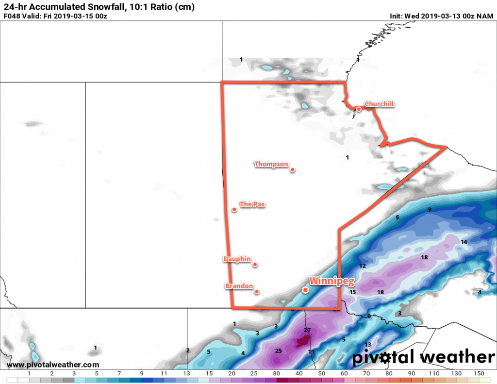
The American NAM model keeps almost all of the snow southeast of Winnipeg. 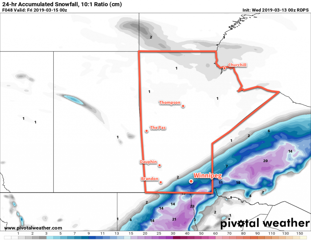
The Canadian RDPS model brings almost 10 cm of snow to Winnipeg.
Temperatures will remain steady near -2°C on Thursday with northerly winds continuing at 40 to 50 km/h. Blowing snow shouldn’t be too much of an issue, except for the southeastern Red River Valley. In that area, moderate snow will combine with the strong winds to produce poor visibilities in snow and blowing snow. In Winnipeg, any remaining snow should taper off mid-morning but skies will remain cloudy through the day. The wind will ease through the evening to around 20 km/h. The clouds should break up a bit overnight as temperatures head to a low near -8°C.
Friday will bring mixed to mostly cloudy skies as some morning sunshine gives way to afternoon cloud. Temperatures should reach a high near -4°C and winds will remain out of the northwest at about 20 km/h. Cloudy skies should remain in place Friday night with a low near -13°C.
Long Range Outlook
The weekend looks pleasant with temperatures returning 0°C, variable cloudiness, and light winds. Daytime highs will continue to climb into the low single digits next week.
Today’s seasonal daytime high in Winnipeg is -1°C while the seasonal overnight low is -11°C.