Winnipeg will say goodbye to the hazy skies and seasonably warm temperatures as a cold front ushers an Arctic ridge back into the region for the weekend.
Breezy northerly winds near 30 gusting 50 km/h behind will bring markedly cooler temperatures to Winnipeg today. After reaching 30.4°C yesterday, the city will find itself over 10°C cooler with a high of just 18°C. Skies will be sunny, but it’s likely that we’ll see some haze in the morning as forest fire smoke moves through. The winds will ease off this evening as temperatures head to a rather cool low near 4°C under clear skies.
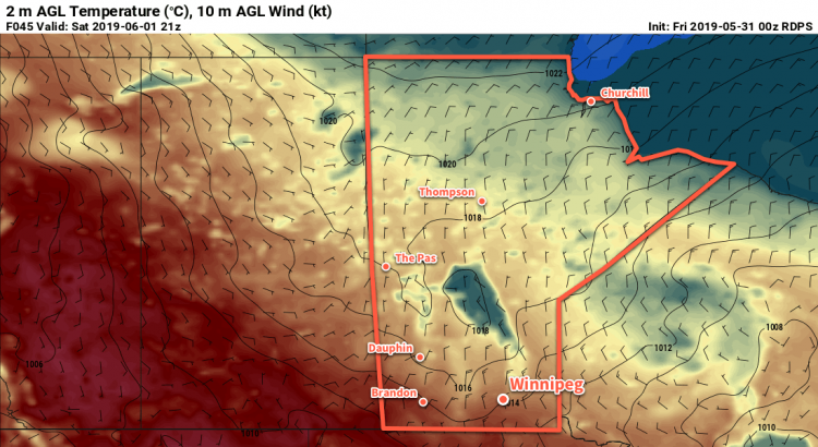
Temperatures will be even slightly cooler on Saturday as the Arctic ridge builds into the region. Winnipeg will see a high of 17°C with breezy northerly winds picking back up in the morning under sunny skies. With the ridge moving through on Saturday night, temperatures will cool off to another cool low near +3°C.
Sunday will be pleasant with mainly sunny skies and light winds. Temperatures will start to recover; Winnipeg should see a high around 20°C. Winds will begin to pick up out of the southeast on Sunday night as a low pressure system over Alberta begins to push eastwards across the Prairies.
Long Range Outlook
The heat returns next week with highs climbing back into the upper 20s to start the week. This weather pattern will differ from the heat on the weekend; instead of a dry westerly flow, southerly winds in the low level will begin pulling humidity northwards out of the American Plains. With disturbances cross the region being able to tap into some moisture, it’s likely that Winnipeg will see variable cloudiness with chances for showers or thunderstorms.
The warm weather looks to continue right through the week. Summer arrives! This also means that Winnipeg will likely be entering into the start of the summer severe weather season over the next week or two. We’d like to remind our readers that you can access Environment & Climate Change Canada’s official thunderstorm outlook product on our bulletin viewer. This product updates twice a day: first for “today” during the early morning, then for “tomorrow” in the afternoon. It’s a great resource for finding out what sort of thunderstorm activity may occur in your area!
Today’s seasonal daytime high in Winnipeg is 22°C while the seasonal overnight low is 8°C.