A complicated, slow-moving upper low over the Prairies will bring cloudy conditions with a chance for showers to the Red River Valley this weekend.
Winnipeg will see mostly cloudy skies today as cloud cover moves in ahead of the upper low building into Saskatchewan. As a result, the daytime high will be a bit lower than yesterday at a seasonal 24°C. The wind will be more pronounced than yesterday too, picking up out of the southeast to 30 gusting 50 km/h. The city should stay dry through the day, but the chance for showers increases heading into the evening. Showers are likely overnight as temperatures dip to a low near 15°C.
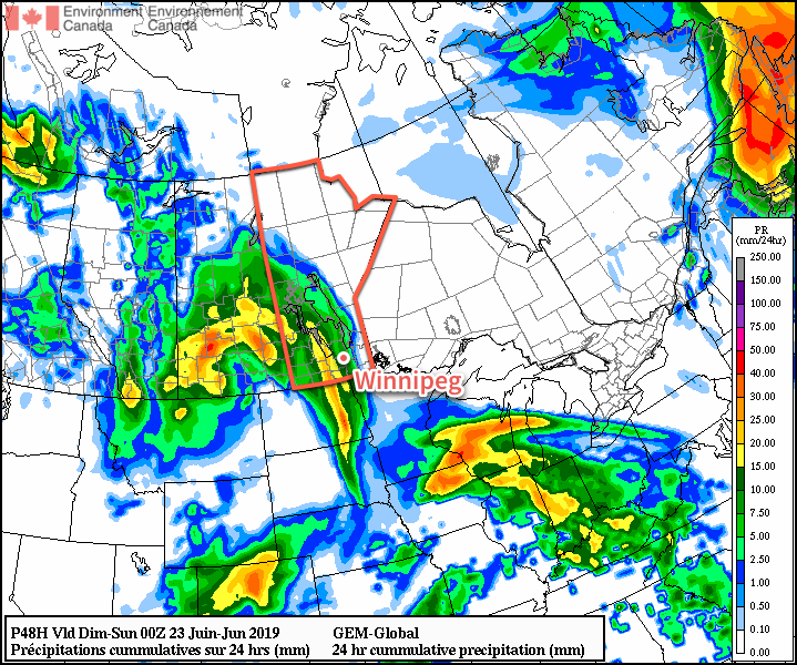
On Saturday, Winnipeg will see more showers in the morning as an upper-level feature called a trowal1 moves through. There is still a lot of uncertainty as to how much rain will fall, but the general agreement is that much of the Red River Valley will likely see 5 to 15 mm Friday night through midday Saturday. The showers should scatter out through the afternoon hours. With all the cloud and precipitation, temperatures will be cooler with a high near 22°C in Winnipeg. Winds will continue through the day out of the south at 20 to 30 km/h.
By Saturday evening, the cloud cover should begin to break up as any remaining showers exit the region. Winds will keep out of the south near 20 km/h through the night with temperatures dipping to a low near 14°C.
Sunday will bring mixed skies to the city as the region moves into the dry slot of this system. With the return of some sunshine, temperatures will climb back to seasonal values with a high near 24°C. Winds will also gradually shift to the west through the day and then ease from 20 km/h to light through the evening. The city should see a low near 15°C on Sunday night.
Long Range Outlook
Much warmer temperatures will build into the region next week as a strong upper-level ridge develops over the eastern Prairies. Next week looks to be the first extended stretch of heat this summer. Daytime highs will be in the upper 20s, potentially reaching 30°C by the end of the week, while overnight lows stay in the mid- to upper-teens. Humidity levels are forecast to be comfortable through much of the week, but may begin to climb into muggier values next weekend.
Forecasts show mainly dry conditions through the week, but with the heat moving in there may be several chances for thunderstorm development.
Today’s seasonal daytime high in Winnipeg is 24°C while the seasonal overnight low is 12°C.
- A trowal is a trough of warm air aloft, more specifically defined as the cyclonic branch of the warm conveyor belt of a mature, occluding low pressure system. ↩