Cool weather continues this week with more precipitation in the forecast. Another batch of snow is heading to the province on Wednesday, followed by another winter storm on the weekend.

Yesterday’s sunshine will be gone today as more cloud builds into the region. Warmer air moving in aloft will bring the cloud, but the southeasterly wind will keep it cooler near the ground. Winnipeg will see a high just above freezing today.
Some light snow will push into the region tonight ahead of the warm front. The snow should start sometime after 7PM and continue into the overnight period. Winnipeg should see around 2–4 cm by Wednesday morning with lesser amounts to the south. Lows will stay mild with the approach of warmer air; Winnipeg should dip to around 0 °C overnight.
On Wednesday morning, a second area of snow will blossom along the cold front and upper jet in North Dakota. This will push into the Red River Valley mid-morning, bringing a second batch of snow to the region. The precipitation should ease later in the afternoon with another 2–5 cm accumulation in the affected areas. The above-freezing temperatures will help compact and melt some of the snowfall as the day goes on. Winds will ease through the day as the low centre moves across the province. Today’s high will reach the low single digits.
Temperatures will dip down to around freezing again on Wednesday night. A few flurries will are likely as well. Northerly winds will pick up into the 30–40 km/h range overnight on the backside of the departing low.
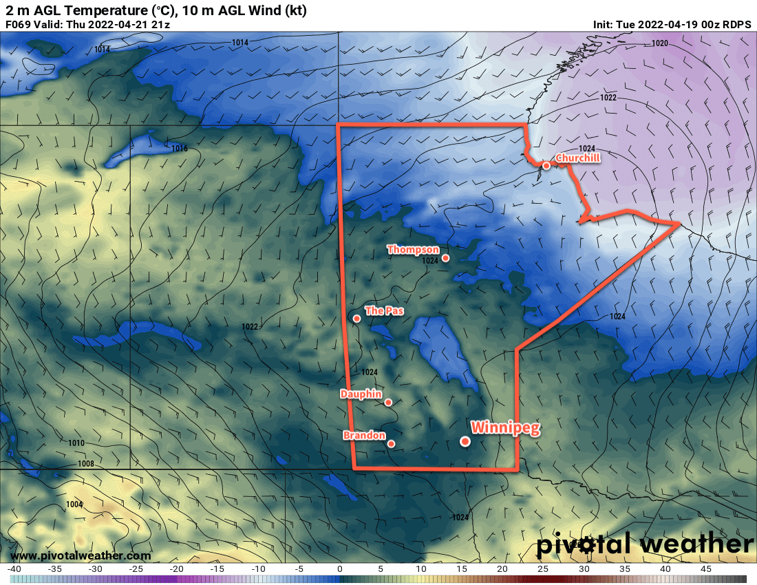
A ridge of high pressure will slide into the province on Thursday, bringing gradually easing winds and some sunny breaks to the region. A high again in the low single digits will continue the below-normal temperature trend in the region. Temperatures will dip to around the freezing mark again on Thursday night with cloudy skies.
Long Range Outlook
Beginning on Friday, the region will start to be affected by a strengthening Colorado Low. While the low centre will stay well south in the United States, precipitation will move into the province already on Friday.
There’s a lot of uncertainty as to what exactly will fall over the province. The Canadian long-range model is trending warmer with most of the precipitation falling as rain. The American models are slightly cooler and trend towards a snow/ice pellet solution. The ECMWF model, on the other hand, sits somewhere in the middle. It has a mainly rain event for the Red River Valley, southern Interlake, and southeast corner of the province. For southwestern Manitoba, the Parkland, and northern Interlake, it produces a mix of ice pellets and snow.
This will be a multi-day system that impacts
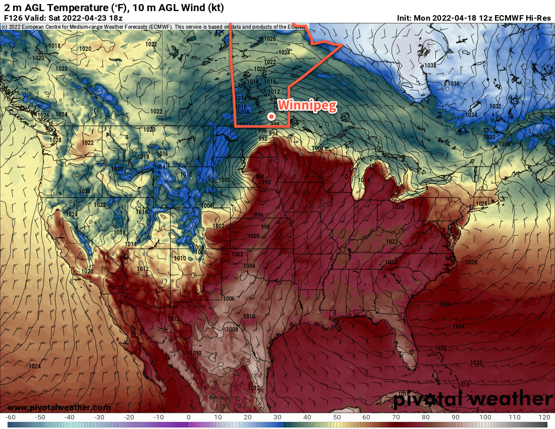
the region through Sunday. For areas in western Manitoba, it’s looking like it will be another considerable dump of snow with 20–50 cm possible in some areas. Western Manitoba is also looking like the most likely region to see fairly persistent precipitation through the event. Further east, the precipitation will come in multiple waves separated by relatively benign weather with perhaps a bit of drizzle.
In the waves that do move through, the rain or snow may be quite heavy at times, driven by convective elements. With the snow already on the ground across parts of the region, this could result in rapid snow melt. If you live in a property that has grading issues, you may want to move snow away from your home/foundation before the weekend to help minimize any potential overland flooding risks.
As with the last Colorado Low, this system will also likely see a dry slot wrap into southern Manitoba, most likely for the Red River Valley and areas east. This would result in a 6–12 hour break of benign, mild weather with the only real threat being a bit of drizzle.
As the low pushes off to the east on Sunday, some areas that have only seen rain may see some accumulating snow as well.
We’ll be keeping an eye on this system as it develops through the week and have more details in our Friday forecast!
Today’s seasonal daytime high in Winnipeg is 12 °C while the seasonal overnight low is 0 °C.