Cloudier Second Half Of The Week Coming Up

Cloudier conditions will be on tap for Winnipeg & the Red River Valley through the remainder of the work week, however with little precipitation expected and seasonal to slightly above seasonal temperatures, conditions will be fairly pleasant.

Skies will be mixed to cloudy across Winnipeg & the Red River Valley today as a complex disturbance in the United States spreads cloud across much of the Southern Prairies. A chance of showers exists along the American border, but further north the chance drops off quite quickly. Winds will be fairly light as temperatures climb to a high near 18°C. Heading through tonight, skies will be partly cloudy to mixed as temperatures drop to a low near 7°C.

With the jet stream riding across the southern Prairies, southern Manitoba will see cloudier conditions with a chance for some shower activity near the American border.

Thursday will likely start with partly cloudy skies, but see more cloud cover move in through midday. Temperatures top out near 18°C with fairly light winds. Expect cloudy conditions on Thursday night as temperatures dip to around 8°C.

Friday is a bit of a wildcard at this point, but it appears that morning cloud will give way to some afternoon sun before more cloud cover moves into the region on Friday night. Temperatures will top out near 19°C with winds out of the east at 20-30 km/h.

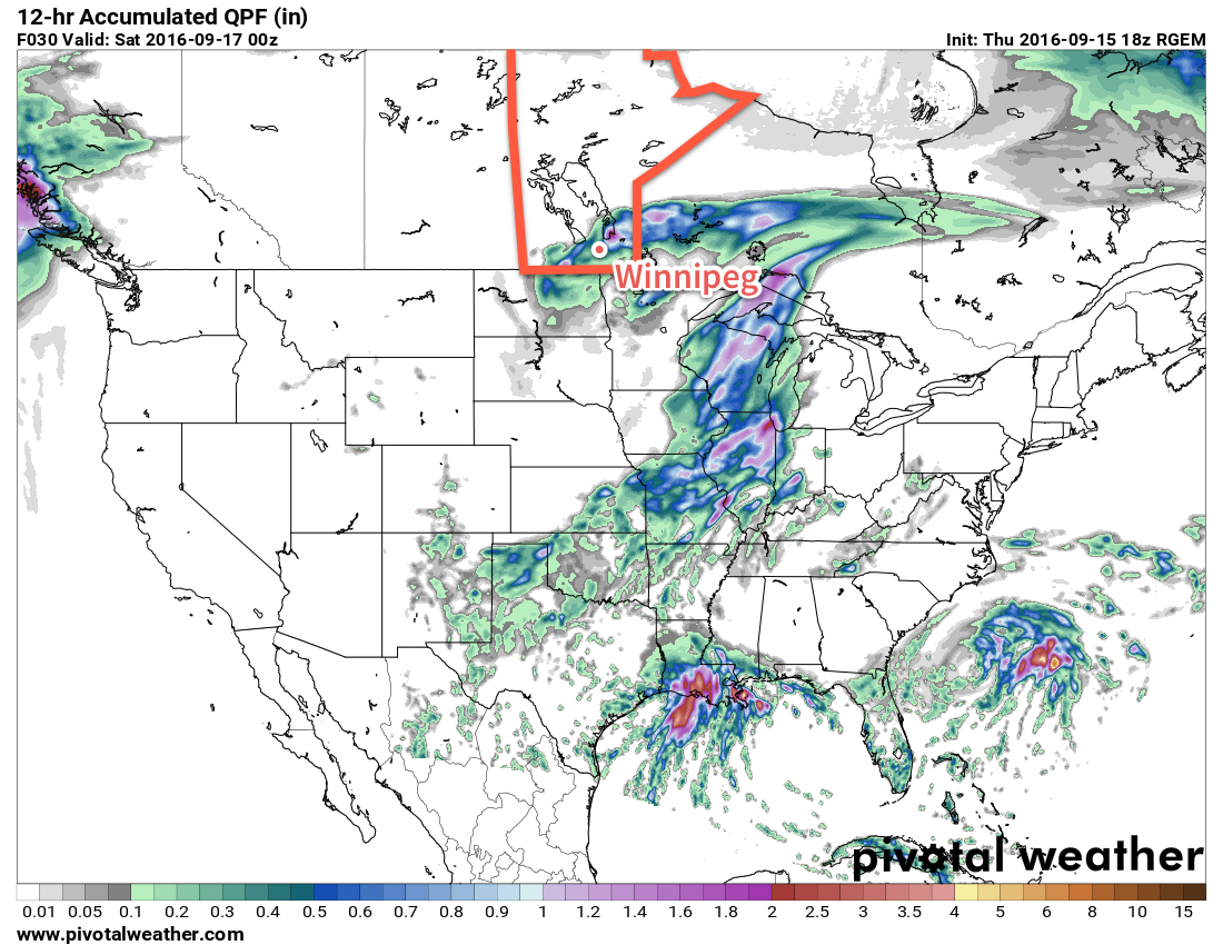
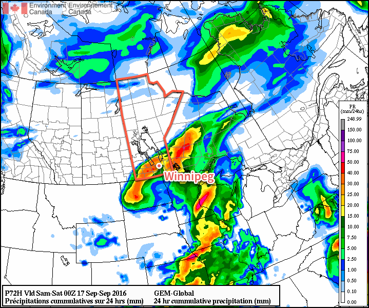
Friday night will bring cloudy skies with a good chance of rain as a more organized area of rain moves from southern Saskatchewan and southwestern Manitoba into the Red River Valley.

Long Range

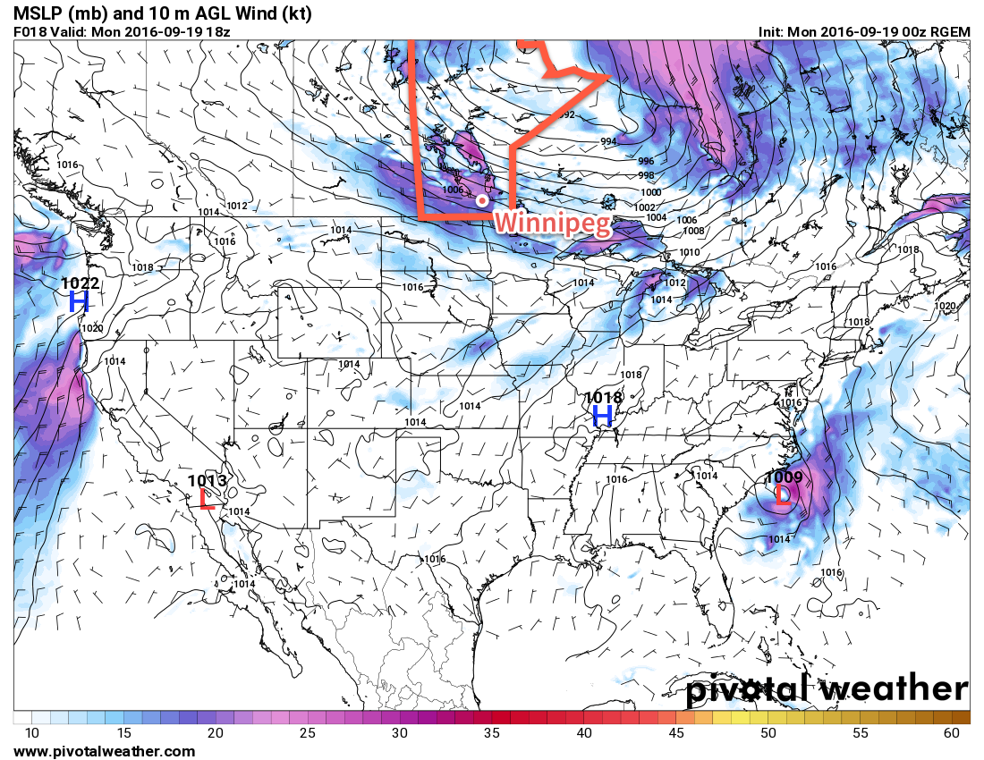
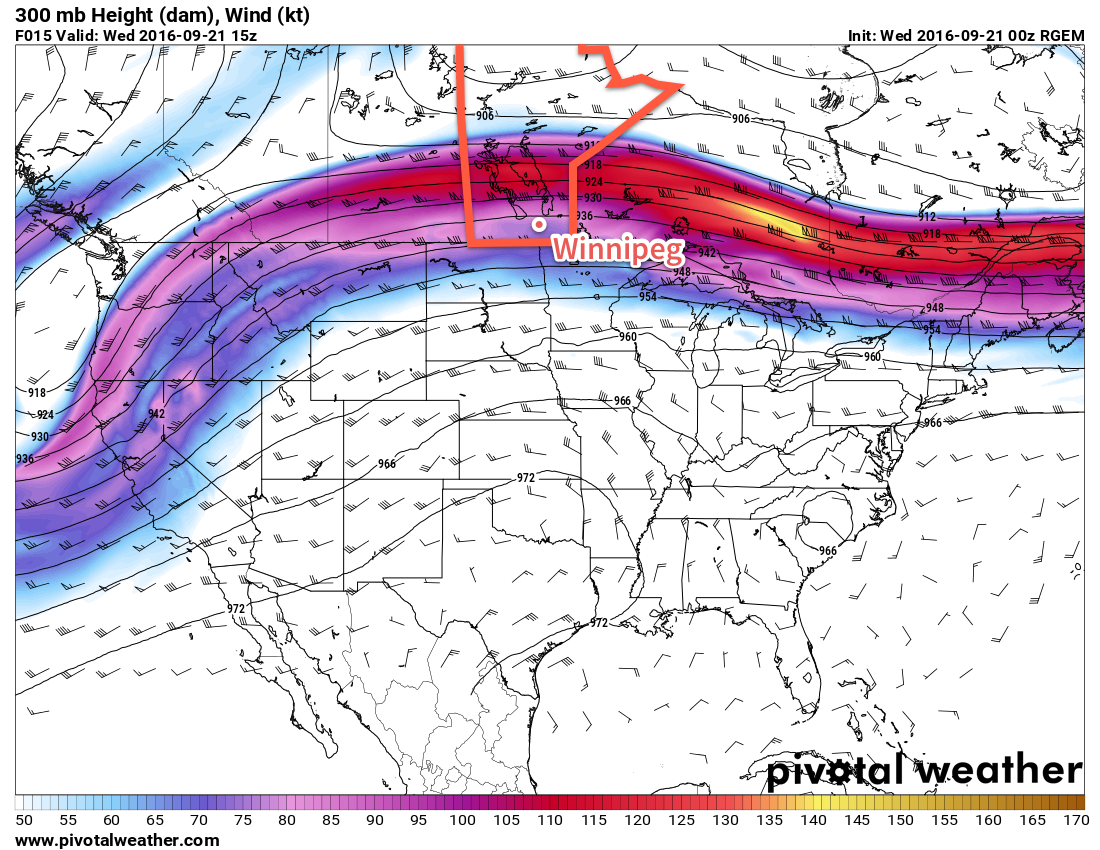
The weekend is looking quite unsettled and wet with rain likely both Saturday and Sunday as a slow moving upper-low moves towards the region. At this point, it looks like there may be a significant convective element to this system, meaning that rainfall amounts could be highly variable across the region. Daytime highs will continue to sit near 17°C through the weekend with overnight lows in the low teens.

Winnipeg’s seasonal daytime high is currently 17°C while the seasonal overnight low is 5°C.

Windy Start To A Week of Fall Weather

Fall-like weather will move into Manitoba this week as moderate westerly winds behind a cold front that moved through yesterday usher out any notion of humidity and bring cool nights back to the region.

Today will be a mild day with a high near 21°C in the Red River Valley, but beneath sunny skies will be a moderate westerly winds of 40 gusting to 60 km/h. Expect to see a few less leaves on some of the trees when the day is done.

Strong westerly winds (shown by purples and pinks) will develop over southern Manitoba today.


Winds will taper off this evening as the temperature heads to a low near 9°C under clear skies.

Tuesday will be another mainly sunny day courtesy a ridge of high pressure moving into the region. Winds may pick up to 20-30 km/h in the morning, but will then taper off in the afternoon as the main ridge axis moves into the Red River Valley. Temperatures will climb once again to a high near 21°C.

Temperatures will head to a low near 10°C on Tuesday night with increasing cloudiness as a low pressure system begins to organize south of the border.

Wednesday will bring mixed to mostly cloudy skies to Winnipeg & the Red River Valley. There will be a chance for some light rain near the International border as this weather system grazes along the 49th parallel, but little accumulation is expected at this point. Winds will be out of the north at 15-25 km/h and temperatures will climb to a cooler high of 17 or 18°C.

Expect skies to clear on Wednesday night as temperatures head to a low near 8°C.

Long Range

A fairly strong low pressure system is forecast to develop in the second half of the week, but general consensus at the moment is that it will remain the United States’ problem, leaving us to wrap up the second half of the work week with partly cloudy skies and seasonal highs in the mid-teens. As we head into the weekend, the chance for rain will re-emerge as the weather turns a little more unsettled. At this point, it doesn’t appear that any widespread or major rainfalls are expected.

Winnipeg’s seasonal daytime high is currently 17°C while the seasonal overnight low is 5°C.

Rainy Friday, Pleasant Weekend

Rain will be the story of the day for Winnipeg as a stalling low pressure system continues to produce rainfall over portions of Southern Manitoba. The wet weather will give way to a fairly pleasant weekend, however, as a westerly flow develops and spreads warmer air eastwards across the Prairies.

Winnipeg can expect another 5-10 mm of rain today as a slow-moving low pressure system continues to produce a band of rain stretching from the Pilot Mound region northeastwards through the Red River Valley, over the south basin of Lake Winnipeg and off through the Nopiming Provincial Park into Ontario. With the wet weather, temperatures will be near-seasonal as the daytime high sits near 17°C. The wind will be gusty out of the north at around 30 km/h gusting to 50 km/h.

Forecast rainfall amounts from the RDPS for Friday between 7AM and 7PM local time.

The rain will taper off this evening as the low moves off into Ontario. Clouds will then scattered out as the wind gradually tapers off and the temperature dips to a low near 7°C.

Saturday will be a fairly nice day with a high near 20°C under sunny skies. Expect a low near 11°C on Saturday night under clear skies.

Sunday will be a warmer day with temperatures climbing into the mid-20’s as warmer air spreads eastwards across the Prairies. Cloud cover will increase through the day, though, as a cool front sweeps through the Red River Valley in the afternoon. At this point, no rain is expected. Winds will shift from 20-30 km/h out of the south to 20-30 km/h out of the northwest behind the front. Skies will gradually clear overnight as temperatures head to a low near 13°C.

Long Range

Next week is looking relatively unsettled with multiple chances for rain through the week. Temperatures will be near seasonal for much of the week, although it appears that a more pronounced cool-down may come with some rain at the end of next week.

Winnipeg’s seasonal daytime high is currently 18°C while the seasonal overnight low is 6°C.

Warmer Weather Returns Alongside Chance of Rain

With the ridge of high pressure that brought the decidedly fall-like temperatures now moving off to the southeast, temperatures will begin to warm and head back towards seasonal. Although today will bring plenty of sun to the region, a low pressure system is heading our way from Idaho and will bring cloud and a renewed chance for rain for Thursday night and Friday.

A beautiful sunny day, hopefully unimpeded by a rogue cloud bank that should remain in North Dakota, will be in place through Winnipeg & the Red River Valley today. Our very cool start to the day will be quickly forgotten as temperatures climb to around the 20°C mark this afternoon with a southerly wind near 20 km/h. Tonight will be milder than last night with a low near 10°C.

Thursday will bring increasing cloudiness to the region ahead of an incoming low pressure system. A southerly wind once again near 20 km/h will continue to draw mild air northwards and help temperatures climb to a high near 22°C. By evening, an area of rain will likely push into the region from the southwest, with the wet weather continuing overnight as temperatures fall to a low near 14°C.

The GDPS is forecasting a swath of 20-30mm of rain through Winnipeg on Thursday night and Friday, however some other models suggest much less rain and the main swath pushed a bit further southeast.

Friday will be mainly cloudy with a continued chance of rain through Winnipeg and the Red River Valley eastwards to the Ontario border. Winds will shift out of the north as the low pressure system moves into Ontario which will combine with the extensive cloud cover to keep our daytime high to just 16 or 17°C. As skies clear on Friday night, temperatures will dip to a cool low near 7°C.

Long Range

The weekend is looking quite pleasant with dry weather, plenty of sunshine and daytime highs returning to the low- to mid-20’s.

Winnipeg’s seasonal daytime high is currently 18°C while the seasonal overnight low is 6°C.