Near-Record Heat for Thanksgiving Weekend

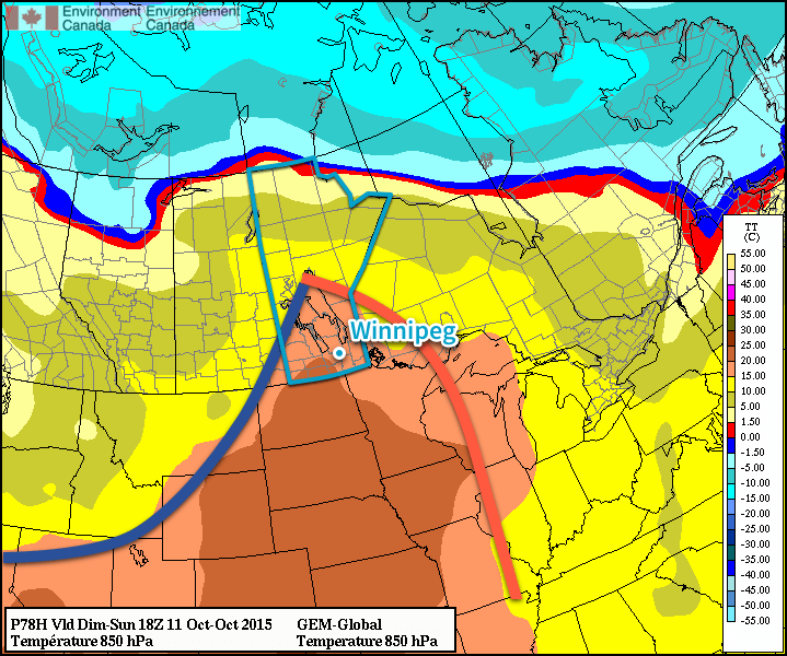
The heat is on for Thanksgiving weekend in Southern Manitoba as a low pressure system tracking across the northern Prairies and draws unseasonably warm air eastwards into the province. Temperatures will soar into the 20’s on the weekend—some 10–15°C above normal for this time of year—with possible record-breaking heat in place for Sunday.

Today will be a fairly cloudy day despite our sunny start, thanks to a large area of cloud spreading eastwards along the leading edge of the warm air. As the cloud moves in, winds will increase out of the south-southeast to 30–40km/h with a bit of gustiness on top. Today’s daytime high will be near 15°C throughout much of the Red River Valley. The cloud cover will thin this evening into the overnight as temperatures dips to the high single digits.

GDPS 850mb Temperature Forecast valid Sunday October 11, 2015 at 18Z.
Shown by this forecast of 850mb temperatures, a large area of warm air will be in place over southern Manitoba on Sunday.

Saturday will be a gorgeous day with partly cloudy skies, southwest winds at 20–30km/h and a high temperature around 23°C in the Red River Valley.[1] Temperatures will dip to around the 10°C mark on Saturday night with clear skies.

Sunday will bring mixed skies as a cold front approaches from the northwest. Temperatures will soar into the mid–20’s, giving a run at the record high of 26.1°C set in 1942. It looks like Winnipeg’s temperature will likely end up just short of the record, but it’s something to keep an eye on!

Record Temperatures for Thanksgiving Weekend 2015 in Winnipeg, MB
Date Record Temperature Record Year
October 9 27.8°C 1938
October 10 27.8°C 1934
October 11 26.1°C 1942

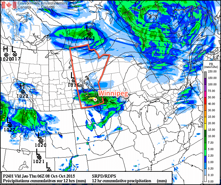
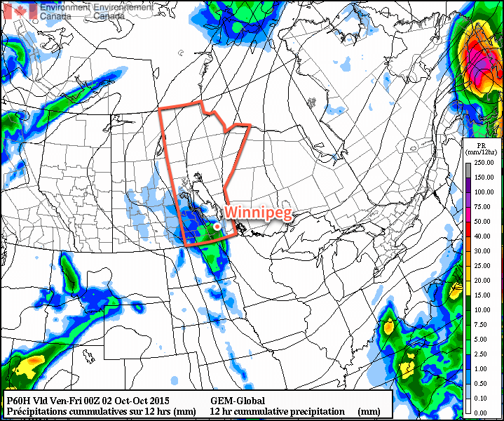
A cold front will slump through the Red River Valley on Sunday evening, ushering in breezy northwesterly winds up to 40–50km/h and a cooler airmass. The low temperature will settle around 10°C on Sunday night. There will be a chance for some rain on Sunday night into Monday depending on exactly where the wrap-around precipitation of the low passing to our north ends up, but at this point there’s too much uncertainty to make any confident forecast at this point.

Thanksgiving Monday & Beyond

Thanksgiving Monday looks less pleasant than the weekend; there will be plenty of cloud around alongside a chance for rain as a strong low pressure system moves into northern Ontario. Winds will be fairly strong, likely around 40km/h or so. The daytime high will only be in the 10–15°C range, so it will certainly feel significantly cooler than the weekend.

After Monday, things look fairly seasonal with temperatures potentially slightly above normal. No particularly big weather systems appear to be on the horizon, although a slight northwest flow is forecast to develop mid-week, which could increase our chances of some shower activity. All in all, though, a fairly quiet week expected.

Happy Thanksgiving! Enjoy your weekend!


  1. Daytime highs might climb a degree or two higher near the western escarpment of the Red River Valley where southwesterly downslope winds may add a bit of warmth.  ↩

Wednesday Rain Lead Transition to Warmer Weather

A low pressure system moving across Southern Manitoba today will produce some rain this afternoon that may have a slight risk of an isolated thunderstorm in the heavier bands. This system is on the leading edge of a large-scale pattern shift that will transition the region into a warmer, but windier, regime for the end of the week and extending through Thanksgiving weekend.

Today will be a bit of an unpleasant day; moderately strong southeasterly winds will develop through the morning to around 40 km/h (with some gusts on top of that) by this afternoon while temperatures struggle from a chilly sub-zero low to just the low-to-mid teens. The strengthening winds will be courtesy an approaching low pressure system that will push across the Red River Valley later today; this system will be responsible for some widespread shower activity late this morning into the afternoon hours that will push from west to east across southern Manitoba.

RDPS 12hr. Precipitation Totals valid Thursday Night
The RDPS is showing 5-10mm of rain through the RRV with this system, however pockets of 10-15mm appear possible.

Winds will diminish as the low passes by in the evening. Expect mainly cloudy skies overnight with a low near 6 or 7°C.

Seasonal Temperatures Lead to Weekend “Heat Wave”

Thursday and Friday will both be fairly similar days thanks to a ridge of high pressure dominating the region. Winds will be relatively light, skies fairly sunny[1], and temperatures fairly seasonal with daytime highs near 13°C and overnight lows near in the –1 to 4°C range.

The winds will begin to pick up out of the southwest on Friday evening as the ridge of high pressure moves off to the east and a more zonal flow pattern begins to develop for the weekend.

This zonal flow pattern will result in much warmer air pushing eastwards across the Prairies, sending temperatures soaring 5–8°C above normal for this time of year. At this point, it looks like daytime highs will be around 20–22°C this weekend with winds in the 20–30km/h range.

No precipitation is expected on Saturday or Sunday, however a cold front pushing through Sunday afternoon may bring in some breezy winds. For Thanksgiving Monday, pleasant conditions with highs in the mid-to-upper teens are expected. Winds will likely be breezy out of the west to northwest, though, at around 30km/h.

NAEFS 8-14 Day Temperature Anomaly Outlook
The NAEFS continues to forecast above-normal temperatures for Western North America in the 8-14 day range.

Further down the road in the 8–14 day range, the NAEFS continues to forecast above normal temperatures for western North America. There isn’t a whole lot to say about it, so just enjoy the (relatively) pleasant weather outside. If a frosty morning here or there has you down, just remember that it’s October and we’re looking at 20°C+ highs for Thanksgiving weekend!


  1. Except for Thursday morning, where any remnant cloud from today’s system will be clearing out.  ↩

Mild Weekend Ahead

The first weekend in October is looking like a great one; plenty of sunshine will be seen over the coming few days alongside temperatures 2–3°C above normal for this time of year.

Today and tomorrow’s weather pattern will be dominated by a large ridge of high pressure anchored from northwestern Ontario into northern Quebec, whose presence will be one of the guiding impacts on the track of Hurricane Joquain. Here in Manitoba, dry outflow from the ridge will ensure skies stay clear and a polar jet stream mainly locked in the Arctic will keep the cooler weather well to our north and allow for slightly above-seasonal daytime highs[1] through the weekend.

Here in Winnipeg, we can expect mainly sunny conditions today and tomorrow with daytime highs around 16–17°C. Winds will be out of the south or southeast at 20–30km/h both days, although today will likely be a bit windier than Saturday. Overnight lows both tonight & Saturday night will sit around +3°C.

Sunday will see the pattern begin to break down a bit. The quasi-stationary ridge to our east will begin to shift off towards the east, easing the pressure gradient over the Red River Valley and finally giving us a break from the windy conditions that will have been in place for several days by that point. As things shift to east, however, cloud will begin to spill eastwards into the valley from a low pressure system that has been stalled over the western high plains for several days. This means that Winnipeg will likely see a fairly cloudy day, but daytime highs should be relatively unaffected and remain a couple degrees above normal near 15–16°C.

As we head into Sunday night, the chance for some light shower activity will increase. Very little is expected by way of significant precipitation, although at this point it appears that the slightly unsettled conditions will likely persist through Monday & Tuesday next week.

Above-Normal Temperatures To Persist

Looking ahead into the long range, it appears that the above-normal temperatures are likely to stick around.

NAEFS 8-14 Day Temperature Anomaly Forecast
NAEFS 8-14 Day Temperature Anomaly Forecast valid for October 10 – 17, 2015

As the NAEFS 8–14 day outlook here shows, there’s a high probability of above normal temperatures throughout most of Manitoba for the period of October 10–17th, as well as for almost the entirety of the remainder of North America. The NAEFS ensemble has been persistent with this trend for quite a while now, and is what we expect to see in strong El Niño years as it often shunts the polar jet stream to the north and east, allowing warmer air to spill eastwards through the southern Prairies in a more zonal upper-level flow.

El Niño Winter Pattern
A typical generalized winter weather pattern during strong El Niño events. Credit: NOAA Climate

In El Niño years, persistent low pressure off the west coast of North America tend to produce ridging over the Rockies, drawing warmer air further to the northeast. This ridging shunts the polar jet stream further to the northeast and typically keeps the Arctic blast freezer bottled up a little more.

How strong is this El Nino now? The only real way to answer this is to throw a bunch of numbers at you. Essentially, it’s “pretty strong.”

This year’s El Niño is on track to be one of the strongest on record, which would have a high correlation of generally persistent above-normal temperatures. This doesn’t mean that cold weather isn’t possible this winter; rather it just means that any cold outbreaks will likely be shorter-lived than typical. One of the potential down-sides to this year’s event is that strong El Niño events tend to correlate with cloudier winters in the Red River Valley.

Again, all this is very generalized climate speak; the day-to-day weather can certainly vary significantly and the end result won’t just be a result of the El Niño, but also its interactions with the AO, NAO, and a few other large-scale patterns.

At the most simple level, though, it’s looking like above-normal temperatures will continue for a while yet. Perhaps the most disappointing thing at this point will be watching that “seasonal high” curve get lower and lower.

Enjoy the pleasant fall weekend!


  1. Seasonal daytime highs for this time of year in Winnipeg are around 14°C.  ↩

Seasonal & Unsettled Weather Ahead

The cold weather evidenced by a temperature that dipped down to a very chilly –3.8°C at the Winnipeg Airport on Tuesday morning has quickly been replaced by more seasonal conditions which will persist through the remainder of the week. Sunshine will be a bit harder to find, though, with plenty of cloud and unsettled weather in place as low pressure system stalls out over Southern Manitoba.

Today will start off fairly pleasant with temperatures in the 8–10°C range and partly cloudy skies. The cloud will only increase as the day progresses, however, ahead of an approaching low pressure system. As the low gets closer, winds will strengthen out of the south to 30–40km/h, with some gustiness on top of that, while the temperature climbs towards our daytime high of 17°C.

Scattered showers will develop through the afternoon and become more widespread heading into the evening. There’s a very outside chance of a thunderstorm, but the risk is quite isolated and something along the lines of isolated moderate to heavy showers activity is more likely. Rainfall amounts overnight will vary widely with anywhere from 2–10mm generally expected, however localized patches of more or less are possible. Winds will continue out of the south to southeast at 30–40km/h overnight with a low near 11°C.

GDPS 12hr. QPF valid 00Z Friday October 02, 2015
One shot in the dark at rainfall totals across Southern Manitoba through the day on Thursday.

Thursday will see the showers gradually taper off through the day as temperatures climb to around 15°C with breezy south-easterlies continuing at 30–40km/h. Skies will remain fairly cloudy through the day and into the overnight hours. Some clearing will work its way into the Red River Valley from the east overnight as temperatures dip to around 7°C.

Friday will finally bring clearing skies and slightly warmer temperatures as the cloud pushes off to our west. Winds will remain fairly breezy at 30–40km/h for much of the day before tapering off towards evening hours. Temperatures will climb into the upper teens for daytime highs through the Red River Valley and dip down to a chilly 5°C or on Friday night.

Pleasant Weekend Ahead

All things considered, this weekend will be quite pleasant. Just a few clouds are expected to be around with daytime highs in the mid-teens & less windy conditions than we’ll have rounding out the work week.