Deluge of Rain Falls on Eastern Australia

A persistent area of low pressure off the coast of Eastern Australia is to blame for extreme amounts of rainfall that fell during the mid-week.

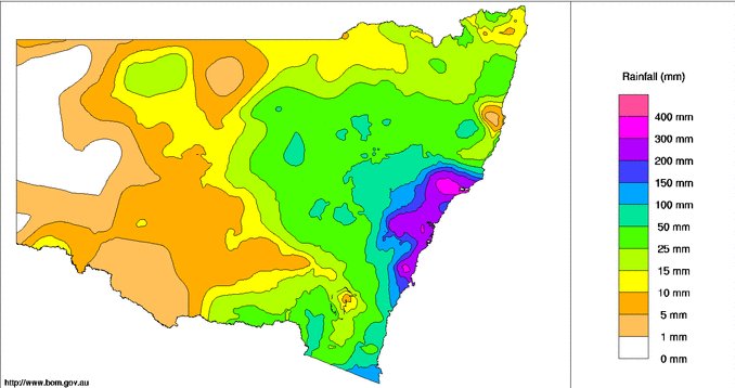
[map autofit=”1″ disable_scrollwheel=”1″] [pin]Sydney[/pin] [pin tooltip=”Maitland”]Maitland, Australia[/pin] [pin tooltip=”Dungog”]Dungog, Australia[/pin] [/map]

An upper level low that was cut-off from the main jet stream to the south was the reason for the slow movement of the surface low. Sydney and surrounding regions were hardest hit from the storm where over 300mm fell in some areas in less than 24 hours. Dungog and Maitland, towns north of Sydney, received some of the highest amounts in the region; 312mm fell in Dungog in 24 hours and 301mm fell in Maitland in the same amount of time. Sydney received 225mm during a two-day span – relatively speaking, this is a significant rainfall for them. According to the Australian Bureau of Meteorology this was the most rain Sydney has received during two-day period in more than a decade. What made conditions even worse was that winds howled to 80km/h in Sydney and over 130km/h in three separate regions on the east coast of Australia. The high winds made for swells of over 6m out at sea.

The state of New South Wales is pictured with one-week rainfall totals. Bright pink shaded areas are areas that saw over 300mm of rain fall throughout the week.

Due to the high winds and flooding rains, power to 215,000 people was knocked out in the region. In addition to that, creeks quickly became dangerous, fast-flowing rivers in the Dungog region. Several houses in Dungog were washed away due to the floodwaters and unfortunately four people perished.  There were also 150 water rescues that had to be executed. As of Friday morning where were still a few thousand people isolated by floodwaters that cut off main roads. In total, 12 communities were officially declared a natural disaster area by the government – insurance companies estimate the damage to be around 100 million dollars.

Since then the soggy weather has continued, off and on, throughout the end of the week. With another system and associated cold from arriving from the west today, the chance for rain continues – amounts will be nowhere near the ones that were observed this past week, however.

Pleasant Weather Returns

Winnipeg will see a reprieve from the below-normal temperatures this weekend as the ridge of high pressure that’s brought the cooler weather shuffles off to the . In its place, a southerly flow will return warmer air to the region with temperatures climbing back to near the seasonal mark.

Over the next few days, no significant weather is expected in Winnipeg or the Red River Valley. Today will start off with some lingering cloud that will clear out through the day. Temperatures will climb to a high of around 13°C with a light southeasterly wind. Expect a low near 0°C under clear skies tonight.

Saturday will bring mainly sunny skies, light southeasterly winds and a high near 16°C. Saturday night will see a low near +2°C with a bit of cloud cover.

RDPS forecast Temperature for Friday Afternoon
The RPDS weather model is forecasting highs climbing above 15°C in Winnipeg on Saturday afternoon.

Sunday’s high will also be near 16°C, however with a few more clouds than Saturday. The temperature will drop to 7°C or so on Sunday night with increasing cloudiness overnight.

Cold Trough over Manitoba & Ontario

Cool And Sunny, Becoming Unsettled

Temperatures will be stuck well below-normal for late April through the remainder of the week as a stationary long-wave trough locks Manitoba into a pool of cold Arctic air. To make lemonade of it, skies will at least be quite sunny and winds light making things comparatively pleasant to how the week started.

The next two days will be very similar and very quiet weather-wise. Both today and tomorrow will bring mainly sunny skies, light winds and high temperatures near +5°C. Tonight will be another brisk evening with a low near –7°C while tomorrow night will bring slightly warmer temperatures with a low near –3°C. All of these temperatures are well below normal, though. Daytime highs will be about 8°C below normal[1], a far cry from the 10–15°C above normal we saw last week, and overnight lows will be 4–8°C below normal.[2]

RDPS 500mb Winds valid 12Z April 22th, 2015
The 500mb wind pattern Wednesday morning shows a highly amplified ridge over Alberta & the Western Arctic diving into a very deep trough over Manitoba & Ontario.

By Friday, the stagnant ridge-trough pattern that has set up over North America will begin to break down. Throughout the day, Southern Manitoba will increasingly come under the influence of a trough of low pressure stretching from a low tracking through South Dakota to a low lifting through Alberta. Out ahead of the South Dakota low, it’s likely that some flurries will develop along the US border in southwestern Manitoba and spread east along border regions through the day. At this point, it looks highly probable that any flurry activity will remain south of Winnipeg. That being said, Winnipeg will see increasing cloud cover and a fairly cool high of just 4°C. Clouds should clear out Friday night with a low near –4°C.

Long Range: A Shift To a Wetter Pattern?

The long range forecast is a little tricky at this point, however we can break it down into two categories of uncertainty: timing and weather pattern. The second there’s a fair amount of confidence in; the timing, however, is a lot more difficult. The current long-wave weather pattern over North America is known as a blocking pattern. These weather patterns are very stable configurations of the jet stream and other upper-level features that result in stagnant weather patterns; these can be stretches of hot, dry weather in the summer[3] or long periods of well below-seasonal temperatures.[4]

Weather models are quite good at forecast what sort of weather pattern may develop when the blocking pattern breaks down, however they are generally quite poor at the actual timing of the break-down. This is because to shift these very stable features, significant changes in the long-wave pattern have to develop across huge distances, and those changes can be very difficult to forecast accurately.

That being said, we should start to see our current weather pattern break down this weekend, driven by an approaching low that will drive a wedge into the elongated upper ridge over the west coast as well as the retrogression of an upper-level low[5] from Ontario. As this happens, cool weather will blanket much of the Prairies – although it won’t likely be any cooler than we’re seeing now – and it looks like there will be an increased chance of precipitation through the Southern Prairies, perhaps even multiple low pressure systems coming through.

All to say it’s going to go from cool and dry to cool and, quite likely, unsettled through the coming weekend. Looking even further ahead, it does look like next week we’ll see a return to seasonal temperatures.


  1. Normal daytime highs for late-April in Winnipeg are around 13°C.  ↩
  2. Normal overnight lows for late-April in Winnipeg are around 0°C.  ↩
  3. Under what’s known as an omega block.  ↩
  4. This happens when an area gets stuck underneath a cold trough; this is what’s happening over Manitoba right now.  ↩
  5. A low pressure system “retrogrades” when it’s motion becomes opposite that of the usual motion; in our case, it’s when a low moves from east to west instead of west to east.  ↩

A Change for the Cooler

This week’s weather will be significantly cooler than what we experienced last week as a upper-level system to our east pulls down chillier air from the north.

Cool weather will prevail on Monday under a stiff northerly flow

Monday

Today will be cool, cloudy, and precipitation-y. We’ll see some mixed showers and flurries throughout the day as a strong low pressure system exits our region. High temperatures will be in the mid single digits, meaning that even if it does snow it won’t stick around for long. Winds will be gusty due to the departure of that weather system, with values from the northwest of 40km/h gusting to 60km/h.

Tuesday

Tuesday will remain cool and breezy, but we will see some sun! High temperatures will be in the upper single digits under mainly sunny skies. Winds will be northerly at 20-30 km/h, making it feel on the chilly side.

Wednesday

Wednesday will be slightly cooler than Tuesday as more cool air pours in from the north. High temperatures will be in the mid to upper single digits, but skies will remain mainly sunny. Winds will be northerly at 20-30km/h once again

Long Range

The long range forecast suggests that this cooler pattern will stick around for at least the rest of the week. A persistent trough is expected to remain parked just to our east, meaning that cool air will be continually pumped into southern Manitoba during the short to medium-term. However, in the longer range this pattern is expected to break-down, ushering in a return of more seasonal conditions.