Conditions will remain at or above normal this week, unfortunately “normal” continues to get colder by the day.
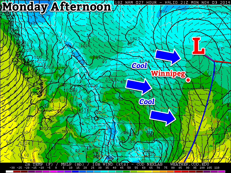
A cool westerly flow will dominate southern Manitoba on Monday
Monday
Monday
8°C / 2°C
Mix of sun and cloud
Today will be mild by early November standards, but that doesn’t mean it will be warm. Temperatures will be in the mid to upper single digits in southern Manitoba with a brisk westerly wind. Skies will be a mixture of sun and cloud as an upper-level weather system moves across Manitoba.
Tuesday
Tuesday
4°C / 0°C
Mainly cloudy with chance of showers or flurries
Tuesday will be cooler than Monday as we see a brisk north-westerly flow behind a departing low pressure system. Temperatures will generally be in the mid single digits under mainly cloudy skies. There may be a few flurries or rain showers, but no significant accumulations are expected.
Wednesday
Wednesday
3°C / 1°C
Mainly cloudy with chance of showers/flurries
Wednesday will see continued cool weather in southern Manitoba with temperatures in the low to mid single digits, but lighter winds than what we saw earlier in the week. Skies will remain mainly cloudy and we may once again see some light flurries or rain showers.
Long Range
The long range forecast suggests we’ll continue to see normal to above-normal weather for at least the next week or so. Beyond that model solutions diverge, with equal chances of us ending up above or below normal.
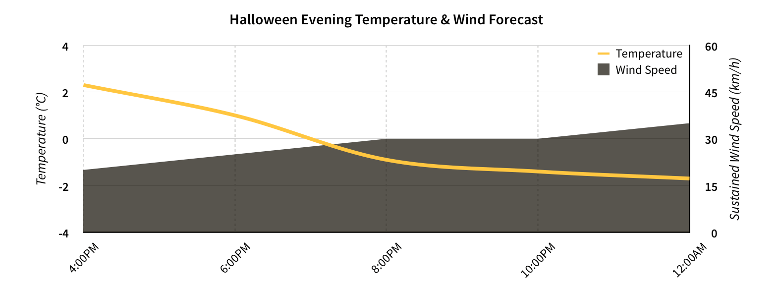
A very cool Halloween evening is ahead in the Red River Valley thanks to a large high pressure system from the Arctic that will slowly move out of the province through the day. Unfortunately, as it begins to move out this evening, a fairly breezy southerly wind will develop and make things feel even colder than they already are.
Friday
2°C / -3°C
Mainly sunny and cool; becoming windy through the afternoon
Saturday
4°C / -2°C
Cloudy periods and breezy
Sunday
8°C / 2°C
Mixed to cloudy skies
Today will be a very chilly day with temperatures struggling to reach a daytime high of just 1 or 2°C thanks to a substantial amount of colder air that has pushed into the province with an Arctic ridge that’s moving through. Winds won’t be too bad this morning, but through the afternoon – as the ridge moves southeastwards into Minnesota and NW Ontario – southerly winds will strengthen to about 30km/h with gusts to around 50km/h.
Temperature & wind forecast for Halloween evening in Winnipeg.
Temperatures will quickly drop to just below freezing this evening which, when combined with the ≥ 30km/h winds, will feel closer to the -8 to -10°C range. For anyone heading out, it will be quite a cool evening and be sure to bring some gloves and toques to keep warm.
Temperatures will drop to around -3°C overnight with the wind persisting.
Warming Through the Weekend
Temperatures will slowly climb as warmer air begins working into Manitoba from the west. Saturday will be another windy day with southerly winds at 30-40km/h with gusts as high as 60km/h. The temperature will climb to around 4°C for a high, but will certainly feel cooler than that with the strong winds. There will be a few clouds through the day, but it will be a relatively sunny day overall. The temperature will drop to around -2°C on Saturday night.
Sunday will bring the warmest weather in a while with temperatures climbing into the upper single digits. Winds will be lighter than Friday or Saturday which will make that warmer temperature feel more pleasant. Skies will be much cloudier and there may even be a very slight chance of a shower. Sunday night will see temperatures drop to 1 or 2°C with an increased chance of some shower activity.
Unsettled Week Ahead
The warmth and cloud reaching us by the end of the weekend is thanks to a developing low pressure system in Montana that is forecast to push into Manitoba early next week. There’s significant uncertainty to where and/or how much precipitation will fall, but at this point it looks like Winnipeg will see some share of the unsettled weather on Monday and Tuesday.
Temperatures for much of the week look to be near-normal[1] but there are hints that a significant low pressure system is possible at the end of the week that could bring Southern Manitoba its first wintery blast of the year. A lot can change between now and then, though, so we’ll just keep an eye on things for now and enjoy the warmer end to the weekend ahead!
Normal daytime highs heading into the beginning of November are around 3 or 4°C. ↩
The shot of cool air that worked its way into Winnipeg in a somewhat unwelcome fashion yesterday will remain entrenched over the region for the next few days, resulting in seasonal to just below seasonal temperatures heading towards Halloween. Fortunately, the weather looks to be drier, and it’s unlikely that we’ll see much more of the white stuff.
Wednesday
4°C / -1°C
Mainly cloudy; slight chance of morning flurries
Thursday
2°C / -6°C
Partly cloudy and cool
Friday
4°C / -2°C
Mainly sunny with increasing cloud in the afternoon
Today will remain mainly cloudy but, unlike yesterday, our temperatures should manage to sneak just a little bit higher, to around 4 or 5°C[1] with substantially calmer winds. A weak low pressure system skirting along the U.S. border will bring a slight chance of showers to areas in the vicinity, but it looks like rain will likely remain States-side. A chilly night ahead tonight as some of the cloud starts clearing out and we head to a low of around -1°C.
Thursday will be a cool day as an Arctic ridge builds southeastwards into the province. Skies will be partly cloudy with no real chance of precipitation and it will be quite cool as temperatures are only expected to climb to 1 or 2°C. The overnight low will dip down to a very chilly -6 or -7°C under mainly clear skies. Thursday night looks like the low point for our temperatures over the next while.
A Chilly Halloween
Temperatures will begin to moderate on Friday but it will still be a chilly Halloween evening. The day will start off mainly sunny, but as the Arctic ridge slides off to our east and another low pressure system begins approaching from the west, more cloud will begin pushing in from the west. The temperature will climb to around 4°C by the afternoon and, thanks to the increasing cloud, gradually cool off through the evening.
Preliminary temperature & wind forecast for Halloween evening.
Alongside the increasing cloud coverage will come gradually increasing winds. While early in the evening they’ll be only around 15-20km/h, the wind will gradually increase to 30 gusting 50km/h by mid-evening and then further increasing to 40 gusting 60km/h by late in the evening. The temperature will drop to around -2°C overnight. The wind will make it feel rather cool, despite the fairly seasonal temperatures expected.
Unsettled Weekend
The weekend looks somewhat unpleasant as warmer air tries to work its way back into the province. Saturday looks quite windy and fairly cloudy as temperatures climb into the upper single-digits. Sunday brings some uncertainty as a larger system develops in the northern United States and lifts northeastwards. Temperatures will remain slightly above normal, however it is possible that it ends up being a fairly rainy day. There’s significant disagreement with the models on the timing of this system, though; some bring rain in early on Sunday while others delay the rain until Monday. We’ll be sure to keep an eye on this system as it develops and we’ll take a closer look at it in Friday’s post!
Seasonal highs for late October in Winnipeg sit near 5°C. ↩
Conditions will cool down this week, but temperatures won’t stray that far from normal.
A cold front will pass through southern Manitoba on Monday
Monday
Monday
10°C / 2°C
Mix of sun and cloud
Today will be a transition day as a cold front moves through southern Manitoba. The front won’t pass through in dramatic fashion, so you probably won’t even notice it. However, it will set up cooler weather for the next few days. Despite the passage of that front, temperatures today will remain above seasonal, with highs near 10C and light winds.
Tuesday
Tuesday
4°C / 0°C
Mainly cloudy with chance of showers or flurries
Tuesday will be a much cooler day in the wake of Monday’s cold front. High temperatures will be in the single digits with a breezy north-west wind. There may be some light showers or even gasp flurries during the day, but accumulations should be minimal.
Wednesday
Wednesday
5°C / -2°C
Mainly cloudy
Wednesday will remain on the cool side with temperatures remaining in the single digits. No precipitation is expected, but skies will likely be mainly cloudy. The wind will be light and from the south or south-east.
Long Range
The long range forecast continues to look good. The NAEFS suggests that above-normal weather will persist into November. So far there is no sign of any significant snowfall in the forecast, which is always a good thing!