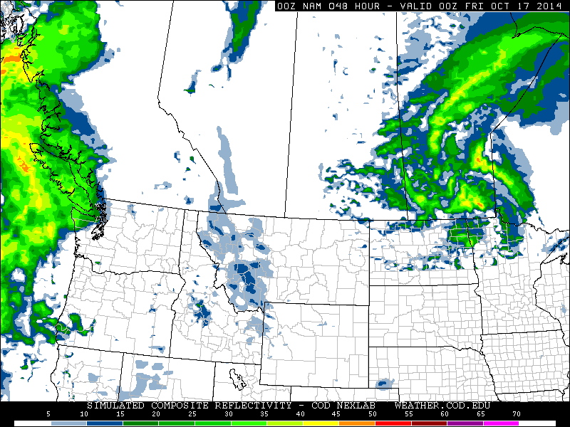
Another week, another tropical disturbance forms – this time in the Atlantic. Gonzalo started to organize earlier this week just east of the Caribbean and drifted west, slowly organizing itself at the same time. By the time it reached the eastern islands of the Caribbean such as Anguilla and the British Virgin Islands, Gonzalo was a category one hurricane and brought strong winds and heavy rains to the islands. Hurricane Gonzalo then started curving northeast and quickly strengthened into a category four, with a pinhole eye after it cleared the Caribbean Islands. The storm was then headed for Bermuda, which meant trouble for the small island out in the Atlantic.
Deep convection in the northern eye wall of Gonzalo depicted by the black colors. Bermuda is identified by the white arrow.
Gonzalo made landfall on Bermuda Friday evening, lashing Bermuda with high end category two winds (175km/h) as the eye wall made its way across the island. Reports of how Bermuda fared were difficult to find as of Friday evening, but it appears the island did quite well with no deaths or injuries reported. However, power was knocked out to about 90% of Bermuda’s residents as well as flooded streets reported. Compared to last week’s EIWN, the big difference is that the infrastructure in Bermuda is built to withstand fairly strong hurricanes, unlike most of the buildings in the region of India that Hudhud affected.
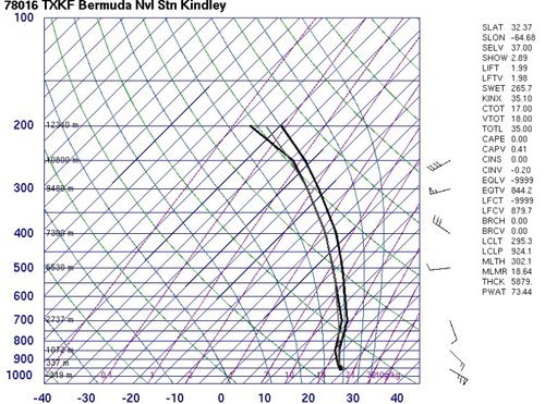
The Bermuda Weather Service launched a weather balloon as the eye approached Bermuda at 00z. (Source: University of Wyoming)
Hurricane Gonzalo will continue its trek northeastwards and may even clip Newfoundland by Sunday as it transitions to extratropical. Interestingly enough, Gonzalo will likely make it all the way to the United Kingdom as an extratropical storm early next week. No other storms are expected in the near future in the Atlantic.
Cooler temperatures have moved into Southern Manitoba behind a low pressure system that brought a few showers and strong northerly winds as it moved across the Red River Valley yesterday evening. Today will be a cool, dreary return to chilly fall weather, but a gradual moderation of temperatures is in store for the remainder of the weekend.
Friday
7°C / 0°C
Cloudy; chance of drizzle or showers
Saturday
10°C / 6°C
Mainly cloudy
Sunday
14°C / 3°C
Mainly sunny
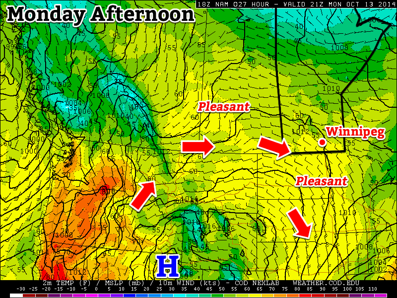
A less-than-pleasant day is in store for Winnipeg today as breezy northerly winds around 30km/h continue to push a cool air mass southwards into the Red River Valley, leaving us with a dreary day with a high barely above where it starts the day off at. The temperature will struggle to climb to 7 or 8°C today under cloudy skies alongside a slight chance of drizzle or shower activity. Skies will remain mainly cloudy tonight with a chance of a few clear breaks late overnight; the temperature will drop to between 0–2°C for the overnight low.
This animation of 850mb temperatures (running from Friday evening to Saturday evening) shows warmer air pushing eastwards into Manitoba.
There isn’t too much to say about the weekend other than conditions will gradually improve. Saturday looks fairly cloudy with a high near 10°C and light winds. A partly cloudy night will see the temperature dropping to 6°C or so. Sunday will be quite a pleasant day with temperatures climbing back above normal under mainly sunny skies. Expect a high near 14–15°C and an overnight low on Sunday night near 3°C. At this point, it does look like a low pressure system will move through the Interlake on Sunday, bringing some showers along with it. Current indications are that all of that activity will remain to the north and east of Winnipeg, but we’ll keep an eye on it as the system develops.
Heading into next week looks very nice with temperatures returning to the upper teens as another upper-level ridge builds into the Prairies, spreading mild Pacific air eastwards once again.
The beautiful weather we’ve been enjoying over the Thanksgiving weekend is set to continue for a couple more days before slightly cooler weather moves in for the weekend. Fortunately, the dip in temperatures looks to be short-lived before warmer air once moves back into the region.
Wednesday
19°C / 9°C
Warm & windy; mostly cloudy
Thursday
17°C / 5°C
Becoming cloudy with showers in the afternoon
Friday
9°C / -1°C
Mainly cloudy & windy, clearing in the evening
Wednesday
Today will be marked with significant warmth hampered somewhat by the breezy southerly winds that will develop. An approaching low pressure system, responsible for spreading the above-average temperatures in Manitoba, will produce a strong pressure gradient over the Red River Valley today which will result in southerly winds increasing to around 40km/h by late this morning with gusts approaching 55–60km/h. These stronger winds will persist well into the evening before tapering off overnight.
Otherwise, it will be a fairly nice day. Temperatures will climb to around 19°C, with a very slight chance of eking out a 20°C for the day, and skies will be fairly mixed, probably trending towards the cloudier side of things. Skies will clear out a bit overnight as we head to a low of 9°C or so.
Thursday
Thursday will be perhaps an even nicer day than today will be. Skies will be a bit sunnier and temperatures nearly as warm – around 18°C for a high – but without today’s wind.
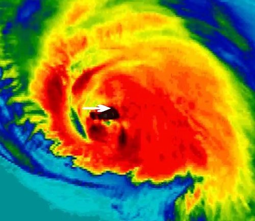
The NAM is generating quite a bit of shower activity across Southern Manitoba – shown here by this simulated RADAR image – on Thursday evening.
A low pressure system and associated cold front are poised to move through in the evening, however, which will bring with them some shower activity as the system swings across the Red River Valley. Northwesterly winds behind the cold front will begin tapping cooler air as we head to a low of 3°C overnight with showers possibly persisting through the overnight period.
If slightly heavier activity is maintained overnight, there’s a slight chance that the showers may change to mixed precipitation or flurries for a few hours, but no accumulation of snow would be expected. We’ll keep an eye on this system and provide updates in the comments below if necessary.
Friday
Friday will be a relatively unpleasant day, although in reality quite close to the normal conditions for this time of year. Gusty northwesterly winds to 30km/h and mainly cloudy skies will be the name of the game as our high sits 10°C cooler than Wednesday or Thursday at around 9°C. Little in the way of precipitation is expected.
Winds should taper off Friday evening alongside clearing skies as we head to an overnight low just below freezing.
The Weekend
Conditions will gradually improve through the weekend. Highs both days will climb somewhere in the 10–12°C range with relatively light winds. Sunday appears to be the more interesting of the two days as some showers push into Western Manitoba. It’s unlikely that any rain will make it into the Red River Valley, but we’ll certainly see some cloud from the system as it moves through.
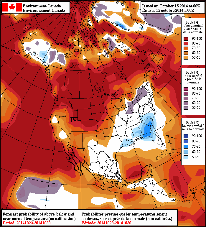
The NAEFS is forecasting above normal temperatures next week.
The passage of Sunday’s system will mark the return of warmer air to our region and, at this point, it looks like we’ll be returning to above-normal temperatures for next week. Medium-range forecast models, such as the NAEFS, all show a strong signal of above-normal temperatures returning for the last week and a half of October.
The Thanksgiving long weekend will end on a nice note, with mild temperatures and sunny skies for holiday Monday.
Holiday Monday will be pleasant in southern Manitoba
Monday
Monday
16°C / 4°C
Mainly sunny
Today will be very nice in southern Manitoba. Temperatures will be in the mid teens with light winds and sunny skies. This pleasant weather is the result of a ridge of high pressure building over the Prairies, which will continue to bring mild conditions to Manitoba for much of the week.
Tuesday
Tuesday
17°C / 7°C
Increasing cloudiness
Tuesday will be another nice day in southern Manitoba as temperatures climb into the upper teens. A gusty south wind will develop by late in the day, but otherwise it should remain quite pleasant. There will be an increase in cloudiness through the day, as some upper-level cloud cover begins to spill into Manitoba from the west.
Wednesday
Wednesday
19°C / 10°C
A few clouds
Wednesday will see a continuation of the warm weather from Monday and Tuesday. However, there will also be a very stiff south wind, making it feel a bit chillier than it would otherwise be. Temperatures will nonetheless be in the upper teens or near 20C, which is of course well above normal for this time of year.
Long Range
A cold front is currently forecast to pass through southern Manitoba on Thursday, ushering in cooler conditions to end the week. However, models have been strongly hinting at a return to above-normal weather by next week, a trend that may last through the end of the month.
")