State of the Climate – Meteorological Summer of 2014

As of September 1st, meteorological summer[1] has come to an end and the fall season is upon us. That means, of course, it’s time to take a look back on the summer of 2014 to see just how it fared in the grand scheme of things. Was it actually all that cold, or is that just our memories suffering from the prolonged winter? How wet was it actually? Was it a particularly stormy summer? We’ll take a look at how all of those things fared in Winnipeg as well as highlight a couple major events from the past 3 months across the province!

Meteorological Summer Rankings for Winnipeg International Airport
Category Summer 2014 Total or Average Rank
Average High Temperature 24.3°C Tied 51st coldest
Mean Temperature 18.2°C Tied 67th coldest
Average Low Temperature 12.1°C Tied 53rd warmest
Total Rainfall 276.9 mm 29th rainiest
Thunderstorm Days 17 days Tied 23rd least

Temperature-wise, there wasn’t much to talk about this summer in southern Manitoba. The summer averaged pretty much bang on normal in most areas, including Winnipeg where the average mean temperature of 18.2°C was just 0.2°C below normal. A similar story in Brandon where the average mean temperature of 17.4°C was just 0.1°C above normal. However, there was a notable lack of very hot days. There were only 5 days above 30°C in Winnipeg, below the normal of 12 days, and the least since 2009 when there were only 3 days over 30°C. Interestingly, the hottest day so far this year was actually in May when we hit a record 33.3°C on May 24th. Although it is not the first time our hottest day of the year was outside of the summer season, it is unusual. The last time this occurred was in 2004 when our hottest day of the year was on September 19th.

August Ends 10-month Cold Streak

Top 5 Longest Streaks of Colder Than Normal Months Since 1872
Rank # of consecutive below normal months Timeframe
1 18 months Dec 1882-May 1884
2 14 months Jul 1884-Aug 1885
3 11 months Oct 1887-Aug 1888
4 10 months Oct 2013-Jul 2014
5 9 months 1949/50, 2008/09 & 2012/13

August finished 0.5°C above the previous 30-year (1984–2013) average mean temperature of 18.7°C. This marked the end of a 10-month streak, from October 2013 to July 2014, of months colder than the previous 30-year average. This 10-month streak was the 4th longest of its kind since 1872 and the longest since an 11-month streak in 1887–1888.

Summer Flooding

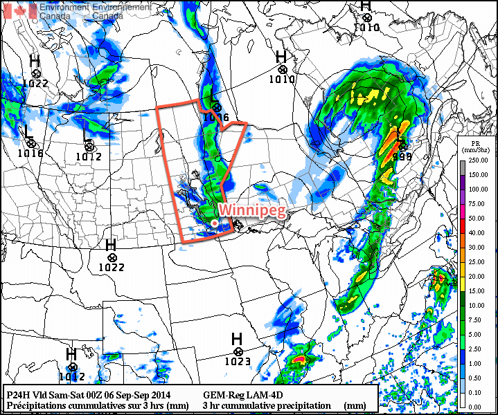
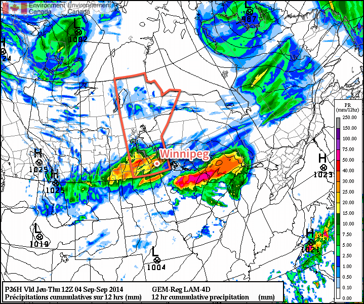
A grand total of 276.9 mm of rain fell at Winnipeg airport June, July and August. Although this may seem like a lot of rain, this is actually only 12% above the 1981–2010 normal of 247.5 mm. So overall, we were pretty close to normal rainfall totals this summer. However, the problem this summer was that the rain was not spread out through the entire season. Rather, the majority of our rain fell in mid-late June and mid-late August. These two periods featured flooding in parts of southern Manitoba as too much rain fell in too little time. In fact, over 130 mm of rain fell in just 17 days in the second half of June at Winnipeg airport. The month finished 12th rainiest on record with 147.1 mm.

Excessive rainfall over southwestern Manitoba this summer resulted in significant flooding along the Assiniboine river. Brandon, MB – pictured above – was one of many communities hit hard by the widespread flooding.
Excessive rainfall over southwestern Manitoba this summer resulted in significant flooding along the Assiniboine river. Brandon, MB – pictured above – was one of many communities hit hard by the widespread flooding.

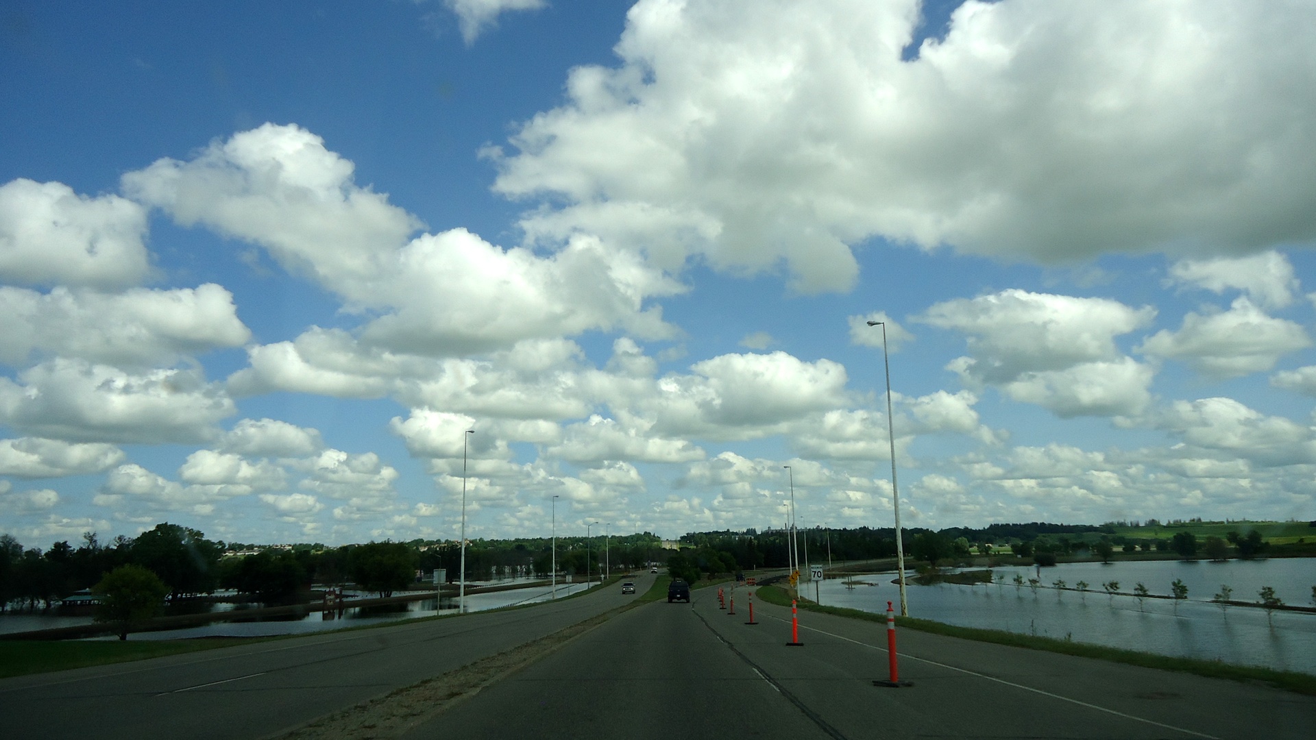
Conditions were worst in southwestern Manitoba this summer with well above normal rainfall; over 300 mm of rain fell in some of the hardest hit locations. Brandon was one of these locations, receiving a whopping 347.2 mm, almost an entire year’s worth of rain in just 3 months. 251.6 mm of this fell in June alone, Brandon’s rainiest June on record. In fact, 219.8 mm fell in just the last 12 days of June, more than half a year’s worth of rain!

The Year So Far

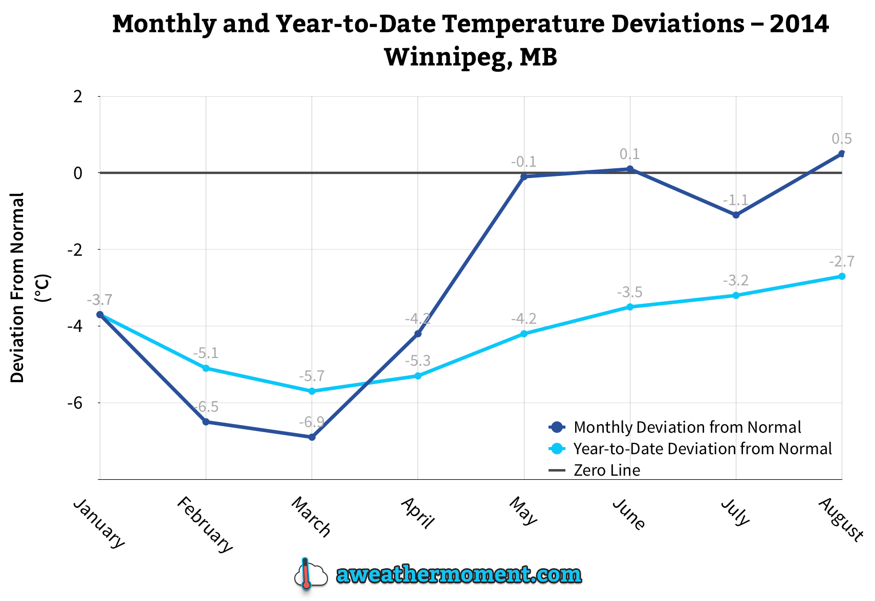
2014 continues to be much colder than normal. Up to August, the year has averaged 1.7°C; 2.7°C colder than normal for the period. This ties for 17th coldest January to August period on record since 1873, and is the coldest since 1979 when we averaged 0.7°C in the same period. Here’s hoping the year ends on a warmer note!

The monthly and running year-to-date temperature deviation from normal (1981-2010).
The monthly and running year-to-date temperature deviation from normal (1981–2010).

In terms of rainfall, the airport has seen 344.1 mm so far this year (up to August 31), which is pretty much bang on normal for the period. Higher amounts, closer to 400 mm, have fallen in southwestern parts of Winnipeg where heavier rains fell in August.


  1. Metorological summer is considered June, July and August.  ↩

Pleasant Weekend Before Big Cool Down

After a dreary evening last night, conditions will gradually improve to quite a pleasant weekend for Winnipeg & the Red River Valley.

The RDPS model is forecasting a line of showers & thunderstorms through the Red River Valley by 5-7PM this evening.
The RDPS model is forecasting a line of showers & thunderstorms through the Red River Valley by 5–7PM this evening.

Today will start off with a bit of cloud through the Red River Valley thanks to the Manitoba lakes. We won’t see completely sunny skies, though, as a combination of increasing instability and some cloud moving in ahead of a trough moving across the province produce mixed skies through much of the day.

Friday
18°C / 5°C
Increasing cloud; a chance of showers or thunderstorms in the afternoon.

This afternoon into early this evening will bring a slight chance for showers or thunderstorms across the Red River Valley as that trough line works its way through the region. At this point it doesn’t look like severe weather is likely. Once the trough swings through, northerly winds at around 30km/h will move into the region and general clearing will take place.

Cooler air aloft will once again slump over Southern Manitoba tonight, bringing with it a chance for lake-effect cloud and drizzle once again. Winds, in general, don’t look particularly favourable which will likely limit or exclude their development. Winds will taper off overnight and low temperatures will be near 4 or 5°C.

Improving for the Weekend

Saturday
21°C / 8°C
Cloudy periods

Sunday
23°C / 12°C
A few clouds

Warmer weather will move in for the weekend as multiple low pressure systems draw warmer air eastwards across the Prairies as they move across Central Manitoba. Precipitation is expected to remain through Central & Northern Manitoba, leaving us dry with seasonal highs in the low 20’s. Overnight lows look to dip to around the 10°C mark, give or take a couple degrees.

Big Cool Down Next Week

Unfortunately, the pleasant weather will not be sticking around. Colder air builds into the Northern Prairies behind the systems tracking through during the weekend, which will then be driven southwards early in the week as an Alberta-clipper type system races across the Prairies.

The CPC 6-10 day temperature & precipitation anomaly outlook calls for below normal temperatures and near- to slightly above-normal precipitation.
The CPC 6–10 day temperature & precipitation anomaly outlook calls for below normal temperatures and near- to slightly above-normal precipitation.

850mb temperatures are forecast to drop into the 0°C to –5°C range by mid-week, resulting in daytime highs dropping towards the low teens and overnight lows likely dipping towards the 0°C mark. By mid-week, frost will be a definite concern across Western Manitoba and into the Red River Valley. The big question here in Winnipeg & the RRV will be exactly how much cloud the lakes produce when the cold air slides over them.

At this point it looks like a brief moderate at the end of the week before another cold blast potentially moves through.

Another Storm on the Way

Wednesday will be a brief reprieve from the showery weather before a fairly potent low pressure system spreads more rain & thunderstorm activity across Southern Manitoba tonight into tomorrow morning and brings dreary weather for Thursday with strong northwesterly winds.

Wednesday
23°C / 13°C
A few sunny breaks; rain overnight.

Thursday
19°C / 6°C
Rain and drizzle tapering off mid-day. Risk of a thunderstorm. Windy.

Friday
19°C / 5°C
Mainly sunny.

Today will be a fairly pleasant day with mostly cloudy skies and a high near 23°C or so. There’s a slight chance of an isolated shower or three through the Red River Valley, including Winnipeg, but for now it looks like the activity should mainly remain to our west over southern Saskatchewan and southwest Manitoba.

Tonight, an inverted trough extending NW from a low pressure system moving through the Dakotas will spread rain with the risk of thunderstorms eastwards into the Red River Valley. Rain will likely start sometime after 1AM and persist until mid-morning Thursday. The temperature will dip to around 13°C.

The Canadian RDPS is one of the models rather bullish on higher precipitation amounts Wednesday night.

Rainfall totals for tonight are still uncertain; the general agreement is for between 10–20mm, however if substantial elevated convection develops as much as local amounts of 40–50mm may be possible. The low end of precipitation forecasts produce only around 5mm of rain.

I feel fairly comfortable with 10–20mm of rain tonight, but we’ll reassess the elevated convection potential later today and update if necessary. We’ll try and have an update fairly early this afternoon.

Unpleasant Thursday

Thursday will be quite an unpleasant day as Winnipeg moves onto the back side of the low pressure system lifting northeastwards into Ontario. The bulk of the rain should taper off mid-day, but brisk northwesterly winds building to 30–40km/h will accompany cloudy skies and a high struggling to climb into the upper teens. It’s also fairly likely drizzle will persist after the main area of rain moves out, making for a generally dreary day.

Skies will clear out for the evening, although there may be some cloudy periods through the first half of the night with some cloud moving off of Lake Manitoba, and temperatures will drop to a chilly 5 or 6°C.

Fall-Like Friday

Friday will be fairly pleasant, albeit cool, with mainly sunny skies and a high near 19 or 20°C. Winds will be fairly light through the day.

Friday night should bring clear skies and a low near 5 or 6°C.

A Look Ahead to the Weekend

The upcoming weekend is looking fairly good with unpleasant weather staying to our north. It’s looking like plenty of sun is in store with daytime highs in the ballpark of the seasonal 21°C mark and overnight lows moderating by the end of the weekend.

Plesant End to the Long Weekend

This week will start off with pleasant conditions, as we experience a nice end to the long weekend.

Labour Day will be pleasant in southern Manitoba

Monday

Monday
23°C / 8°C
Mix of sun and cloud with a chance of showers or thunderstorms

Today will be a pleasant day in southern Manitoba. Temperatures will be in the low to mid twenties with a light westerly wind and partly sunny skies. There will be a slight chance of showers or thunderstorms, but any rain should be isolated and short-lived. Overall, it will be a good end to the last long weekend of summer.

Tuesday

Tuesday
24°C / 10°C
Mix of sun and cloud with a chance of showers or thunderstorms

Tuesday will be another nice day in southern Manitoba. Skies will be a mixture of sun and cloud, with temperatures in the mid twenties. There will once again be a slight chance of showers or thunderstorms, but they’ll again be isolated.

Wednesday

Wednesday
24°C / 13°C
Mix of sun and cloud

Wednesday will once again feature seasonably warm conditions in southern Manitoba. High temperatures will be in the low to mid twenties with light winds.

Long Range

The long range forecast is a bit uncertain at this time. It looks like we’ll generally see near seasonal conditions in the short to medium term, which means temperatures in the lowish twenties. There will however be some days warmer, and some cooler, than seasonal values.