Weather Set to Slowly Improve

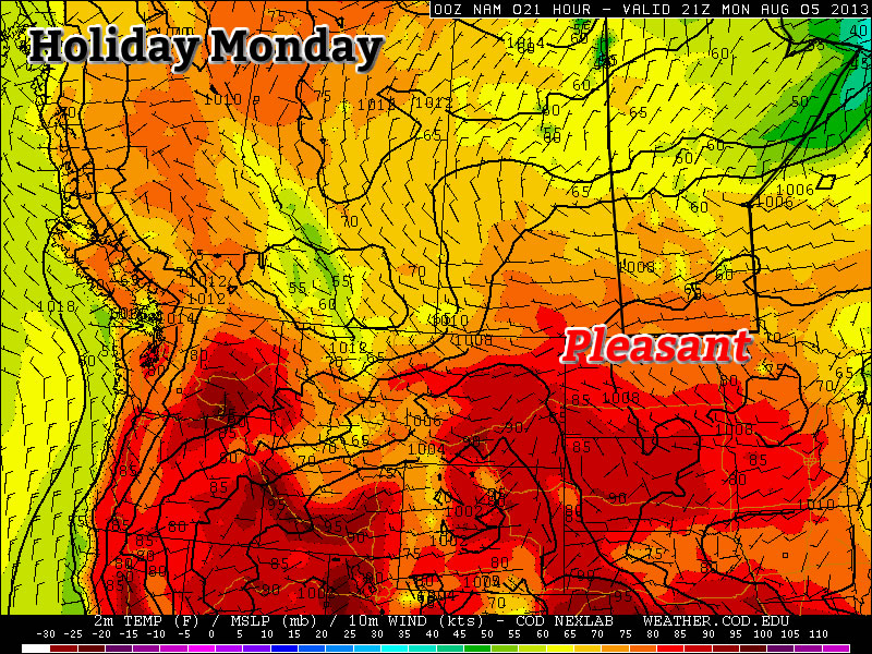
After a few days under the influence of significantly below-normal temperatures, conditions are set to gradually improve as the cold low that has been anchored over Northern Manitoba, Northwestern Ontario and Hudson Bay – for what feels like forever – begins to slowly shift off to the east.

Friday

21°C / 9°C
A few scattered showers in the morning, then a mix of sun and cloud.
Saturday

22°C / 11°C
Mainly Sunny
Sunday

24°C / 11°C
Mainly Sunny

This morning will start with mostly cloudy skies and a few scattered showers through the Red River Valley. These showers will taper off through the morning and should be over by midday. After that, we’ll see a mix of sun and clouds (although there’s a slight chance we might end up fairly cloudy, but I’ll bet on some sunshine) as we climb to a high of only around 21°C. We’ll have a partly cloudy sky tonight as we drop to a low of about 9°C.

Forecast for 700mb heights & winds from the RDPS valid this morning. The orange dashed line represents an upper trough swinging southwards that is expected to produce a few showers Friday morning.

Saturday and Sunday will be fairly nice days. Winds won’t make much of an appearance while much of our cloud cover finally moves off into Ontario and some warmer air finally starts to push back into the region. We may see a bit of a cloudy start to Saturday, but things should quickly turn sunny as we climb to around 22 or 23°C. We’ll drop to around 11°C Saturday night and then climb to a sunny high of 24°C on Sunday.

Moderation, At Last

The NAEFS 8-14 temperature anomaly outlook issued 12Z August 8th.

The NAEFS 8–14 temperature anomaly outlook issued 12Z August 8th. The lack of colours over Manitoba represents a return to seasonal weather is expected.

Long-range forecast models are finally forecasting a return to seasonal weather over the next week or two. With the relocation of the cold low into Eastern Canada, the persistent cold trough that drove our northwesterly winds will also vacate the region allowing milder air to push back in. Like we mentioned on Wednesday, no particularly warm is set to push into the area, but the warm August sun should quickly modify our air mass back towards seasonal values.

Little to no precipitation is expected in the next 5–7 days as broad upper-ridging slowly builds into the Prairies. A couple weak disturbances will have to be monitored, but for now there’s no rainy days in sight.

Fall Arrives Early

Distinctly fall-like weather will dominate over Southern Manitoba through the rest of the work week as a (unfairly) cold low slumps southwards into Central Manitoba, spreading cool Arctic air southwards across the Red River Valley and into the northern Plains of the United States.

A cold low slumping southwards into Central Manitoba will bring cooler, distinctly fall-like weather to Southern Manitoba. Image depicts 700mb temperatures for midday today.

A cold low slumping southwards into Central Manitoba will bring cooler, distinctly fall-like weather to Southern Manitoba. Image depicts 700mb temperatures for midday today.

Today & Tonight

Wednesday

18°C / 8°C
Mainly cloudy with a chance of showers.

We’ll see mainly cloudy skies today as the upper low continues it’s southwards trek pushing cool, unstable air into the Red River Valley. There may be some drizzle or a few showers to the in the lee of Lake Manitoba and the south basin of Lake Winnipeg this morning, although there may be enough wind shear to prevent any lake-effect precipitation from forming in this cool air mass. Temperatures will climb to only around 18°C today with some scattered showers developing through the day in most areas of the Red River Valley. The clouds and showers will move out in the evening leaving us with clear skies and light winds as we drop down to a temperature of around 8°C.

Thursday & Friday

Thursday

20°C / 11°C
Mainly cloudy with a chance of showers.
Friday

22°C / 9°C
Cloudy with a chance of showers in the morning then clearing.

Thursday will start off nice and sunny but quite cool. Scattered clouds will develop midday before a more organized area of cloud begins work it’s way into the city from the north in the afternoon. The afternoon cloud will limit our daytime high to only around 20°C. By late afternoon or early evening we’ll see a chance of showers move into the Red River Valley as another batch of moisture wraps around the back-side of the upper low and down through the Interlake. The cloud cover will help keep our overnight low a little warmer – close to 11°C – instead of the cooler temperatures of Wednesday night.

Early Friday morning we’ll probably see mostly cloudy skies with a chance of showers. The cloud cover will push out in the mid-to-late morning and we’ll be left with sunny skies and a high near 22°C. Friday night will be cloudy with a low of around 9°C.

Hope For the Weekend?

While some long-range models are forecasting temperatures in the mid–20’s, at this point it doesn’t look like we’ll see a warm-up that quickly. While the cold air definitely begins to push off to the east through the weekend, no particularly warm air is pushing in to replace it. We’ll see gradual warming thanks to the sunny skies, but at the moment a more conservative forecast of temperatures climbing towards the mid–20’s – instead of rocketing past it – is probably a safer bet. At this point it does look like it will be nice and sunny through the weekend, though, so all in all it will be quite pleasant.

Nice Holiday Monday, but Then it Gets Ugly

The last day of the long weekend will be quite nice, but then conditions will turn ugly for Tuesday as a strong cold front pushes through.

Monday will be a Generally Pleasant Day in Southern Manitoba

Monday

Monday

Mix of Sun and Cloud. Chance of Showers.
25°C / 14°C

Today will be fairly nice in Southern Manitoba. Afternoon temperatures will be in the mid twenties under a mix of sun and cloud. The atmosphere will be a bit unstable later in the day, meaning that some isolated showers or thunderstorms may develop. These showers and storms are most likely to occur along and north of the Trans-Canada, though some areas south of the highway will still stand a slight chance of seeing an isolated cell move through. Wind speeds will be light, so overall it will be a quite a nice day in those areas that don’t see any showers or storms move through.

Tuesday

Tuesay

Rain early, then Decreasing Cloudiness
18°C / 5°C

The weather will be in transition on Tuesday as a strong cold front blows through early in the morning, setting up unseasonably cool weather for much of the week. There will likely be some showers, or perhaps even thundershowers, associated with this front as it passes through. However, amounts don’t look to be particularly high. In total, amounts will probably range from about 5 to 15mm, with locally higher amounts. Once the rain clears the region on Tuesday morning, temperatures won’t recover very much. Highs on Tuesday will only be in the mid to upper teens with a stiff northerly wind. Obviously Tuesday will be an unpleasant day, certainly not what we’d hope for in early August.

Wednesday

Wednesday

Increasing Cloudiness. Chance of Showers.
19°C / 9°C

Wednesday will be another cool day in Southern Manitoba from start to finish. Early morning temperatures will be in the mid single digits, with a recovery to the upper teens or perhaps twenty degrees by afternoon. Unfortunately, the atmosphere will quickly destabilize with daytime heating, prompting numerous showers to develop by afternoon. By this point you can probably recognize that this week isn’t going to be very nice.

Long Range

Medium range weather models suggest that the remainder of the work week will stay cool and showery. In the longer range models suggest we may begin to see temperatures trend back towards normal by next weekend, but that is still a bit far away to get overly excited about.

Elsewhere in Weather News: August 3rd, 2013

Damaging Tornado Touches Down in Italy

On Tuesday, the 30th of July a strong tornado touched down in the northern part of Italy in the city of Milan. The storm which was associated with the same upper level low as talked about in last week’s EIWN, as well as a very potent shortwave nearby, was fed by very moist air coming straight from the Mediterranean Sea. The conditions were favorable for tornadoes with low cloud bases and a favorable shear profile.

The tornado, rated an EF-2 (winds of 178-217km/h) on the Enhanced Fujita scale, touched down in the industrial part of Milan, called Grezzago. It quickly picked up lots of debris; easily ripped off roofs, snapped trees and even picked up vehicles. One lucky resident caught in the tornado remembers her car being lifted into the air and thrown about 10 meters, she was uninjured. Thankfully, no fatalities came from this tornado, though 15 people were found to have injuries caused by the twister. There easily could have been more injuries, such as the person who was filming this video, had the windows not held up.

Very dangerous video of an office worker watching the tornado from close up. Notice all the debris. (Source: AP)

This is not the first serious tornado Italy has seen this year, back in the beginning of May, a strong EF-3 tornado touched down in the central part of Italy, caused quite a bit of damage as well as injured 20 people. Italy will get a break this weekend as no severe weather outbreaks are expected.