East Pacific Continues to be Active
This past Tuesday the 10th hurricane in the Eastern Pacific formed and slowly strengthened into a category two hurricane and remains at this status as of Friday night. The hurricane, Norbert, is not expected to make any landfalls, however it is scraping by the Baja Peninsula region bringing adverse weather conditions to the region. Tropical destinations along the coast such as Cabo San Lucas saw tropical storm warnings as well as hurricane warnings. Norbert’s tropical storm force winds expanded a good distance from its centre which prompted these warnings. In fact, Cabo San Lucas had sustained winds of 98km/h overnight Thursday and combined with strong outer rain bands, this made for nasty conditions.
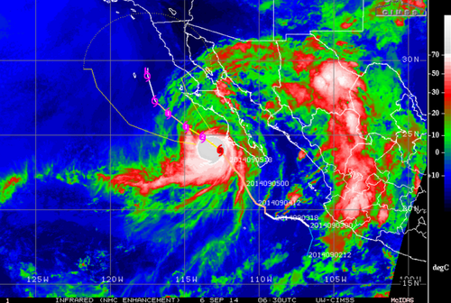
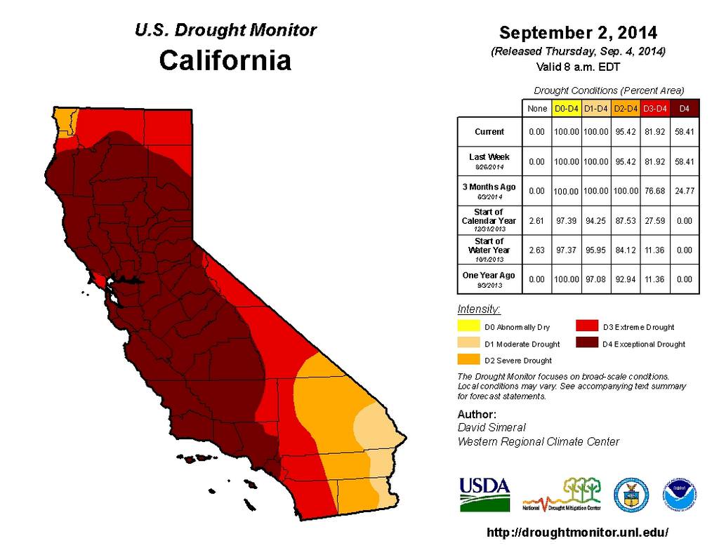
Norbert is expected to slowly continue northwest to its death and stay offshore. One potential benefit is that the remnants of Norbert could help a bit with the drought in California. The tropical plume of moisture should hold together and has the potential to move into southern California next week, making a small dent in the significant drought that is occurring:
The Eastern Pacific hurricane season lasts from mid-May to the end of November and on average features 8 hurricanes. In contrast to the Eastern Pacific hurricane season, the Atlantic hurricane season has been off to another slow start with only 3 hurricanes this year with no real prospects of possible storms in the near future according to the models, even as we approach the peak of the season. The Atlantic sees on average six hurricanes every year.