Light Snow Will Bring Reprieve From The Bitter Cold

After experiencing the coldest day of 2017 on December 30th, Winnipeg will see relief from the bitter cold as the Arctic high moves out of the region and temperatures return closer to seasonal values. Temperatures will climb to near-seasonal values on Tuesday with some light snow, but a cold front moving through Tuesday night will bring colder temperatures back for Wednesday.

Today will be the first day where temperatures really start breaking from the Arctic chill in Winnipeg with the high temperature climbing to around -20°C. Skies will remain mainly clear for much of the day, however a bit of cloud will begin working into the region late in the day; so late, in fact, that it may end up being dark before the cloud finds its way into the Red River Valley. The wind will become a little more noticeable as the day progresses, though, climbing to around 20 to 25 km/h by the end of the afternoon, producing a wind chill values in the -30 to -35 range.

Winnipeg will see partly cloudy skies tonight as temperatures dip to a low near -24°C with south-southwesterly winds of 20 to 30 km/h. Wind chill values will be in the -35 to -40 range. A bit more cloud will push in through the latter half of the night as a low pressure system begins pushing into the Interlake region from northern Saskatchewan.

3km NAM 12hr Snowfall Totals (10:1 SLR) valid 00Z January 3, 2018
Winnipeg will likely see a light dusting of snow on Tuesday

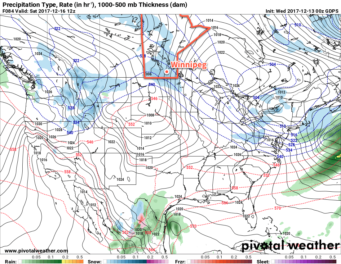
Tuesday will bring mostly cloudy skies to Winnipeg as a low pressure system brushes by the region. Temperatures will be the warmest they’ve been since December 23rd1 as highs climb to around the -15°C mark. Winds will ease midday, but a cold front sweeping through in the afternoon will usher in brisk northwesterly winds of 30 to 40 km/h, bringing an end to the brief mild spell.2 Skies will remain mostly cloudy to mixed overnight as temperatures dip to a low near -25°C. Wind chill values will once again fall into the mid -30s.

Wednesday will bring clearing skies with temperatures reaching a well below-seasonal high of -21°C. The winds will ease to light by midday, making for a relatively nice afternoon if you bundle up. Winnipeg should see clear skies and light winds on Wednesday night as a ridge of high pressure moves into the Red River Valley. Lows will be cold, though, with temperatures expected to drop to around -29°C in Winnipeg.

Long Range Outlook

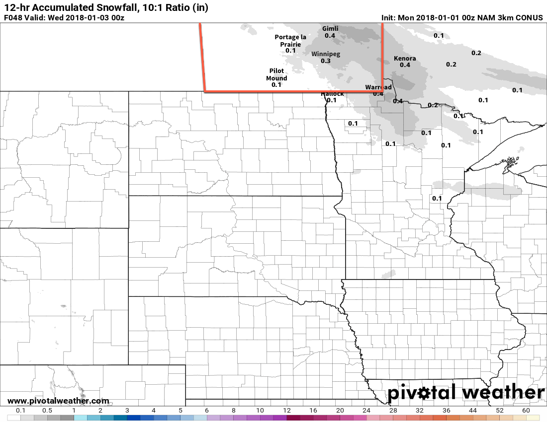
Over the next while, it looks like temperatures will remain seasonal to below-seasonal, although not to the extremes seen at the end of December. It also looks fairly dry; after Tuesday’s light dusting, the next chance Winnipeg may see a bit of snow is on Saturday night into Sunday morning as another low moves through, bringing milder air with it. So no extreme cold, no big snows, just some relatively calm winter weather ahead.

Winnipeg’s seasonal daytime high is currently -13°C while the seasonal overnight low is -23°C.

  1. Winnipeg’s daytime high on December 23, 2017 was -11.4°C.
  2. Which should be noted is still below seasonal average temperatures.
GDPS Forecast 850mb Temperature Anomaly valid 12Z December 25, 2017

Polar Express On The Way

The Polar Express is on its way to Winnipeg, and we’re not talking about the book. After near- to slightly below-normal temperatures through the latter half of the work week, Arctic air will surge southwards this weekend, sending temperatures towards what may end up the coldest Christmas Day in two decades.

Today will bring mainly cloudy skies to Winnipeg as a low pressure system crosses through the Dakotas, spreading a broad area of cloud ahead of and north of its path. This low will also reinforce light northerly winds over the Red River Valley, tapping into the first of a series of Arctic highs that are slumping southwards out of the north. The cloudy skies and cool wind will result in temperatures a bit below seasonal with a high around -15°C in Winnipeg. No accumulating snow is expected today, either in Winnipeg or south of the city; it should remain south of the American border in the Dakotas.

Skies will clear out overnight as temperatures head to a low near -25°C.

Winnipeg will see light winds and sunny skies on Thursday with temperatures once again climbing to a high near -16°C. A low pressure system moving across the northern Prairies will begin spreading a milder air mass into the region in the evening; skies will cloud over as southerly winds pick up into the 20 to 30 km/h range. Temperatures will climb overnight to around -13°C early Friday morning.

Friday will mark the start of the major transition in temperatures over southern Manitoba. After reaching a high near -10 or -11°C, a cold front will sweep through region bringing a bit of light snow. Northwesterly winds will develop behind the front and temperatures will gradually begin to fall. The one saving grace will a rather extensive patchwork of cloud left in the wake of the cold front, which will prevent things from getting too cold. Temperatures will fall to a low near -20°C with a slight chance of flurries overnight.

Long Range Outlook

Temperatures will plummet across southern Manitoba this weekend as a large-scale pattern change happens, allowing bitterly cold Arctic air to spill southwards across the Prairies.

GDPS Forecast 850mb Temperature Anomaly valid 12Z December 25, 2017
Forecasts are showing a bitterly cold air mass in place over southern Manitoba on Christmas Day, represented here by 850mb temperatures over 20°C below seasonal values

This bitterly cold air mass will become entrenched over the region, bringing cold daytime highs at or below the seasonal overnight lows for several days on end. Looking towards Christmas Day, it looks like high temperatures will be around -24°C. This would be the coldest Christmas in 20 years, back to 1996 when the daily high was a frigid -27.8°C. No significant improvement in temperatures will occur through the remainder of next week.

Stay warm, Winnipeg!

Winnipeg’s seasonal daytime high is currently -11°C while the seasonal overnight low is -21°C.

More Snow on the Way

A pair of low pressure systems working their way into the Prairies will spread snow eastwards into the Red River Valley today.

Under cloudy skies, Winnipeg will see temperatures climb to a high near -11°C today as snow develops through the morning hours. Once developed, the snow will persist through Friday night before tapering off on Saturday morning. Although it will snow for quite a while, it won’t be a particularly large snowfall event, with just 2 to 5 cm of snow expected in the Red River Valley. Further west, in parts of southwestern Manitoba and into the Parkland areas of western Manitoba, amounts will be higher with 4 to 8 cm expected by the time it tapers off. Temperatures will remain steady near -11°C tonight in Winnipeg with winds out of the east-southeast at 15 to 20 km/h.

RDPS Total Snowfall (10:1 SLR) valid from 12Z Friday December 15 to 15Z Saturday December 16, 2017
Winnipeg is forecast to recieve around 4-5 cm of snow by Saturday morning

Snow will taper off on Saturday morning, then some sunny breaks will work into the Red River Valley through the afternoon. Temperatures will climb to a high near -7°C with light winds. Mixed to cloudy skies are expected on Saturday night as temperatures dip to a low near -10°C.

Milder air will continue moving into the region on Sunday as Winnipeg climbs to a partly cloudy high near -4°C and winds out of the southwest at 15 to 20 km/h. Clouds are forecast to build back into the region on Sunday night, bringing a chance of flurries to the region as temperatures drop to a low near -7°C.

Long Range Outlook

Another big pattern shift will occur in the coming week, this time bringing the deep freeze.

GPDS Forecast 850 mb Temperature valid 00Z Sunday December 24, 2017
The forecast 850 mb temperatures reveal a significantly colder airmass in place over the reigon by late next week

A significant low pressure system will work its way across the Prairies on Monday and once it passes, a potent Arctic ridge is forecast to build into the Prairies from the northwest. This will usher a much colder air mass into the region that will plunge daytime highs down into the low minus teens by the later half of the week.

So get out there and enjoy the mild winter weather; it doesn’t look like it will be sticking around for too much longer!

Winnipeg’s seasonal daytime high is currently -10°C while the seasonal overnight low is -20°C.

Cloudy and Cooling with Occasional Light Snow

Winnipeg will see several batches of light snow over the coming few days as temperatures slowly slide towards seasonal values.

Today will bring falling temperatures to Winnipeg as a cold front slumps south and brings another shot of light snow through the region. Not much snow will fall, perhaps 1 to 2 cm, and it should taper off by the afternoon. Winnipeg will see breezy northwesterly winds around 30 gusting to 50 km/h, but over the western Red River Valley they’ll be a bit stronger and closer to 40 gusting 60 km/h. The winds will taper off through the afternoon across the region as temperatures fall to around -9°C. Skies will remain mostly cloudy tonight as temperatures remain steady near -10°C.

Thursday will bring more cloud to the region with a chance of some more light snow as another weak upper-level disturbance slides across the region. Temperatures will climb to a high near -7°C with light winds. Some clearing will work into the region on Thursday night as temperatures dip to a low near -16°C.

GDPS Forecast Precipitation Type and Rate valid 12Z Saturday December 16, 2017
Some accumulating light snow is expected to move through Winnipeg on Friday night into Saturday morning

Friday will bring mixed skies to Winnipeg, but the cloud will push back into the region in the afternoon as another Mackenzie clipper begins dropping southeastwards out of the Northwest Territories. Temperatures will reach a high near -11°C before the cloud thickens up in the afternoon.

Models are wavering a bit on the location, but snow will likely push into southwestern Manitoba in the afternoon and then eastwards into the Red River Valley on Friday evening. Temperatures will hover around the -10°C mark on Friday night. Total snowfall amounts are a bit in the air at this point, but around 2 to 5 cm looks probable for Winnipeg.

Long Range Outlook

The weekend looks mild as warmer air pushes eastwards into the province, bringing daytime highs back to around -4°C. Saturday will still bring plenty of cloud, but the sun may make a return on Sunday. At this point, it looks like Monday may be the warmest day with temperatures possibly climbing above freezing before cooler air begins working back into the region with seasonal temperatures returning mid-week.

Winnipeg’s seasonal daytime high is currently -10°C while the seasonal overnight low is -19°C.