Mild Friday Leads to Cooler Weekend

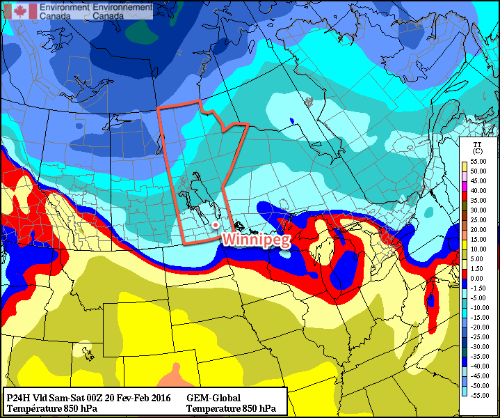
The mild weather will continue today with daytime highs of +1 or +2°C today as yet more warm air washes over Southern Manitoba. The system responsible for this mild spell will be making its way across the region today and after it brings some mixed precipitation, it will push eastwards into Ontario, taking the warmth with it. Northerly winds will develop tonight and begin to usher in cooler, more seasonal temperatures.

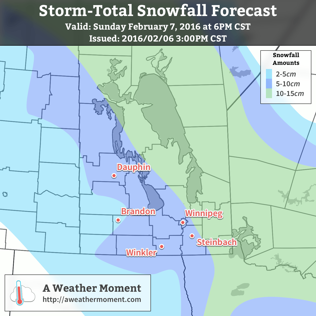
Today will bring some more organized precipitation across the Red River Valley as the main disturbance that’s been responsible for the warmth this week moves across the region. With temperatures so close to the freezing mark, what type of precipitation will be falling is a bit of a difficult question to answer. Looking at the Red River Valley as a whole, we can say that there will be mixed precipitation, however for any one location may see just rain, just snow, or both. Even if snow falls, with the above-0°C temperatures, it won’t be able to accumulate much. By the time the precipitation tapers off, just 1-2 mm of rain or cm of snow will have fallen.

With light winds and above-zero temperatures, it also is possible that drizzle or fog patches are an issue throughout much of the day.

As the system moves into Ontario later today, northerly winds will begin developing over Southern Manitoba and draw in cooler air from the north. Drizzle or freezing drizzle will be possible through the early evening hours, but that risk should dissipate heading into the overnight period. Temperatures will dip to about -6°C with gusty northerly winds up to 30 km/h.

GDPS 850mb Temperature Forecast
The GDPS shows the gradual return of colder air via 850mb temperatures.

Saturday will bring mixed skies and diminishing winds as the Red River Valley sees a weak ridge of high pressure begin to build in. There’s a bit of uncertainty to exactly how much cloud will clear out of the region; it will likely trend towards cloudier, but we should see a few sunny breaks through the day. Temperatures will recover just slightly from the overnight low to a high of -5°C. The colder weather will continue pushing southwards with gradual clearing through the evening & overnight that will allow temperatures to dip to an overnight low near -17°C.

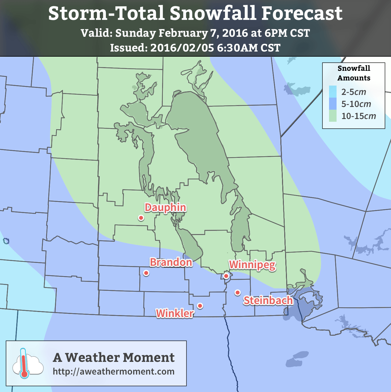
Sunday will bring partly cloudy skies to Winnipeg, but the southern Red River Valley will likely see cloudier skies as a weak low pressure moves through North Dakota. This system will produce some light snow for areas further south, but in Winnipeg there will just be a chance of flurries. Temperatures will be slightly cooler than seasonal with a high of -12°C. Skies should clear on Sunday night as temperatures head to a low near -16°C.

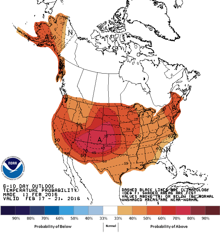
Long Range: Not Cold For Long

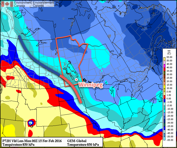
This cool-down will be brief; by Monday daytime high temperatures approaching the freezing mark will return to the Red River Valley.

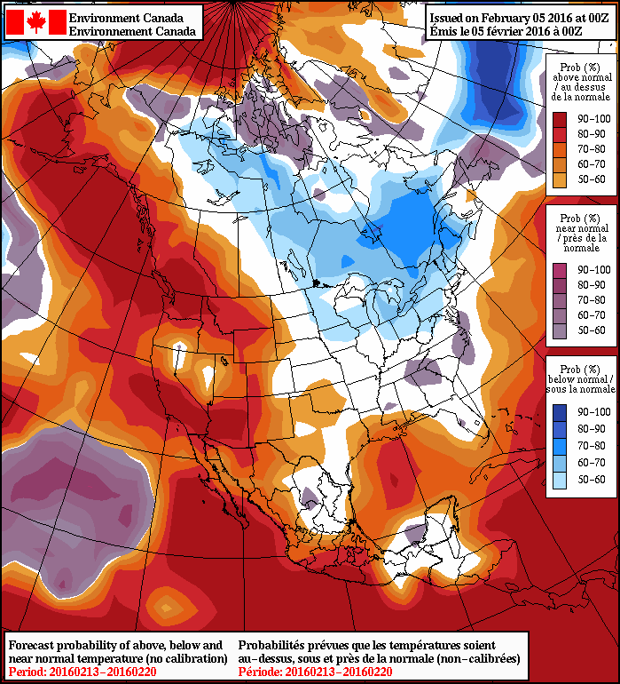
Temperatures will be variable next week with warm days giving way to 1-2 days of seasonal temperatures before warmer weather returns again. No significant precipitation events are expected through next week.

Winnipeg’s seasonal daytime high is currently -7°C while the seasonal overnight low is -18°C.

Mild Weather Returns for End of Weekend

Bitterly cold temperatures will be in place today as a strong Arctic ridge of high pressure moves through the region. This cold snap will be short-lived as warmer air begins moving into the region through the weekend; by Sunday, milder temperatures will be in place alongside some light snow.

Today will be, temperature-wise, the coldest day of the week as temperatures are held back by the breezy northwesterly winds of an advancing Arctic air mass. Temperatures will recover only a little bit as they struggle to climb to an afternoon high near -21°C before quickly beginning to drop as the sun goes down this evening.

Environment Canada's extreme cold warning issued Thursday afternoon.
Environment Canada’s extreme cold warning issued Thursday afternoon.

Temperatures will plummet to the -30°C mark by Saturday morning as winds gradually diminish. Wind chills this morning as well as tonight will likely be flirting closely with the -40 mark. Environment Canada has issued an extreme cold warning for much of the province because of that.

Saturday may end up feeling like a colder day than Friday; while warmer temperatures may begin to work into the region, they’ll be accompanied by those famous winter southerlies that result in a fairly miserable transition day to warmer weather. While temperatures will rise towards -15°C by the end of the day, southerly winds will strengthen to around 40km/h making it feel significantly colder than it actually is. As a warm front begins moving into Manitoba later in the day, it will spread cloud cover into the Red River Valley and by mid-evening, it seems likely that skies will be mixed to cloudy with a chance of flurries. It will stay fairly windy through the night as temperatures continue to rise to around -12°C by Sunday morning.

GDPS 850mb temperature forecast valid Sunday evening
A frontal wave will pass through Manitoba on Sunday brininging warmer weather and light snow.

Sunday will be significantly more pleasant as mild weather continues to move into the region. Temperatures will climb to near -6°C on Sunday afternoon with light winds and a good chance of light snow. No significant accumulations are expected with Sunday’s disturbance, although 1-2cm of snow could pile up locally. Temperatures will fall to just -9 or -10°C on Sunday night under cloudy skies.

Long Range: Generally Mild

Looking ahead into next week, it looks like Southern Manitoba is transitioning into a generally above-normal temperature pattern.

CPC 6-10 Day Temperature Anomaly Forecast
The CPC is calling for above normal temperatures in the 6-10 day timeframe.

Milder Pacific air will be building into the province through much of next week. The start of next week will see a bit more variability in temperatures, with some days above normal and some below, but by the second half of the week there seems to be a fair amount of confidence of temperatures switching to a more persistent above-normal pattern. Current guidance places daytime highs near -5°C by the end of next week into the week after.

Through this period, no significant precipitation events are expected.

The normal daytime high for Winnipeg is currently -9°C and the normal overnight low is -19°C.

Weekend Storm To Bring Snow & Warmer Weather

Warm weather is on the way for Winnipeg this weekend as a strong low pressure system developing over Northern Alberta spreads mild air eastwards through the Prairies. This storm system will then slide southeastwards across the Prairies, bringing a moderate snowfall event to Manitoba primarily through Saturday afternoon and Sunday, followed by falling temperatures, gusty winds and blowing snow.

Winnipeg will see mainly cloudy skies today as the city remains locked underneath a tight baroclinic zone. [1] There will be a continued chance of occasionally seeing some of the flurry activity that developed last night over the city, however no real accumulations of snow are expected today. Temperatures will be fairly pleasant with a daytime high near -6°C, which is 4°C above the normal high of -10°C for this time of year.

The chance for any flurry activity will diminish tonight, but the cloud will stick around as temperatures dip to around -11°C for the overnight low.

Storm System Moves in on Saturday

Saturday will bring the arrival of both warmer weather and the storm system that will bring a new batch of snow to the region. First the good news: temperatures will be on their way up through the entire day. From the morning low near -11°C, temperatures will gradually climb to near -5°C midday and then up to near -1°C by evening. Temperatures will then remain fairly steady through the night, wavering around the -1°C mark. Cooler air will begin working into the region on Sunday, dropping the temperatures in Winnipeg to around -8°C by the evening.

AWM Snowfall Forecast for February 6/7, 2016
Updated AWM Snowfall Forecast for February 6/7, 2016 (Original here)

While some flurries are possible through the morning, the real snow will develop through the afternoon hours as the low centre of the storm begins moving into Southern Manitoba. Snow will intensify into the evening and the heaviest snow of the storm will be through Saturday night. On Sunday morning the snow will likely begin to ease, but continue to persist much of the day. By the time all is said and done, it looks quite likely that essentially all of Southern Manitoba will have seen at least 5cm of new snow before things taper off on Sunday night.

The heaviest amounts will fall to the north of the low track, which, given that it’s still a day and a half out, could change. The current agreement seems relatively dependable, however if it does end up shifting south even just a little, it’s possible that Winnipeg could surpass 10cm.

Although this system has the potential of producing a lot of snow, it doesn’t look like it will qualify for a snowfall warning from Environment Canada, which requires 10cm to fall within a 12hr. time period. This system will produce higher amounts more through it’s longer residency time than its intensity. That said, it’s still early for a lot of things with systems like these; we’ll be keeping an eye on it and updating forecasts if it looks like it’s going to change significantly from current expectations.

Lastly, there will be a bit of wind with this system too. Winds won’t be too bad on Saturday, however for a short while in the afternoon winds may climb up to around 30-40km/h out of the southeast. Winds will diminish overnight before picking up on Sunday out of the northwest. Blowing snow will be an issue on Sunday as the northwesterly winds increase to 40 gusting 60km/h and combine with the fresh snow. Through the Red River Valley, the strong winds will be in place by mid-day Sunday and persist into the late evening hours, so if you have plans to travel on Sunday afternoon or evening, prepare to give yourself some extra time to account for poor visibilities and driving conditions. For those reading this in southwestern Manitoba, the stronger winds will be in place by Sunday morning and persist into the overnight period as well, making blowing snow an issue all the way west into southeastern Saskatchewan.

Long Range: Colder Weather…But Only Briefly

Behind this storm system, cooler air will begin slumping into the Prairies, returning temperatures to seasonal values. Another batch of snow is possible Tuesday night as another disturbance moves through the region, which will usher in a pattern change that will see southwestern Manitoba clipped by several systems while even colder air works into the Prairies.

NAEFS 8-14 Day Temperature Anomaly Forecast — Valid February 13-20, 2016

Into the second half of next week, below-seasonal temperatures will begin moving into the province with daytime highs slumping into the low minus teens and overnight lows dipping below -20°C. This cooler weather will likely persist into the early parts of the following week before a moderating trend begins, shown by the higher probabilities of cooler-than-normal weather in the NAEFS forecast above.

The seasonal daytime high for February 5th in Winnipeg is -10°C, while the seasonal overnight low is -21°C.


  1. A baroclinic zone is an area where there is a strong temperature gradient across relatively short distances, either at the surface or aloft.  ↩

Seasonal Temperatures & Occasional Snow

Near-seasonal temperatures are on the way for Winnipeg through the remainder of this week with multiple chances for light snow as several weak disturbances slide across the region.

Today’s weather will be dictated by a weak low pressure system moving through the region that will spread more cloud and snow across Southern Manitoba. Although the snow will be widespread as it gradually pushes eastwards across the province, it will also be quite light. The grand-total for around 4-6 hours of snow will be just 1-2 cm, with some areas that see little-to-no accumulation. Here in Winnipeg, we’ll see some sun through the morning, then increasing cloud with some light snow starting late in the afternoon. It will be pleasant for early February, however, with daytime highs around -11°C and light winds. Expect temperatures to dip to around -15°C tonight under mainly cloudy skies.

RDPS-based precipitation forecast valid from 18Z - 06Z February 3/4, 2016
RDPS-based precipitation forecast showing snow over Manitoba through Wednesday afternoon & evening

Thursday will be a benign day with mainly cloudy skies, daytime highs once again near -11°C for Winnipeg, and light winds. There’s a very slight chance of some flurries thanks to the temperature profiles through the lower atmosphere, but if they do develop, they will be quite weak. Temperatures will drop to about -14°C on Thursday night with cloudy skies as the next low pressure system moves in from the west.

Friday will be another cloudy day with daytime highs climbing a couple degrees higher to around -9°C. There’s a decent chance of some flurry activity through the Red River Valley as the next low pressure system tracks through the region. Temperatures will dip to around -14°C on Friday night under cloudy skies.

Long Range

The long-range outlook shows a fairly significant pattern change next week, but not before things turn a little more unsettled.

Through the weekend and into the first half of next week, the weather looks to turn more unsettled as the storm track shifts over Manitoba. No major snowfalls are expected at this point, but several relatively strong lows will likely move through the region, at least bringing a little more variability to the temperature and some windy conditions at times.

GFS-based forecast of 850mb temperature anomalies for the end of next week

A major large-scale pattern change begins early next week as the polar vortex slumps southwards into Northern Ontario as large scale upper-level ridging takes place over the west coast of North America. This combination will shift winds at all levels over Manitoba to northerlies straight out of the Arctic, and a surge of colder air will blast southwards in response. This will likely happen in multiple stages with a weaker shot mid-week and then a stronger surge at the end of the week. The image above shows the GFS forecasting 850mb temperatures [1] over 10°C below normal for next Friday.

If this forecast comes to fruition, then through the latter half of next week daytime highs would fall into the -15 to -20°C range.

The colder air doesn’t appear to be likely to stick around for too long, though, with seasonal temperatures building back in by the end of the weekend.

Seasonal daytime highs in Winnipeg for early February are -10°C while seasonal the overnight lows are -21°C.


  1. 850mb is approximately 1.5km above the ground.  ↩