Unsettled & Uncertain for the Weekend

The weather will take a turn back towards being unsettled this weekend as a weak trough moving through the region brings another round of shower or thunderstorm activity.  For the most part, though, it appears that most of the next few days will be quite pleasant.

Today will be a pleasant early summer day with daytime highs around the 23°C mark throughout the Red River Valley with mixed skies – likely leaning towards the cloudier side. Winds will be relatively light at just 20km/h or so out of the southeast. The RRV will see increasing cloudiness overnight with a low near 14°C and winds out of the southeast at 20–30km/h.

Saturday

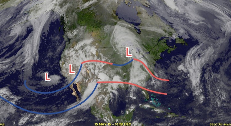
Saturday is a day fraught with uncertainty.  Similar to earlier this week, a disturbance tracking across the Northern Plains of the U.S. will spread rain and thunderstorm activity across North Dakota, while significant uncertainty exists to how far north into Manitoba the precipitation will extend.

Overall, it will be a cloudier day with highs around the 20°C mark. There are several possible outcomes to consider for the day:

  1. We see a large area of rain move across Southern Manitoba on Saturday morning that produces a wide swath of 1–2” of rainfall. It moves out on Saturday afternoon and we see a slight chance of some evening convection.
  2. The bulk of the rainfall stays in North Dakota with a disorganized area of showers moving across Southern Manitoba through the day on Saturday.
  3. The bulk of the precipitation moves through North Dakota while precipitation focuses along a surface trough over Western Manitoba that gradually works its way into the Red River Valley later in the day.

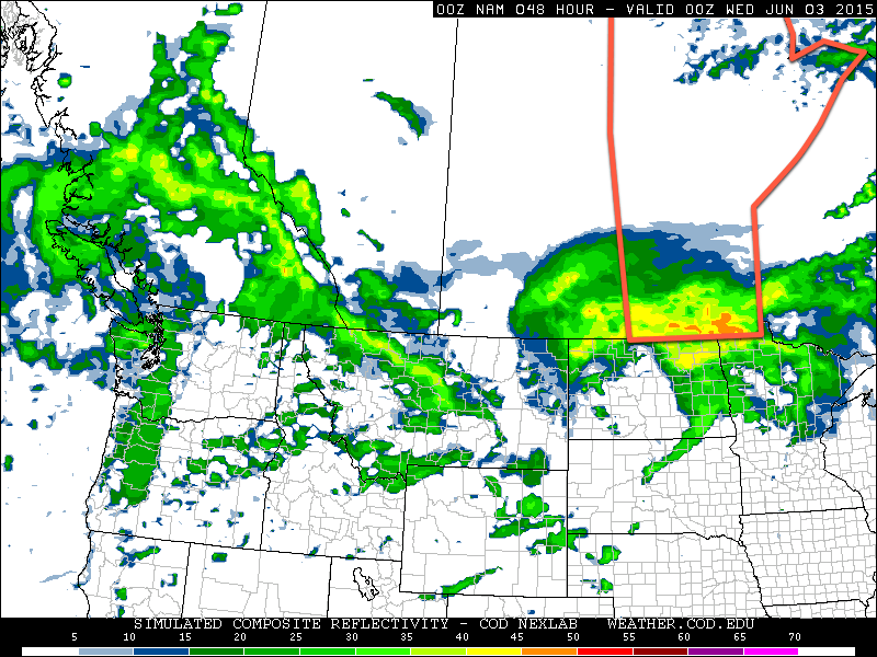
It’s really difficult to tell which outcome will be the correct one at this point; models struggle terribly with systems that are driven by the energy release of thunderstorms; it’s not uncommon to have successive model runs wildly alter precipitation location by over 100km, such as what happened with the system that brushed Southern Manitoba earlier this week.[1]

Probability of ≥ 0.5" (13mm) of rain between Friday night and Saturday night.
Probability of ≥ 0.5″ (13mm) of rain between Friday night and Saturday night.

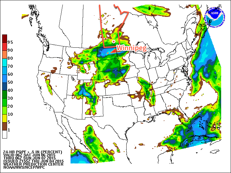
With all the uncertainty regarding what may happen on Saturday, I’d err towards the current HPC 24hr. rainfall probability outlook. This image shows the probability of receiving more than 0.5 inches (13mm) of rain over the 24-hour period. It shows roughly a 20–30% chance for Friday evening through Saturday evening. This would suggest that the heaviest precipitation stays through the Dakotas while further north we see some shower activity with a slight chance of some thunder mixed in. There’s a decent chance of some thunderstorms along the trough line in Western Manitoba in the afternoon, but much of that activity will likely taper off heading towards the Red River Valley.

At this point, though, I wouldn’t rule out all of the precipitation remaining to the west and south of Winnipeg, leaving us with just a cloudy day. We’ll be tracking this system and providing updates in the comments below as things become a little more clear.

Sunday

Sunday will be a fairly nice day with temperatures climbing back into the mid–20’s under mixed skies. There will be a slight chance for some afternoon pop-up shower activity throughout the Red River Valley, but nothing significant is expected. Overall, it looks to be quite a pleasant end to the weekend.

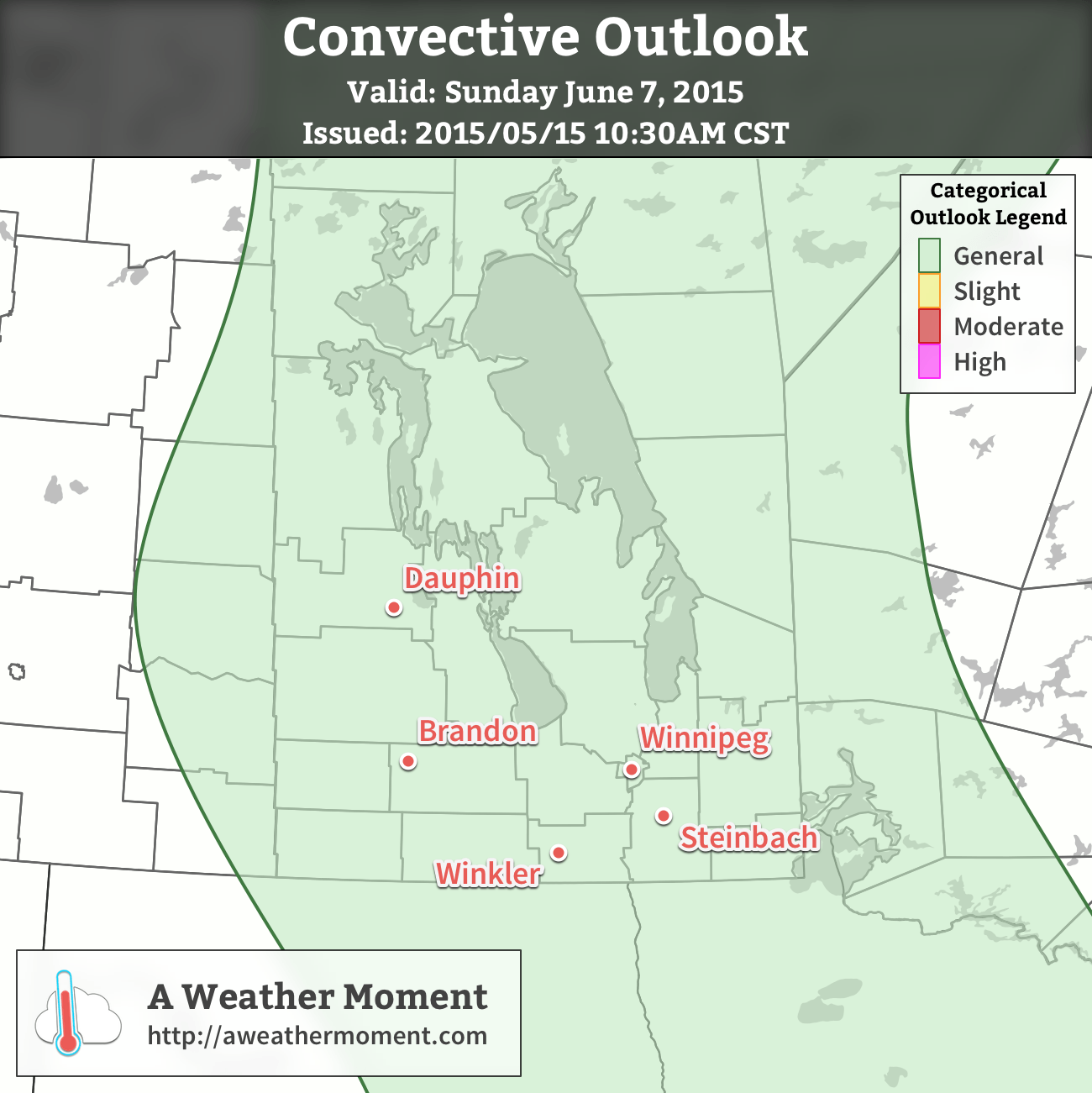
UPDATE: Convective Outlook for Sunday

A risk of thunderstorms exists across much of Manitoba today, including the Red River Valley. Scattered thunderstorms are expected to develop this afternoon as daytime heating, coupled with ample surface moisture, destabilizes the atmosphere. In general, thunderstorms are expected to be non-severe with no organized severe thunderstorm threat. Isolated, short-lived severe storms may be possible, though, particularly along the trough line extending from the Central Interlake southwards through the Red River Valley to the US border.

Convective Outlook - Day 1 - June 7, 2015
Convective Outlook for June 7, 2015

The overall thunderstorm setup doesn’t look too impressive today. MLCAPE values around 1000-1250 J/kg will have only around 15 kt of 0-6 km bulk shear thanks to a unidirectional northwesterly wind profile with low speed shear through the column. Temperatures are fairly mild through the depth of the column, resulting in skinny CAPE profiles. Moisture is sufficient, with dewpoint values in the 15-17°C range through the Red River Valley. It’s possible that some localized backing of the surface winds may occur near the trough, providing a little more inflow structure to the thunderstorms.

In general, a relatively unimpressive day; with limited energy available and weak focusing, once convection starts, everything will be “fighting for scraps” so to say and it’s quite likely that thunderstorm activity will be very pulse-y: a storm will spike up in intensity for 10-20 minutes then weaken as another one pops up.

With the higher moisture, and slightly more favourable directional profiles along the trough, there’s a small chance for isolated, marginally severe thunderstorms. The main feature of today’s storms will be fairly heavy downpours under them, but the unidirectional shear looks like it will successfully push storms along at a decent clip, so no one location should see a storm for too long, unless it roots on the trough line. For any storm that might become severe, the reason would likely be marginally severe hail at around 20mm (a nickel) diameter.

The weather will calm down this evening and we’ll be heading into a gorgeous summer week!


  1. The NAM forecast model went from forecasting ≥ 50mm of rain for Winnipeg to 0.5mm on the next run of the model.  ↩

Unsettled Start to the Week

The first part of this week will see unsettled weather as a strong low pressure system passes to our south. This system will likely result in moderate rainfall and a risk of thunderstorms over southern Manitoba on Tuesday.

Monday

Today looks to be mainly cloudy ahead of an approaching low pressure system. There may be a few passing showers throughout the day, but no major precipitation is expected. High temperatures are expected to reach the low twenties with gusty south winds.

Tuesday

Tuesday looks quite unsettled as we sit north of a fairly strong low pressure system over the Dakotas. A warm front will likely be located over northern North Dakota, allowing for warm and potentially stormy weather just to our south. In southern Manitoba, we will remain stuck in a cool easterly flow north of the warm front. As a result of our position relative to the warm front we likely see moderate rainfall during the day with a chance of embedded thunderstorms.

NAM Simulated RADAR Reflectivity
The simulated RADAR reflectivity from the NAM forecast for Tuesday afternoon shows a large area of rainfall moving over Southern Manitoba.

Should the warm front move further north than expected, our risk of thunderstorms will be higher, but at this time that does not look probable. Total rainfall amounts in southern Manitoba could be in the 15-35 mm range, although it is difficult to predict this sort of system ahead of time. Higher rainfall amounts are certainly possible on a localized basis due to isolated thunderstorm activity.

Wednesday

Wednesday looks cool and cloudy as Tuesday’s system departs. We my see a few showers during the day, but in general not much precipitation is expected. The wind will be from the north at around 30 km/h.

Long Range

The long range forecast suggests we’ll see generally normal to above-normal weather through the middle of June. Numerous weak to moderate weather systems are expected to traverse the region over the next while, meaning our weather will continue to feature unsettled patches, before we return to more favourable conditions.

More Warmth Ahead This Week

The weather this week will continue from where the weekend left off as warm and mainly sunny conditions prevail. Temperatures will remain in the upper twenties, before dropping off a bit mid-week.

Monday

Today will be mainly sunny, although some upper-level cloud may drift through southern Manitoba as a result of a large weather system to our south. Other than that, there isn’t much weather to discuss for today. Temperatures will climb into the upper twenties and winds will remain light.

Tuesday

Tuesday looks to remain quite warm, with temperatures once again reaching the upper twenties. During the afternoon it is expected that the atmosphere will destabilize a bit due to slightly higher humidity and daytime heating. This may result in the development of some showers and thunderstorms. Any storms that do develop will be weak with only very small hail and/or brief gusty winds being possible.

Wednesday

A cold front will pass through southern Manitoba on Wednesday morning, ushering in slightly cooler temperatures. Highs are expected to be in the low to mid twenties under mainly sunny skies. There may be some light showers associated with the passage of the cold front, but other than that no significant weather is expected.

Long Range

The long range forecast suggests we’ll generally stick with above-normal temperatures, although not necessarily as warm as it has been recently. Highs will more likely reside in the low to mid twenties, although the occasional jump into the upper twenties is certainly possible.

Unsettled & Unpleasant May Long Weekend Ahead

Winnipeg, and many other regions in the Red River Valley, received the most significant rainfall so far this year yesterday as an area of moderate rain moved into the province from North Dakota and stalled out for much of the day. Rainfall totals in most places were near 20–30mm with slightly higher amounts in the southwestern Red River Valley:

Rainfall totals for the May 14, 2015
Location Rainfall Total (mm)
Letellier 41
Altona 37.6
Morris 34.2
Winkler 29.8
Steinbach 27.8
Winnipeg 24
Dugald 22
Elm Creek 12.6
Portage la Prairie 9.6

The Altona/Letellier areas seem to be the winners for total rainfall with almost 1.5” of rain in total. Unfortunately for farmers who are still working at getting seed into the ground, there won’t be much of a reprieve from wet weather before more rain is on the way as another major low pressure system is hot on the heels of the previous one and is set to bring a whole host of unsettled, pleasant and stormy weather for the May long weekend.

Pleasant Friday, then Downhill

Friday
18°C / 7°C
Partly Cloudy

Today will be a very pleasant day across the Red River Valley with mainly sunny skies and temperatures climbing into the high teens under partly cloudy skies. Winds will be fairly light out of the northwest. Friday night will see temperatures drop to around 7°C under clear skies. The nice weather won’t last too long, though, as a potent low pressure system moving into the Northern Plains of the United States tonight will result in cloud and some light rain spreading across Southern Manitoba early on Saturday.  The heaviest rainfall will hold off until much later in the day, however, as this system will end up being strongly driven by convection.

SPC Day 3 Convective Outlook valid Saturday May 16, 2015

The SPC[1] in the US currently has a slight risk of severe thunderstorms in their outlook for Saturday scrunched right up the Canadian border. Further north in our area, it looks like an initial shot of some showers associated with elevated convection will lift through the region early in the day. Temperatures will warm towards the 20°C mark with an increasing risk of showers or thunderstorms.

Saturday
20°C / 9°C
Cloudy; scattered showers with the risk of a thunderstorm

Later in the afternoon, best indications at this point are that an area of thunderstorms will initiate in North Dakota and push northeastwards through the Red River Valley. It looks like precipitation will most likely be showers or weak thunderstorms, however the outside chance exists that an isolated severe thunderstorm may be seen. A thunderstorm outlook later will be issued later today covering all of Southern Manitoba.

A few showers will be likely through the overnight hours as the temperature drops to 9°C or so.

Sunday will be the most significant precipitation day with rainfall intensifying through the morning into the afternoon. There’s some uncertainty as to where the western cut-off will be for the rain, but general consensus at this point is that the entirety of the Red River Valley will see rain on Sunday.[2] Total accumulations are hard to nail down at this point, but look to be in the 25–50mm range.

Sunday
10°C / -3°C
Rain

Things take an unwelcome turn on Sunday evening as colder air works its way into Southern Manitoba on the back-side of the system. Rain may become mixed with or switch over to snow as it begins tapering off. No significant snow accumulations are expected. Temperatures will drop off to around –3°C on Sunday night with winds gradually tapering off.

Holiday Monday A Cool Improvement

Looking ahead to the start of next week, it looks like Monday will mark the transition out of this active pattern we’ve been in. Sunny skies and exceptionally cool weather look to be on tap with highs struggling to get to even 10°C[3]. Conditions will improve over the subsequent days with drier weather and temperatures returning to the seasonal mark.


  1. Storm Prediction Center  ↩
  2. The GDPS is a bit of an outlier, keeping rain wrapped tightly to the surface low pressure system in Minnesota and keeping the bulk of Sunday’s rain southeast of Winnipeg.  ↩
  3. Average highs for May 18th are around 21°C.  ↩