Temperatures will be on their way up over the next few days as the coldest air slides off to our east allowing temperatures to finally rebound to more pleasant levels. No significant snow is expected, either, so it looks like Winnipeg will actually have a fairly nice weekend coming up!
The next two days will be near carbon-copies of each other as a ridge of high pressure lingers through Southern Manitoba. Both days will feature mainly sunny skies, relatively light winds and highs near –11°C. Tonight’s low will be near –22°C and Saturday night’s low will be moderated somewhat by some cloud moving in and fall to around –18°C.
Sunday looks to start the morning with mainly cloudy skies with a slight chance of some very light flurry activity as a trough of low pressure moves through. Skies will then clear through the remainder of the day as temperatures climb to a seasonal –6°C. Temperatures will drop to around –15°C on Sunday night.
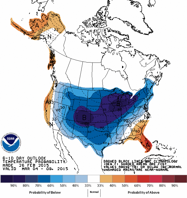
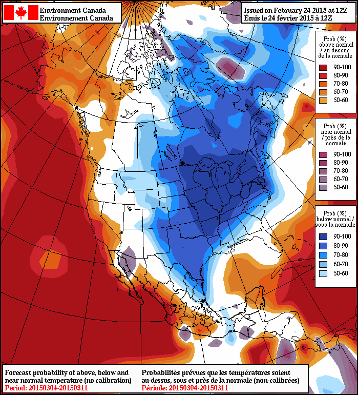
Looking ahead to the long-range, it seems like we’ll see another shot of cold air bringing below-seasonal temperatures next week and then moderate towards a potentially longer stretch of more seasonal temperatures. Little precipitation is expected.

