The warmest day of 2014 is on tap for Winnipeg as a low pressure system tracking through the northern Prairies brings with it an unseasonably warm air mass. With the passage of a cold front today we’ll also see strong – potentially near warning level in some areas – winds that will usher in slightly cooler temperatures than we’ve seen the past few days as well as a slight chance for a shower or two. With so much snow left on the ground, however, the big question is exactly how warm will it get?
Today
We’re off to a great start today with temperatures already above the freezing mark thanks to the incoming mild air and relatively breezy conditions that persisted through the overnight period. Warmer air will continue to stream in through the morning hours, producing a brisk southerly wind through the valley at 30-40km/h. Temperatures will climb the best they can, but the remaining snowpack will do a lot to keep us cooler.
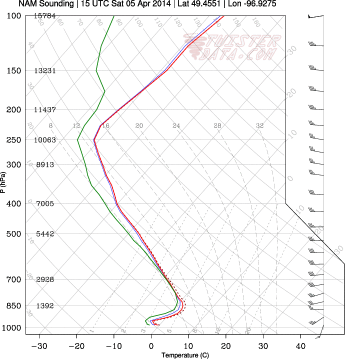
In order for us to reach the full potential of the warm air coming in, we need to be able to mix it down to the surface. The best way to create instability in the lower levels is the sun; it shines down and warms up the surface until it gets hot enough (assuming the sun is strong enough) to create instability and begin mixing the lower atmosphere. This mixing process can help bring warmer air down and maintain a warmer temperature. Unfortunately, snow can dramatically inhibit this process through two main ways:
- Snow is white, so it reflects the incoming energy from the sun back out into the sky. This prevents that energy from being put into warming up the ground or air in the low levels.
- Snow is frozen, so when the temperatures begin to climb above zero the snow begins to melt, removing energy from the air and cooling it off.
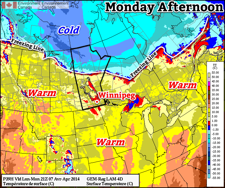
With no snow, all the energy from the sun can go into heating the surface. Today we’ll see a pretty big difference in temperatures between areas with snow versus areas without snow. Here in Winnipeg, temperatures will likely climb to around 9-10°C before a cold front pushes through this afternoon. In the snow-free areas of North Dakota and a few portions of the western Red River Valley, temperatures will likely climb into the mid-to-high teens, possibly as high as the low 20’s.
The abnormally warm weather will be short-lived as a cold front blasts through the province midday. Strong westerly to northwesterly winds with gusts as high as 70km/h will push into the Red River Valley this afternoon. Temperatures may actually climb a degree or two behind the cold front before they begin to drop a bit thanks to all the warm air aloft that is able to be mixed down. There will be a slight chance for a shower with the passage of the cold front, however the chances are better to the north of the Red River Valley, where the lift is stronger, and in North Dakota, where the instability is greater. We’ll head to a low of around 0°C tonight.
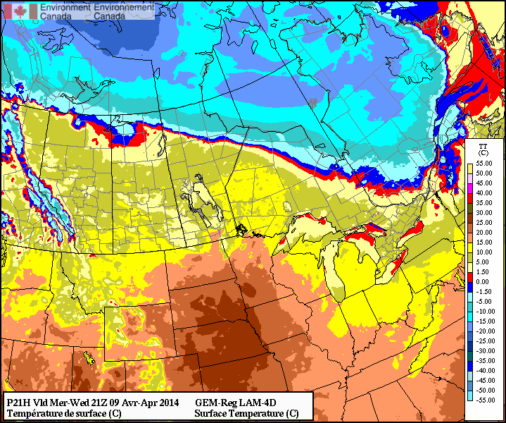
The Remainder of the Week
Tomorrow will be a mainly sunny day with stronger winds that will slowly diminish as the day progresses eastwards. We’ll see a high near 7°C and a low near -3°C. Friday will be another pleasant day with mainly sunny skies and relatively light winds. The high will be near 7°C and the low will drop to around -6°C as some cooler air makes a brief appearance for the weekend.