Hot Weather Returns

After a period of cool weather over the last while, warmer conditions are set to return.

30C temperatures are expected on Tuesday in Southern Manitoba

The NAM model is predicting that Southern Manitoba will see temperatures of 30C or higher on Tuesday

A ridge of high pressure will build over the Prairies this week, allowing for some of the warmest weather we’ve seen this August to develop. Monday will be a pleasant day, with high temperatures in the mid to upper twenties. By Tuesday many areas should see their first 30C readings this month, as warmer air pushes in from the west.

The ridge will begin to break down on Wednesday and Thursday as a series of impulses move in from the Pacific. These impulses with have one or more low pressure systems associated with them, causing some unsettled weather to start developing over the Prairies later this week. It looks like an easterly flow will develop over Southern Manitoba on Wednesday out ahead of an approaching low. Depending on how the frontal features setup on Wednesday we may or may not see another 30C day. At this point it looks most likely that Wednesday will have temperatures in the upper twenties, rather than thirty, but there is the potential for warmer weather. On Thursday we may see our first risk of thunderstorms in a while as a strong southerly flow draws up more humid air from the south ahead of an approaching low pressure system.

As we move toward the weekend weather models show a series of fairly strong low pressure systems moving through our region. Should these systems develop more or less as predicted it would likely mean a rainy and cool last weekend of August.

Cool Nights Ahead, Otherwise Seasonal

We’ll see fairly seasonal weather over the weekend with overnight lows that will start off cool but climb back towards normal as well.

700mb Temperatures for Saturday Morning

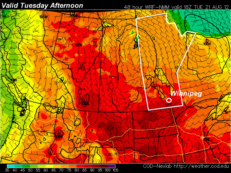
700mb temperatures from the GEM-REG for Saturday morning. A significant pool of cold air remains entrenched over NW Ontario, while warm air builds over Alberta and struggles to push eastwards.

After quite a chilly evening last night, temperatures will climb nicely today towards a high of about 25°C. We’ll see mainly sunny skies today and clear skies tonight as we head down to a low of around 8°C. Tomorrow morning we’ll see some cloud as a weak disturbance travels south through the Interlake with a slight chance of a shower before things clear out midday and we’re left with sunny skies and a high a little cooler near 23°C as more cool air filters down behind the morning’s system. The weekend will close out with another sunny day with a high climbing a little bit higher into the mid-to-upper 20’s.

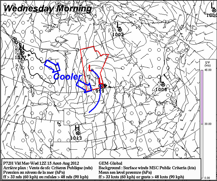
The next chance of precipitation looks to possibly be on Tuesday morning, however the risk is marginal and currently looks like the system will remain to the north of the Red River Valley.

2012 One of the Hottest Years on Record

We covered just how warm July 2012 was a couple posts ago, but what’s shaping up to be an even bigger story is just how hot 2012 as a year is. Last week, Jeff Masters covered how 2012 is shaping up to be the hottest year ever in the contiguous United States and included an image from NOAA that showed average yearly temperatures through the climate record, highlighting the top 5 and coldest 5 years on record:

Year-to-Date Temperature Anomolies for Contiguous U.S.

Year-to-date temperature anomaly, by month, for 2012 (red) compared to the other 117 years on record for the contiguous U.S., with the five warmest years (orange) and five coldest years (blue) noted.

With plenty of warm records having been broken over the past year, and the fact that we’re going on 13 consecutive months with above-normal temperatures, I thought it would be interesting to see what such a chart looks like for Winnipeg.

Methodology

First I calculated the monthly mean temperatures for the entire climate archive for Winnipeg, which covers March 1872 – July 2012. I then calculated year-to-date normal temperatures for each month from 1901 to 2010 to use as a “20th Century Average”. For example, March’s YTD average was calculated simply by:

    March Average = AVERAGE(JAN Average + FEB Average + MAR Average)

To calculate the temperature anomolies, I did a similar process on the monthly mean temperatures for each year, calcluating a YTD value for each month, then simply subtracted that from the associated month’s 20th century average. This process produces the signature tapered look on the above chart, where the large variability from year-to-year evident in January smooths out to nice, clean lines by the end of the year.

Results

The results for Winnipeg are startlingly similar to the United States:

Year-to-Date Temperature Anomolies for Winnipeg, MB

Year-to-date temperature anomaly, by month, for 2012 (red) compared to the other 139 years on record for Winnipeg, MB, with the five warmest years (orange) and five coldest years (blue) noted.

It’s quickly evident that 2012 is on track to end as one of the warmest years on record. The current top 5 warmest years are:

Rank Year Year-End Temperature
Anomaly
1 1987 +2.93°C
2 1931 +2.80°C
3 1878 +2.20°C
4 1998 +2.14°C
5 2006 +2.00°C

This year’s current YTD temperature anomaly is sitting at +3.13°C. This beats out 1987’s year-end anomaly of +2.93°C, however is less than the value calculated at the same time of year (July), which was +4.02°C. We’ve started August off right near-normal, however ensemble outlooks have us returning to slightly above-normal temperatures fairly soon.

Cool Blast Across Manitoba

A powerful low pressure system moving through the Interlake will bring significantly cooler weather to Manitoba over the next couple days. Read on to find out where the rain will be and how cool it’s going to get.

GFS Forecast for this evening

GFS 850*mb* temperature forecast for this evening. I’ve drawn on the strong high over the Western Prairies that is helping our low pressure system pull down cool Arctic air. Cold front and warm fronts have been drawn in blue and red, respectively.

As the low pressure system passes to our north today, it will drag a cold front through the Red River Valley over the course of the afternoon. Preceding this front will be an area of rain, and while a majority of the thunderstorm activity will be through the Interlake, closer to the low, there will likely be some isolated embedded thunderstorms through the Red River Valley.

Accumulations will generally be higher the further north from the international border you go; while up to 25-50mm will likely fall through the Interlake, only 2-5mm are expected over the southern RRV. Any location in the RRV that sees a thunderstorm could easily receive between 0.5 to 1” of rain. Here in Winnipeg, we’ll probably see between 5-10mm with some locally higher amounts if a thunderstorm rolls through by the end of the day.

On the backside of this system a strong northerly wind at all levels will drag down the most potent shot of cool, Arctic air we’ve seen in quite a while. While winds will be out of the south in the morning, gusty northerly winds will kick in quickly behind the cold front, with sustained speeds between 40-50km/h and gusts as high as 60-70km/h. 850mb temperatures approaching 0°C will push down into the Interlake region tonight. This will bring with it the chance for the first significant lake-effect shower event of the “fall”1 season. When looking for the generation of lake-effect showers, there’s a few things to look for:

  1. A temperature difference from the surface to 850mb of at least 13°C.
  2. Less than 60° of wind shear between the boundary layer and 700mb; preferably less than 30°.
  3. At least 100km of fetch which the air travels over open water.

Given that lake temperatures are still sitting at 22-24°C, we’ll certainly see plenty of clouds develop and move south off the lakes. Whether or not lake-effect showers develop will depend precisely on the winds, but it looks fairly favourable right now with winds forecast to be from the NW with minimal directional shear. We’ll likely see some streamers develop overnight, providing showers or drizzle to communities in lee of the lakes. Current forecasts put these narrow bands of precipitation between Portage & Winnipeg and just east of Winnipeg, but we’ll have to see what the actual wind direction ends up being as to where they’ll go. Right now it looks like there won’t be enough of a westerly component to the wind to bring them into Winnipeg.

If the surface winds end up too westerly, or the 850mb temperatures don’t cool off quite as much as forecast, then no streamers will form. It will be interesting to see what happens!

In the end, it could certainly be worse than it’s going to be. The coldest air will be over us during the overnight period, and we’ll likely have cloud cover as well which will help keep things a little warmer. By the time Thursday afternoon rolls around, the cold air will already be exiting the region, so we won’t end up dealing with temperatures quite as cool as many other areas across the Prairies will.


  1. It’s not fall yet! 

Change Is Coming

This week will start out with more of the same normalish weather we’ve had for the past week or so…but it looks like a change in the pattern is coming…

A cold front will swing through Manitoba on Wednesday

A strong cold front (blue line) will swing through Manitoba on Wednesday ushering in cooler weather

Temperatures on Monday and Tuesday are expected to be around normal (or slightly below), with highs in the low to mid twenties expected. Our normal high for this time of year is 25C. We will be under a surface ridge of high pressure during this time period so rain appears unlikely.

A change in our weather is in store around midweek. It appears that a major cold front will swing through Southern Manitoba at some point on Wednsday. Models disagree with the timing of the cold front, but it looks most probably that the front will enter Western Manitoba sometime early Wednesday morning and be out of the province by Wednesday afternoon or evening. Regardless of the exact timing it looks like Wednesday will be a chillier day, with highs struggling to reach 20C and rain being likely. As we move closer to Wednesday the details of the frontal passage should be better known.

After the cold front passes through on Wednesday we’ll be in for a couple of cooler days with temperatures only in the upper teens or lower twenties for Thursday and Friday. Beyond this work-week there is some uncertainty in terms of what will happen next. Many models portray us sticking with more normal weather through the remainder of August, while others show us warming up again. As always, time will tell which forecast is correct!