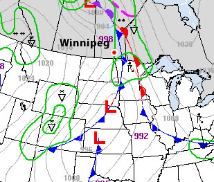
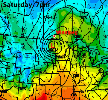
We are about to get our first taste of below-normal weather in quite some time. Temperatures on Monday and Tuesday are expected to be several degrees colder than the seasonal average.

High temperatures on Monday are expected to hover around the zero mark in much of Southern Manitoba. Combined with a brisk north-west wind, conditions on Monday will be rather cool. If you consider the wind chill, it will feel closer to -6 on Monday afternoon (calculated using a temperature of 0C and wind speed of 25km/h). Tuesday won’t be much warmer, with highs only expected to creep up in the low single digits. The wind will be lighter on Tuesday, making it feel significantly warmer than Monday…although it will still be chilly. Both Monday and Tuesday are expected to be mainly cloudy, which will also hold our temperature back. If the sun does come out in some areas on a localized basis it will be slightly warmer. In early April the normal high is about 8 degrees in Southern Manitoba, meaning most areas will be between 4 and 8 degrees colder than normal through the first two days of the week. Models show a gradual improvement in temperatures as we move later into the week. By Wednesday we should get up into the high single digits and by Thursday the double digits will become likely.
In the longer range it appears that next weekend could be a bit unsettled. At this time models show a low pressure system moving up into the Northern Plains, spreading rain across a large area, which may include Southern Manitoba. It is too early to say if this system will affect us at all, but it is something to watch.
Looking even further ahead it appears we are in for a period of more normal weather. Longer range guidance is hinting at normal to slightly above normal weather for the next couple weeks. There is also some indication that our weather may remain somewhat unsettled, which is fairly typical for this time of year. Wouldn’t it be something if the first half of April was cooler than the second half of March!
Elsewhere in Weather News
Intense Low Affects Japan
A very powerful low pressure system made landfall in Japan on Tuesday, April 3rd and brought with it incredibly strong winds and much rain. This storm, believed to be the strongest storm to hit Tokyo since 1959, generated 90km/h sustained winds and 150km/h wind gusts at times (highest gust reported in Niigata prefecture, 156.6km/h), in the western part of Japan. Rain rates of over 60mm/h also fell associated with the squall line as it moved across most of Japan’s main island. This caused more than 20,000 homes to lose power, various buildings to collapse and trees to fall – causing 97 injuries and 4 deaths. Flight cancellations and railway closures also had to be taken into mind when traveling, as more than 600 flights were cancelled departing from Japan. The very strong winds resulted in trucks being flipped over on the highways and bridge closures, bringing the traffic to a crawl. Waves of 10m were experienced off the coast, however it was strongly advised to stay inside.
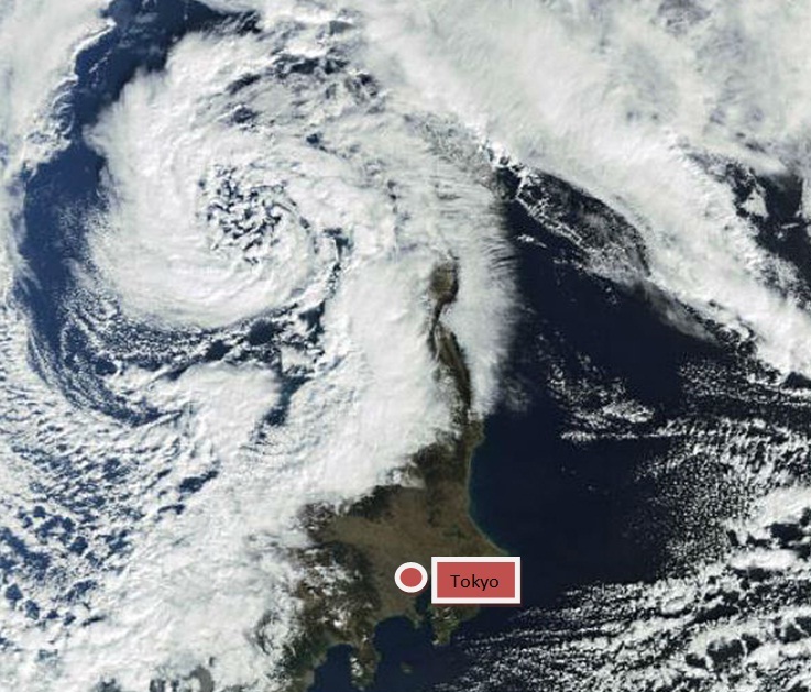
A high-pressure has since moved into place giving way to sunnier skies with some stronger winds associated with it.
Texas Tornadoes
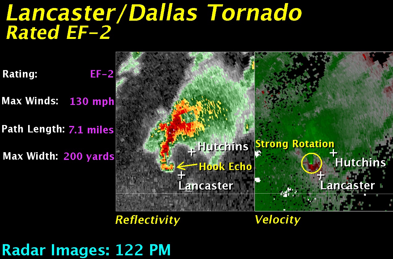
This past week brought very active weather not only in Japan, but also the US, where violent tornadoes hit populated areas of Texas and caused significant damage. Two supercells dropped tornadoes simultaneously on the afternoon of April 3rd in the Fort Worth and Lancaster areas, causing the most significant damage. Preliminary estimates rate these tornadoes between EF-2 and EF-3, where winds are measured at 177km/h to 266km/h. Tornado warnings had been posted by the National Weather Service well before the storm hit allowing residents to take the necessary precautions; although significant damage was caused to neighbourhoods and industrial parks it could have been much worse. Ten injuries and no deaths were reported, the Dallas mayor called it “miraculous” to see that the numbers weren’t more significant after a big damage path could be seen from aerial view.
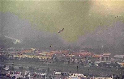
Tornadoes had not been the only culprit to cause significant damage that day, as very large hail was also reported with this storm. Hail damage to 100 airplanes at the Dallas airport was reported, with issues ranging from minor inspection needed, to planes being put out of service indefinitely.
This week, more storms are expected in Texas and most of the Plains, as the jet stream remains south of the border and systems push through Tornado Alley.
Elswhere in Weather News has been provided by Matt