Summer-Like Weekend Ahead

We got a short forecast for you today: beautiful! Nothing but sunshine and warmth on the way for Winnipeg this weekend.

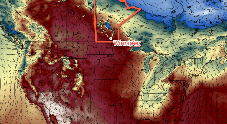
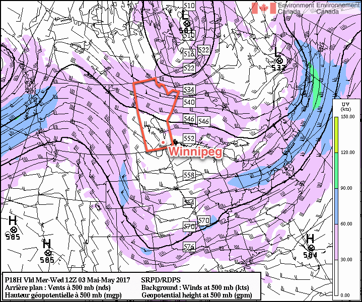
The weather over the coming days will be a result of the upper-level ridge we talked about on Wednesday, which is bringing sunny and warm weather to the region.

An upper-level ridge will be in place over Manitoba for the coming several days.

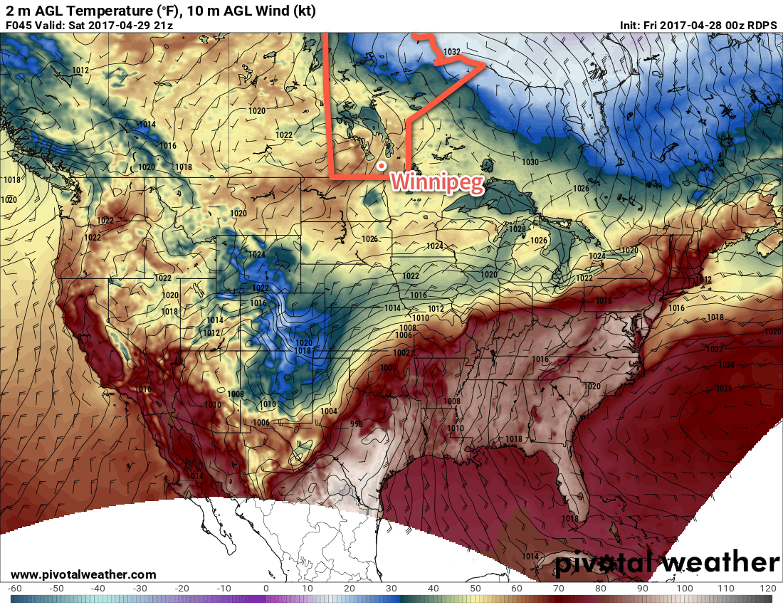
Winnipeg and the Red River Valley will see plenty of sunshine over the coming days with daytime highs in the 19-22°C range and overnight lows gradually warming from around 6°C up to 10 or 11°C by Friday night. Winds pick up out of the northeast today to 20-30 km/h, but then diminish for Saturday. Sunday will see a winds pick up out of the southeast once again to 20-30 km/h.

Long Range

The upper-level ridge will collapse on Monday as a shortwave digs into the Prairies, bringing with it a chance for some rain. Temperatures will remain mild with highs near 20°C though.

A large omega block is forecast to develop over the region next week.

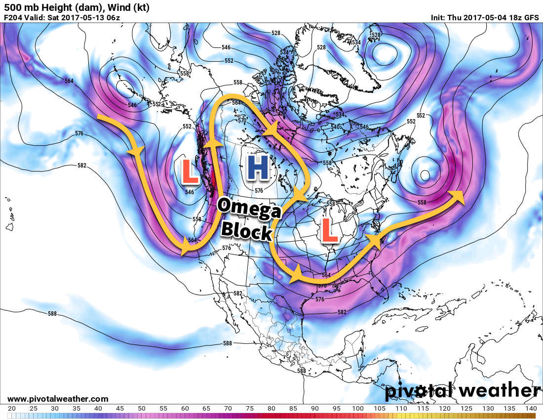
Rapidly after Monday’s disturbance, an omega block — named such as the shape of the jet stream inside one resembles the greek letter Ω — will develop, rooted over the Canadian Prairies. While this will bring cooler, wet weather to both the west coast and eastern Canada, it will bring a prolonged stretch of warm and dry weather to southern Manitoba.

Enjoy getting outside in this fantastic spring weather!

Winnipeg’s seasonal daytime high is currently 17°C while the seasonal overnight low is 3°C.

Showers Give Way To Beautiful Weather

After some more showers move through Winnipeg & the Red River Valley today, conditions will begin to settle as an upper-level ridge builds into the Prairies, bringing sunny skies and warmer temperatures.

A few more showers will move through the Winnipeg region this morning as a low pressure system slides through the region, but overall rainfall totals are expected to remain low. The rain will move off by mid-morning, and Winnipeg will be left with clearing skies and light northwesterly winds. Temperatures will climb up to a high near 16°C.

Skies will be partly cloudy tonight with a very slight chance of a shower overnight. The low temperature will drop to near 6°C.

An upper-level ridge will build into the western Prairies over the coming days.

For Thursday, the weather will be dominated by an upper-level ridge building into the western Prairies. This type of weather pattern brings stabilizing conditions to the eastern Prairies. As a result, Winnipeg will see mainly sunny skies on Thursday with temperatures climbing up to around 19°C. Expect a few clouds on Thursday night with a low near 9°C.

Friday will be another beautiful day, although there may be a few more clouds about than Thursday. It will still be quite sunny, and temperatures will climb above 20°C for a high. Winds will increase to 15-20 km/h out of the north for the afternoon. Expect a low near 7°C on Friday night with mainly clear skies.

Long Range

The weekend continues to look great with plenty of sunshine and highs near 20°C. Winds will also continue to be relatively light as well.

The nice weather will continue into next week, although by mid-week there may be another chance for some showers throughout the region.

Winnipeg’s seasonal daytime high is currently 17°C while the seasonal overnight low is 3°C.

Unsettled Conditions Move In

The weather will gradually turn more unsettled in Winnipeg over the coming few days, although temperatures will continue to remain mild, making for relatively pleasant spring weather.

Today will be another dry day with mild temperatures in Winnipeg as temperatures climb to a high near 17°C with light winds. Skies will start off sunny, but more cloud will build into the region through the day. Skies will remain fairly cloudy tonight as temperatures drop to a low near 4°C.

Tuesday will mark the transition into a slightly more unsettled pattern as multiple weak low pressure systems begin working through the area. Skies will mixed as temperatures climb to a high around 16°C. Through the afternoon, there will be a chance of seeing some showers as daytime heating leads to some pop-up convection. The showers will be relatively weak, though, and no significant amounts are expected. Skies will remain mixed on Tuesday night with a continued slight chance for some showers as temperatures drop to a low near 4°C.

The GDPS is showing an area of showers across Southern Manitoba on Tuesday and Wednesday.

Wednesday will, once again, feature a high near 16°C and a continued chance for showers as another weak disturbance moves through the region. Expect a low near 4°C again on Wednesday night with a continued chance for light shower activity.

Long Range

The remainder of the week looks mild and dry, with conditions stabilizing on Thursday and warmer air pushing in on Friday. Skies look like they’ll remain at least partly cloudy to mixed, but all in all, lovely weather ahead.

Winnipeg’s seasonal daytime high is currently 16°C while the seasonal overnight low is 2°C.

Temperatures Moderate as Sunshine Returns

The coming days will bring an end to the persistent blustery north-northeast winds and a return to seasonal temperatures.

Temperatures will remain a bit cool today as a breezy northerly wind persists for one more day, continuing to tap into cooler Arctic air. Temperatures will climb to a high near 10°C with northerly winds increasing to 30-40 km/h. While it won’t be as windy as yesterday—winds reached peak of 52 gusting 69 km/h in the afternoon—the wind will still be fairly noticeable and making it feel cool. Skies will be partly cloudy as Winnipeg lies on the edge of the cloud shield of the departing Ontario low that has been largely shaping our weather the past few days.

Expect a low near -2°C under mainly clear skies tonight with light winds.

Temperatures will return to seasonal values for Saturday across Southern Manitoba

Saturday will be a welcome break from the weather of the past week with mainly sunny skies sending temperatures to a high near 15°C. Winds will start off light, but pick up to around 30 km/h out of the south for the afternoon as a weak disturbance tracks through the Interlake.

Expect a low near 3°C on Saturday night with diminishing winds and mainly clear skies.

Sunday will be more of the same with plenty of sunshine, a high near 16°C and light winds.

Long Range

The long-range forecast looks like a bit of a mixed bag. Temperatures will return to slightly below-seasonal with daytime highs in the low teens and variable cloudiness. It appears that by mid-week, conditions may begin to get a little more unsettled as another major low pressure system moves through Ontario while a secondary storm track across the Prairies begins getting more active. At this point, no big storms are on the horizon, but it’s worth noting we may see an increased chance for precipitation through the second half of next week.

Enjoy the weekend!

Winnipeg’s seasonal daytime high is currently 15°C while the seasonal overnight low is 2°C.