A few more days of hot weather are in store before we cool down later this week. Enjoy the heat while it lasts!
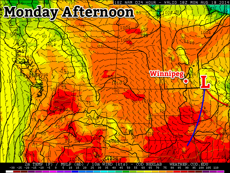
A low pressure system will bring unsettled conditions to south-eastern Manitoba on Monday
Monday
Monday
24°C / 12°C
Mix of sun and cloud with a chance of showers
Today will be a bit unsettled as a large upper-level weather system traverses our region. There will be a chance of showers and risk of thunderstorms in the Red River Valley and south-eastern Manitoba. Any storms that develop will be non-severe, though there is a slight risk of cold core funnel clouds due to the large amount of “spin” with this system. Temperatures will range from the low to mid twenties across southern Manitoba, with the highest readings in western areas.
Tuesday
Tuesday
28°C / 16°C
Mainly Sunny
Tuesday looks to be a very nice day, with temperatures climbing back up into the upper twenties. Skies will be mainly sunny and winds will be light. No precipitation is expected, except for perhaps a stray shower or thunderstorm.
Wednesday
Wednesday
30°C / 18°C
Mainly Sunny
Wednesday looks like another nice day, with temperatures near the 30C mark. There will be a risk of thunderstorms in western Manitoba, but at this point it looks like they should be non-severe. It appears the main risk with any storms that develop will be heavy rain since they’ll be slow-moving due to a weak jet stream overhead.
Long Range
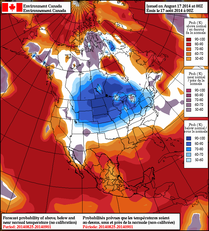
The long range NAEFS model suggests cooler weather will stick around through the end of the month
Unfortunately, it looks like that cool-down I’ve been hinting at is set to take shape later this week. A cold front will probably pass through southern Manitoba on Thursday, dropping temperatures back into the low to mid twenties for late week into the weekend. Models suggest that we’ll see cooler weather – predominately in the low twenties – stick around into next week.
Winnipeg will see a chance for some thunderstorm activity this afternoon with the passage of a weak cold front late today, but today’s unsettled weather will lead into a beautiful August weekend.
Friday
30°C / 17°C
Afternoon cloud; late-day thunderstorm likely
Saturday
27°C / 12°C
Partly cloudy
Sunday
28°C / 18°C
Partly cloudy; risk of showers or thunderstorms late in the day
Thunderstorms Possible in Muggy Airmass
Today will be a hot and muggy day. Temperatures will climb to the 30°C mark by the afternoon with dewpoint values topping out around 20°C, making it feel like the upper 30’s. Winds will be light out of the south.
Things will change as a cold front slumping southwards through the Interlake pushes into the Red River Valley late in the day. Scattered thunderstorms are likely along the front late in the day into the evening; in general the storms will be non-severe, however an isolated severe storm with strong winds or large hail may be possible.
A pleasant night will follow the passage of the cold front; the temperature will drop to around 14°C with clear skies.
Beautiful Weekend Ahead
Saturday and Sunday will be beautiful days for late August with dry weather and warm temperatures in store. Things might take a turn towards the unsettled late in the day on Sunday, although there’s some disagreement on the timing of when the next significant system impacts Winnipeg.
Saturday will be partly cloudy with light northeasterly winds as a ridge of high pressure moves across southern Manitoba. Temperatures will top out around 27°C and drop into the low teens – around 12°C – on Saturday night. Humidity levels will be more comfortable as drier air moves into the province behind Friday’s cold front.
Sunday will be another partly cloudy day with a high near 28°C. More cloud will likely work its way into Winnipeg later in the day ahead of the next low pressure system trundling our way.
There’s fair disagreement on the timing of this next system; the US models bring it through the Red River Valley on Sunday evening, while Canadian models move the system slower and don’t bring it into our region until Monday afternoon. Either way, there’s fairly good agreement that this system will bring a broad area of showers and thunderstorms with it. Depending on the timing and evolution of the system, we may end up with the potential for some severe thunderstorm activity.
Sunday’s weather will be something we’ll keep monitoring and provide an update later in the weekend looking at how this upcoming system is evolving.
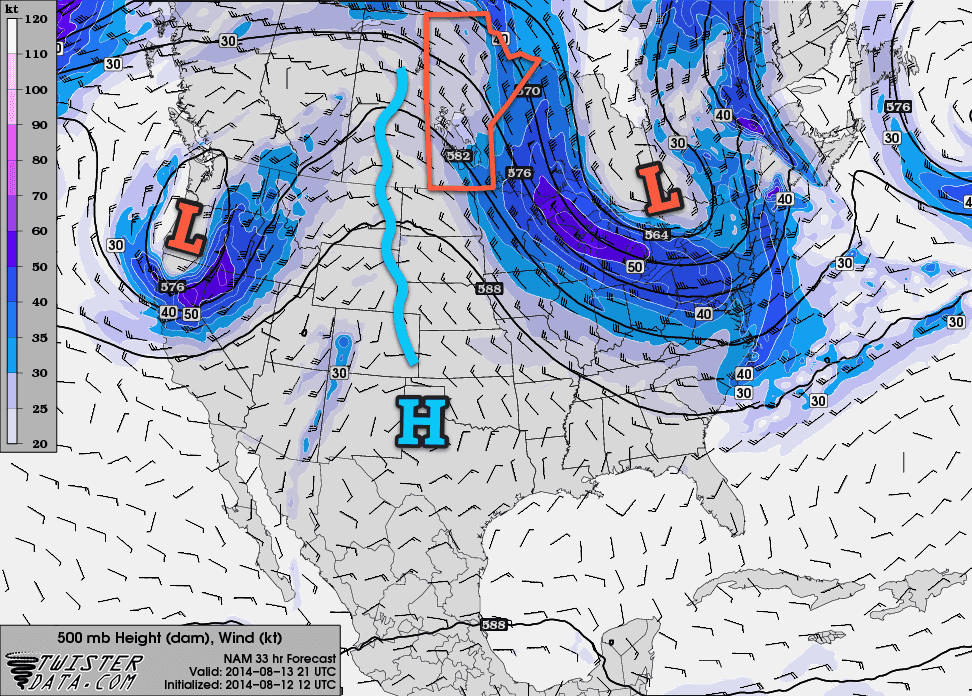
The hot weather that’s been situated over Southern Manitoba for much of the last few weeks will continue through the remainder of the week as a broad upper-level ridge builds into the region. The weather will become more unsettled towards the end of the week, though, as the upper ridge begins to “flatten out” and multiple disturbances trundle across our region.
500mb flow forecast by the NAM shows a prominent upper-level ridge over the Prairies.
Beautiful Wednesday on Tap
Today will be a gorgeous with mainly sunny skies and warm temperatures as the high climbs to around 26°C this afternoon. Winds will be light thanks to a ridge of high pressure at the surface that will be pushing off into northwestern Ontario by the end of the day.
Wednesday
26°C / 15°C
Mainly sunny
Tonight will see a chance for some showers or thunderstorms as a low pressure system pushes across southern Saskatchewan and into southern Manitoba through the overnight period.
As the night progresses, a warm front will slowly push eastwards towards the Red River Valley, bringing warmer air aloft and the slight chance for some showers or thunderstorms sometime in the second half of the overnight period. The risk really is quite minimal; in general there may be a little too much warm air aloft which would inhibit the development of any shower or thunderstorm activity.
Thirty on Thursday
Thursday will be an absolute scorcher as Winnipeg moves into the warm sector of the low pressure system moving through. Daytime highs will climb into the low 30’s through the Red River Valley with, mercifully, dewpoints around 16°C making for not-too-humid conditions.
Thursday
31°C
Sunny and hot
Thursday Night
19°C
Partly cloudy; risk of a thunderstorm
Thursday night will bring a slight chance for some thunderstorm activity. As things begin cooling off in the evening, moisture advecting into the region may end up destabilizing the lower levels of the atmosphere. If any storms develop, there would be a low risk for any severe weather, although there may be a risk for marginally severe hail should all of the instability be realized.
Unsettled Friday
Summer will continue in full swing on Friday as daytime highs approach the 30°C mark again but will likely remain just shy of it at around 28 or 29°C. The humidity will be more noticeable as dewpoints climb into the high teens or perhaps even break the 20°C mark, making it feel closer to the mid–30’s than the high 20’s.
Friday
29°C / 15°C
Mixed skies and warm; risk of a thunderstorm
Skies will be mixed with the potential for more shower or thunderstorm activity as the low pressure system pushing into the province brings some instability with it. Any shower or thunderstorm activity that develops will likely be somewhat scattered in nature, however isolated strong storms will be possible.
Temperatures will dip down to the mid-teens on Friday night under partly cloudy skies.
Warm Weekend Ahead
The warm weather will continue right through the weekend with highs in the upper 20’s both Saturday and Sunday and comfortable humdity.
Saturday looks quite nice with mainly sunny skies, lower humidity and light winds making for a stellar late-summer day. Nothing to complain about there.
Sunday will be warm, although it will be cloudier than Saturday was. Some showers or thunderstorms look to be possible late in the day through overnight as another low pressure system swings through the province.
More summery weather is in store this week, just what you were hoping for I’m sure!
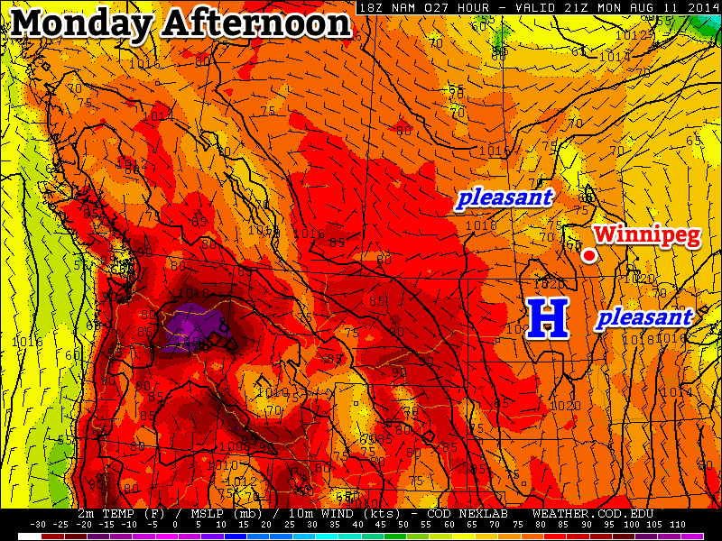
Monday will be a pleasant day in southern Manitoba
Monday
Monday
24°C / 10°C
Mainly Sunny
Today will be a pleasant and uneventful day weather-wise. Temperatures will be in the mid twenties with a light northerly wind and mainly sunny skies. You can thank the surface high pressure system over top of us for the nice day.
Tuesday
Tuesday
28°C / 16°C
Mainly Sunny
Tuesday will be another nice day in southern Manitoba. Temperatures should once again climb into the upper twenties with a light northerly wind and mainly sunny skies. There may be a few pop-up showers or thunderstorms in the afternoon and evening, but they will be highly localized. The most favoured area for one of these storms is in the Interlake.
Wednesday
Wednesday
28°C / 18°C
Mainly Sunny
Wednesday will be fairly similar to Tuesday, with temperatures in the upper twenties and mainly sunny skies. The wind will veer to easterly, but won’t be too strong. No precipitation is expected during the day on Wednesday.
Long Range
The long range forecast is looking pretty good. Some models continue to hint at a cool-down sometime in mid to late August, but there are no indications that cooler weather is imminent. In the mean time, normal to above normal weather should continue, which means high temperatures in the mid to upper twenties.