Cool, showery weather will round out another week of below-normal temperatures in the Red River Valley. Unfortunately, we won’t see any significant warming through the next few days, keeping our daytime highs 3-6°C below seasonal1.

The weather over the next several days will be dominated by a series of disturbances sliding southeastwards across the province ahead of an incoming cold low aloft. The upper-level flow will keep us locked in cooler air until early next week – at the least – until any sort of significant shift in the overall weather pattern may begin to allow more seasonal warmth to begin working it’s way towards the province.
Friday
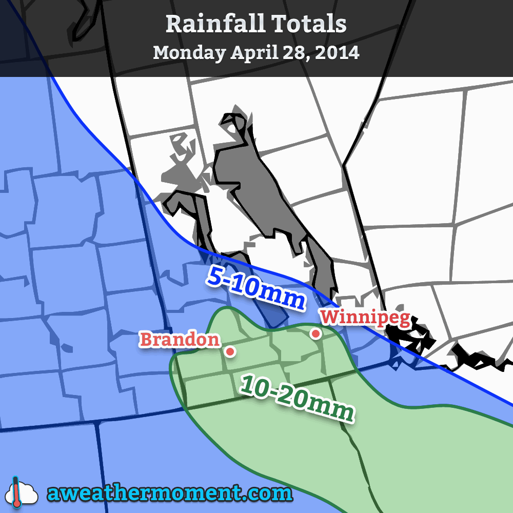
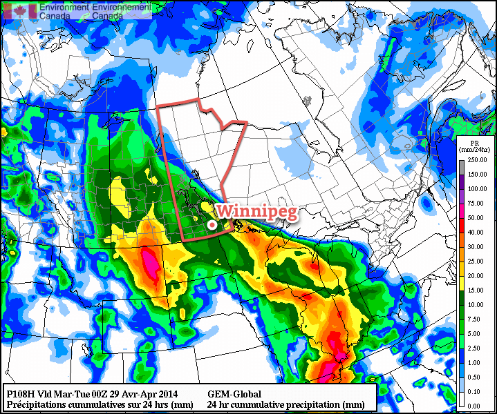
We’ll see a few lingering showers from the overnight period this morning as a low pressure system exits the Red River Valley into Minnesota. The organized preciptiation should taper off fairly early this morning, leaving us with some mixed skies and temperatures on their way to a high of around 11°C.
A weak trough line will extend along a NW/SE line through the Red River Valley, and it’s possible that we may see a few disorganized showers through the day as a result of the daytime heating. If anything develops, it will likely be short-lived and relatively unremarkable thanks to fairly limited low-level instability.
Another low pressure system will slide along the trough line into the Red River Valley this evening, bringing with it another batch of showers. The instability associated with this second low looks rather decent, and if it arrives early in the evening while we’re still near our daytime high, the showers that develop – in particular further to the southwest near the Turtle Mountains and eastwards towards the Pembina Valley – could intensify enough to become a few thunderstorms. There’s no real risk of severe weather, but at this point I think that any sign of summer, even a thundershower or thunderstorm, would be a welcome sight to most people.
The Weekend
Saturday will start out similar to Friday morning, plus or minus a couple hours, as a few showers right underneath the upper-level disturbance associated with Friday night’s low pressure system exit out of the Red River Valley. We’re in for the coolest day of the weekend with a high of only around 8°C as a northerly flow continues to push unseasonal Arctic air southwards over the region. There will be some afternoon cloud that pops up and it should stay at that; the overall level of instability will be quite a bit less than Friday. Saturday night will be another late-season sub-zero night with temperatures dropping to -1 or -2°C through the Red River Valley under clear skies.
Sunday will feature light winds and mainly sunny skies with temperatures climbing to around 11°C. Some cloud cover looks to push in through the evening hours and we’ll see an overnight low near 0°C.
Next Week
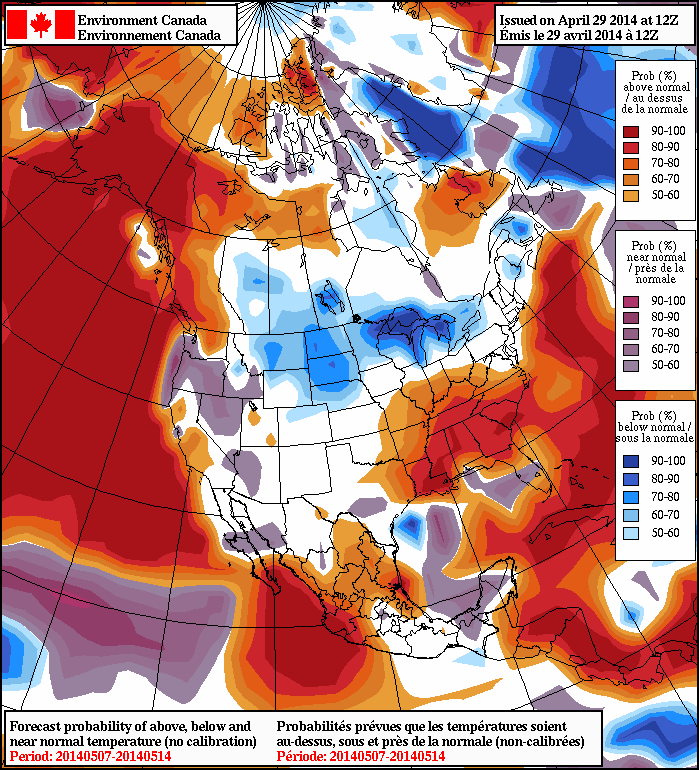
The start of next week looks cool with mixed skies for much of the first half of the week. Early indications are that a series of low pressure systems tracking through the Northern Plains will bring showers to Southern Saskatchewan and perhaps southwestern Manitoba, however a blocking ridge will shunt precipitation southwards into the States, leaving us with cool, dry weather and variable cloud. The NAEFS2 continues to predict below-normal temperatures in the 8-14 day range.