Warm Weather to Continue, Slight Chance of Showers

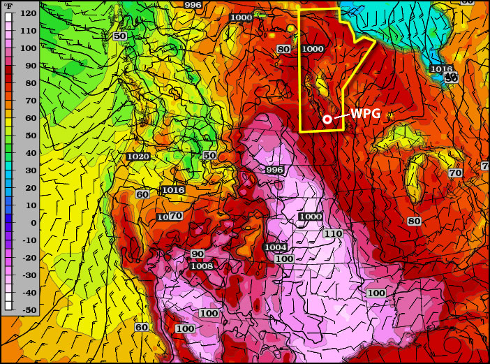
Our warm weather is expected to continue as a significant upper-level ridge continues to strengthen over Southern Manitoba. The weather will slowly grow slightly more unsettled into next week.

500mb Winds valid Saturday Morning

500mb winds valid Saturday Morning. The building/approaching upper ridge is shown by the ridging in the black height contours; I’ve marked the ridge axis with the thick blue squiggly line.

We’ll see sunny skies today with a daytime high of 28°C today and lighter winds only at about 20-30 km/h. Warming temperaures aloft will bring warmer nights back into the cards, with our overnight low tonight and through the weekend expected to sit only at about 17 or 18°C. Fortunately, our dewpoints should remian in the low teens, which will help make the warmth more comfortable.

A weak low sliding across Central Manitoba on Saturday will spread an area of rain and thundershowers through Parkland Manitoba across the Interlake and into NW Ontario. For those heading out to Dauphin for this weekend’s Country Fest, be sure to bring your tarps for your tents and your rain slickers; you’ll likely get a little wet on Saturday morning. Fortunately, conditions should be considerably better than, well, many of the recent years. Here in the Red River Valley, there’s only a slight chance of showers on Friday night/Saturday. For Winnipeg, Saturday will be a mix of sun and clouds with a high near 28°C.

Conditions improve again on Sunday, with more sunny skies across Southern Manitoba and highs near 30°C.

The upper ridge that has brought this beautiful weather to us will begin to break down early next week, bringing slightly more unsettled weather back to the Prairies. It currently looks like we’ll see some rain on Monday evening, and then building heat and humidity mid-week with the threat of thunderstorms. We’ll have more on that first thing next week!

More Warm Weather On The Way

Despite the passage of a cold front today, temperatures across Southern Manitoba will continue to bask in plenty of warm weather through the rest of the week.

Surface temperatures at 00Z this evening

Temperatures from the GEM-REG for 00Z this evening.

A cold front will push across the Red River Valley, ushering in westerly winds that will slowly flush out some of the humid air that has built in over the region over the past couple days. Temperatures will remain in the high 20’s through the remainder of the week across the entire Red River Valley with more comfortable humidity levels, and overnight lows will range between 15 and 20°C tonight through the weekend.

A slight chance for showers exists on Saturday evening, however no significant accumulations are expected. Enjoy many more days of warm, sunny weather!

The Heat Is On!

This week will feature warm to hot weather in Southern Manitoba, a trend which is expected to continue into the long weekend.

Temperatures will be hot over much of Central North America this week

Tuesday’s high temperatures. Reds indicate temperatures near 30C.

A ridge of high pressure will be in place over Manitoba on Monday and Tuesday of this week. This ridge will pump warm air into the province, allowing high temperatures to reach the high twenties and even low thirties. Monday will be quite nice, with temperatures in the high twenties over all of Southern Manitoba. Humidity levels on Monday will remain low, making the day rather comfortable. By Tuesday the humidity will increase somewhat, but will still remain reasonable even as temperatures climb to around thirty degrees (except in Western Manitoba where the air will be a bit more tropical). A cold front will slice through the province on Wednesday, knocking down humidity levels with a strong westerly wind. However, temperatures won’t drop off by much, with highs staying in the mid to upper twenties on Wednesday.

CAPE graphic. CAPE is a measure of how unstable the atmosphere is, in other words, how severe a storm could potentially become

CAPE values are expected to be moderate to extreme over the prairies early this week. CAPE is a measure of how unstable the atmosphere is, in other words, how severe a storm could potentially become

You may be wondering if this heat will generate thunderstorm activity as the cold front moves in on Wednesday. The short answer to that question is maybe, but I will elucidate. There will certainly be severe storms in Saskatchewan on Monday and Tuesday this week, but the threat in Manitoba is less clear. At this time it looks like our best chance for seeing storms will be on Tuesday night into Wednesday morning as storms that develop over Saskatchewan and North Dakota drift into Manitoba during the overnight period. Even though these storms will happen after dark they may still be severe as they will have warm and humid air to work with. There may also be the risk of thunderstorms during the day on Monday and Tuesday in portions of west-central Manitoba (i.e. Swan River, The Pas, etc). Since these regions aren’t our focus, I won’t go into much further detail than that. Nocturnal thunderstorms may drift into Western Manitoba on Monday night or Tuesday morning, but aren’t expected to impact the majority of Southern Manitoba.

After the cold front passes through on Wednesday there will be a couple of days where the heat “reloads” ahead of the long-weekend. In other words Thursday and Friday will be a bit cooler, although still warm, with temperatures more in the mid twenties. It is expected that hot weather will crank up again for the long-weekend, with present modelling suggesting that temperatures near thirty degrees will be possible on Saturday, Sunday, and Monday. It is too early to be certain in those predictions, but at this point the long-weekend is looking rather nice…if you like hot weather that is.

Sunshine!

After an extremely cloudy, soggy two-week streak of weather over the Red River Valley, sunshine is in the cards. Lots of it.

Sunshine will persist across Southern Manitoba for the near future!

Several days of warm temperatures and sunshine are expected across Southern Manitoba, a welcome change from the cloudy, wet weather that has persisted the past few weeks. Photo: Brad V.

An upper ridge will build in over the Central Prairies through the weekend, bringing plenty of sunshine and warm temperatures to the Red River Valley. Daytime highs will sit near 25°C today and tomorrow. Highs will drop a little bit on Sunday as some cooler air slides down from Central Manitoba, giving us a daytime high near 22 or 23°C. Overnight lows through the next few days will range from 9-14°C.

More heat and humidity is forecast to build in through the first half of next week, pushing daytime highs up into the high 20’s and overnight lows into the high teens. The upper ridge is forecast to break down in the second half of next week, bringing the risk of stormier weather back to Winnipeg.

Enjoy a beautiful weekend!