Elsewhere in Weather News: December 8th, 2012

Typhoon Bopha Makes Landfall

(Follow-up to last week’s EIWN article “Typhoon Bopha Takes Aim at the Philippines”)

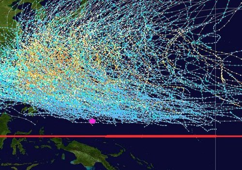
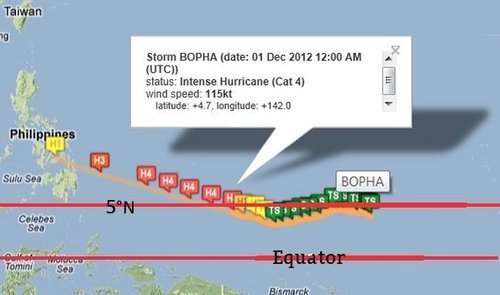
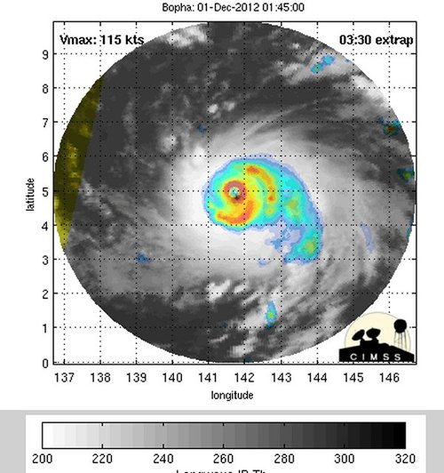
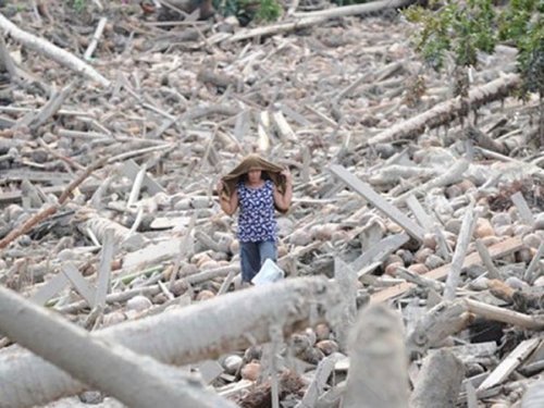
Typhoon Bopha made landfall on Monday, December 3rd, on the southernmost island of the Philippines. The typhoon was classified as a dangerous category five, where winds exceeded 250km/h. As expected with category five typhoons, the devastation and destruction caused extensive damage to infrastructure and crops; one fourth of the banana crops in the region were destroyed. As of Friday, December7th, it was reported that over 500 people had died as a result of the storm, and about 350 were still missing. Rescue workers are working feverishly, looking for survivors assumed to be trapped in their houses because of mudslides, or gold miners trapped in mines. In total, Bopha displaced about 250,000 Philippine residents who mostly took shelter in public buildings to ride out the storm. The Red Cross is providing funds and food to the ravaged country. Bopha appears to be the strongest, southernmost typhoon on record, to have ever affected this region of the Philippines.

Bopha

Infra-red satellite image of Bopha on Friday evening. It does not have a distinct eye and is showing signs of weakening. Forecast track is in white. (Source: CIMSS)

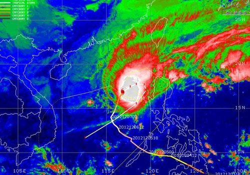
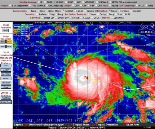
After Bopha made landfall in the Philippines, it emerged into the South China Sea and has re-strengthened to a category three hurricane with a well-defined eye. Its track has taken a northerly direction which was followed by a north-easterly track, which means its outer bands will affect the north-west islands of the Philippines later this weekend. Bopha will continue its somewhat circular track and is predicted to eventually head out in a south-westerly manner towards Vietnam next week. There is a lot of uncertainty as to what will happen after that, but there are some signs that show the storm will weaken off to a tropical depression.

Damage

Incredible damage in New Bataan, a southern Philippine city. (Source: AFP)

In other news, New Zealand experienced its deadliest tornado on record this past week where an EF-2 struck a suburb of Auckland and killed three people. It’s not a common sight to see such a strong tornado in Auckland but the conditions on December 6th greatly contributed to this, as warm, humid air, fueled severe thunderstorms in that area.

Short collection of videos of what it was like being inside the New Zealand Tornado. (Source: AP)

Elsewhere in Weather News: December 1st, 2012

Typhoon Bopha Takes Aim at the Philippines

A strong typhoon dubbed Bopha has spun up in the Northwest Pacific Ocean this past week and is taking aim at the Philippines. The typhoon is currently located at 4.5°N which means that it’s still located within the Intertropical Convergence Zone (ITCZ). This is an area north and south of the equator where north-east and south-east winds meet and cause daily convectional thunderstorms. Near the equator, there is little Coriolis effect which would explain why tropical cyclones rarely form (lack of spin). Since Bopha will move towards the west north-west, it will hold together. If it were moving towards the equator, it would be less likely that it would maintain form.

Typhoon tracks

All typhoon tracks between 1985 and 2005 with equator and Bopha’s approximate location (pink). (Source: Wiki Images)

Bopha

Bopha’s basic into from Friday night, it’s expected track and strength. (Source: Humanitarian Early Warning Service)

It’s expected that Bopha will strike south of Manila and likely make landfall on the Island of Samar on early on Monday, December 4th. It is likely to be a violent typhoon, bringing severe storm surge, copious amounts of rain to areas that are prone to mudslides and flooding. Winds will almost certainly be a problem as it’s predicted that Bopha will make landfall as a category 3, accompanied by winds around 200km/h. As of Friday evening the storm already had a central pressure of 965mb with sustained winds near 200km/h. On Friday evening, it was quickly intensifying with very cold cloud tops around its centre and a well-defined eye was starting to develop.

Microwave imagery - Bopha

Microwave imagery from Bopha on Friday night. The eye was becoming well defined. (Source: CIMSS)

IR Satellite - Bopha

Infra-red satellite imagery from Bopha as a category 4 hurricane. (Source: CIMSS)

On average, the Philippine Islands see an average of 9 hurricanes make landfall annually, with 1-2 usually developing in the month of December. Their peak season for typhoon activity runs at about the same time as the Atlantic Hurricane Season, though it’s not unusual to see typhoons in that area after November 30th.