Elsewhere in Weather News: March 9th, 2013

Australian Waters Remain Active

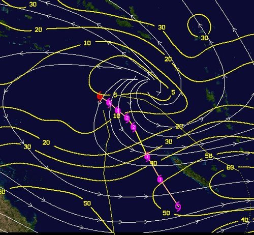
This past week, Australia and its surrounding waters have remained active as yet another cyclone has spun up – this time in the Coral Sea. Cyclone Sandy, currently located about 1,200km north-east of Queensland, Australia, is headed in an easterly direction with sustained category one hurricane winds of 120km/h. The cyclone is too far off coast to adversely affect the state of Queensland at this time.

Sea surface temperatures

Sea surface temperatures with forecast track/intensity and cone of uncertainty (purple) as of Friday night. (Source: CIMSS)

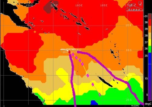
Cyclone Sandy’s route is expected to shift to a south-easterly direction this Saturday but there is much uncertainty as to its destination after the forecasted three-day track. Almost all models agree that Queensland will be spared from this storm, but the island of New Caledonia is still at risk for a direct landfall. This landfall could have a significant impact on New Caledonia as Sandy is expected to continue to strengthen. Before the cyclone weakens, there is a good possibility that it attains a category four level with sustained winds of approximately 180km/h due to sea surface temperatures being very warm (29°C). If the storm does manage to avoid New Caledonia by taking a southerly track, it’s likely that it will die off in the Tasman Sea and not affect populated areas.

Shear

Shear values in yellow, as of Friday night. Low shear environment will contribute to Sandy’s intensification. (Source: CIMSS)

Australia’s cyclone season runs from November 1st to April 30th. Currently they are at the peak of the cyclone season. On average, 11 cyclones affect Australia per year and the tally so far this year (including Sandy) has reached 8 cyclones – a normal count for this time of the year.

Elsewhere in Weather News: December 15th, 2012

Tropical cyclone Evan struck the Samoan Islands on December 13, bringing strong winds and heavy rain to the area.

NASA's Aqua satellite captured this image of Evan as it struck Samoa

NASA’s Aqua satellite captured this image of Evan as it struck Samoa (Source: http://earthobservatory.nasa.gov/NaturalHazards/view.php?id=79989&src=nha)

Evan was a category 1 cyclone when it struck the Samoan Islands region on Thursday, with maximum sustained winds of 144km/h. The storm came onshore near Apia, the capital of Samoa, and the country’s largest city (population 37,708). The cyclone destroyed buildings, ripped up trees, and took down phone, internet, and electricity services across Samoa. In addition, the heavy rain generated by Evan caused widespread flooding. The death toll from Evan is at least 2, with the cyclone being called the worst in many years by local residents.

People walk over a destroyed bridge in Samoa's capital Apia, Friday, Dec. 14, 2012

People walk over a destroyed bridge in Samoa’s capital Apia, Friday, Dec. 14, 2012 (Source: http://www.wunderground.com/blog/JeffMasters/article.html?entrynum=2311)

Evan has taken an unusual track so far, first moving eastward toward Samoa, then making a 180 degree turn over the islands, with its track now taking it westward toward Figi. Evan is currently intensifying, with maximum sustained winds presently at 185km/h. That is high enough to make it a category 3 cyclone on the Saffir-Simpson scale. Current forecasts suggest that the cyclone could approach category 5 status (winds >252km/h) this weekend, before hopefully weakening somewhat prior to affecting Figi. Despite its expected weakening trend ahead of hitting Figi, Evan could become a major disaster for the country, with the country’s leader Commodore Frank Bainimarama’s quoted as saying the following “Fellow Fijians I cannot stress how serious this is, every Fijian will be affected”. Figi is a small country consisting of 332 islands with a population of approximately 850,000.