Two Dangerous Storms Spin Up
Notable activity has expanded from the tropical waters of the Western Pacific into the Bay of Bengal over the past week. We mentioned in last week’s EIWN that typhoon Vongfong could be a threat to Japan sometime this week – this has since become a reality. Formerly known as super typhoon Vongfong, typhoon Vongfong took aim at the Japanese island of Okinawa early this morning. Packing sustained winds of 140km/h which gusted to over 200km/h, the storm caused power outages to 27,000 residents and some locations on the island reported over 200mm of rain.
News agencies in the region report 20 injuries as of Saturday morning but thankfully no deaths from the storm. Vongfong is expected to curve northeast and slowly transition to an extratropical storm, but not before it brings significant rainfall to Japan’s main islands. This could be bad news, especially for the mountainous regions, as this is the second storm to hit Japan in the span of a week. With already saturated ground, these regions are more prone to landslides.
Cyclone Hudhud Develops
The second tropical storm is cyclone Hudhud which spun up only a few days ago. With sea surface temperatures approaching the 30°C mark in the Bay of Bengal, Hudhud quickly became a “very severe cyclonic storm” as classified by India’s Meteorological Department. As of Saturday morning Hudhud was 200 kilometres offshore of India with sustained winds of 205km/h.
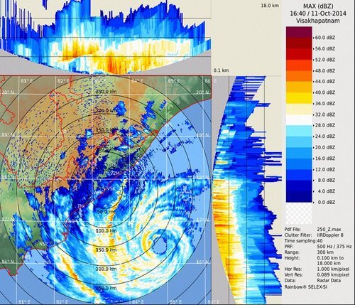
The evacuation of 150,000 people was underway along the coast because a significant storm surge of up to 1.8 metres is expected along the coast. Hudhud is forecast to make landfall overnight tonight just southwest of Visakhapatnam and continue inland, where it will die off, but not before dumping significant amounts of rain. The hardest hit areas can expect over 250mm of rain.