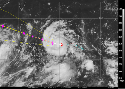
Elsewhere in Weather News: August 17th, 2013

Utor Update

Since last’s week update on typhoon Utor, much has happened. Utor first made landfall in the Philippines; it wreaked havoc as a high-end category 2 typhoon bringing sustained winds clocked at 170km/h with gusts exceeding 200km/h – making it the strongest storm this year in the area. Following that, it continued on through the South China Sea and made a second landfall as a strong tropical storm on the south shores of China.

Unfortunately, quite a bit of destruction was associated with this typhoon, especially in the Philippines region. Flash floods washed away homes in the central part of the Philippines and landslides were more of a problem in the northern region; due to a more mountainous terrain. Seven people have been casualties of the storm in the Philippines and 42,000 have been reported homeless because of Utor. In addition to causing grief to the Philippines, Hong Kong and part of China (mostly Guangdong province) had to take their precautions to keep residents safe. Stock markets as well as businesses were closed and 118 flights needed to be cancelled. One cargo ship also had to be abandoned at sea as it flipped because strong winds from Utor. All of the 21 crewmembers were airlifted to safety.

Utor damage

Ship flipped 90 degrees sideways because of strong winds of Utor. (Source: The Nation/AFP)

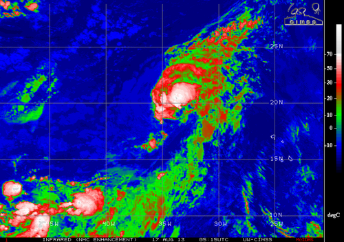
Disturbances in the Atlantic

Two areas of interest have formed in the Atlantic Ocean, one near the Cape Verde Islands and another off the Yucatan Peninsula. The first one near the Cape Verde Islands, named Erin, is of tropical storm force and is drifting west. It will be interesting to see how it interacts with dry air the next couple of days. There is a possibility it might not survive not only because of the dry air but also because of “cooler” sea surface temperatures near 26°C. The second area, a broad area of thunderstorms, is not of tropical storm force and may never become a tropical storm. There is much uncertainty where this system will make landfall and how strong it will get. Models show anywhere from Louisiana to Brownsville, Texas. Wherever it will make landfall it will be a big rainmaker though, bringing in very moist air from the Gulf of Mexico; PWAT values over two inches.

Erin

IR Satellite image of Erin as of Friday night. Quite a bit of dry air on the south part of the storm. (Source: CIMSS)

Elsewhere in Weather News: August 10th, 2013

Potent Heatwave Strikes China; Possible Typhoon on the Way

A prolonged heatwave has been in place for this whole week and even a part of last week over most of Eastern China, including the megacity of Shanghai. An upper-level ridge centered directly over Shanghai (but covering the whole region) is contributing to abnormally high temperatures in the region. Scorching heat, ranging from the high thirties to low forties, covered the whole region while remaining in place yesterday. Numerous heat alerts were issued by the Chinese government urging residents to limit outdoor activities, spend time in air conditioned buildings and most importantly, to stay well hydrated. Unfortunately the death toll had risen to 10 people as of Friday, with Shanghai hardest hit.

China surface temperatures

Map of Eastern China’s surface temperatures for today at 4pm, dark orange is over 36 degrees Celcius. (Source: Wunderground maps)

Such a potent heatwave in this region is not common – it has been said that this one is the worst in 140 years. On August 7th Shanghai broke its all-time record temperature, recording an official high of 40.8°C. Before the recent heatwave began, the highest temperature ever recorded in Shanghai was 40.2°C set in 1934. Shanghai’s average high temperature for August is 32°C. Drought concerns are now coming into play as water sources are starting to run low in the east-central region of China where little to no rainfall is expected in the coming week while the heatwave continues.

The southern coast of China could be under the gun for some drenching rains associated with an incoming typhoon: Typhoon Utor. Utor has still not passed over the Philippines but it is expected to make landfall to the northeast of Manila as a category two. Following its first landfall, it will continue travelling into the South China Sea though there is still a lot of uncertainty as to whether it will curve north into China’s mainland or simply brush the south coast.

Utor

Infrared satellite image of Utor on Friday evening, and it’s expected track. (Source: CIMSS)