A threat of severe thunderstorms will develop across much of Southern Manitoba today as a low pressure system pushes eastwards out of Saskatchewan, however there are several potential hiccups that introduce some uncertainty to where the thunderstorms will actually end up developing. Moving into the weekend, temperatures will cool with highs near to slightly below seasonal and the unsettled weather will slowly improve.
Today is…complex. A huge number of variables are at play, all of which can impact the outcome of today with even small changes, and it’s important to state up front that this is being written on Thursday evening and that how thunderstorms develop overnight will have the potential to make a large impact on Friday’s weather.
With that out of the way: there’s a potential for significant thunderstorm activity later today across much of southern Manitoba. But first, this morning. To start the day, there may be some isolated to scattered thunderstorm activity across southern Manitoba that developed overnight. Any activity still going should weaken and diminish through the first half of the morning. Once that’s out of the way, Winnipeg & the RRV should see mixed skies with temperatures climbing up to a high near 27°C and east to southeasterly winds at 15-25 km/h.
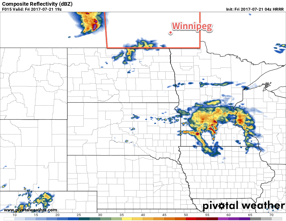
Severe thunderstorms are very likely in eastern Saskatchewan this afternoon, triggering along a warm front that is slowly sliding eastwards. These thunderstorms will push eastwards into southern Manitoba in the early evening, and then continue into the overnight hours. Near the Saskatchewan border, these thunderstorms will have a good chance of producing all manner of severe weather associated with thunderstorms: torrential rain, large hail, damaging winds, and/or a tornado. If they haven’t by the time they move into Manitoba, these thunderstorms will then quickly develop into a line of thunderstorms pushing eastwards and transition towards a primary threat of large hail and strong winds. There is the potential for this line of thunderstorms to develop bow echoes which are segments of the line that accelerate eastwards more quickly than the rest of the line as strong straight-line winds punch through them. It’s important to note that bow echoes can produce damage on par with weak tornadoes, so they can pose a danger to property.
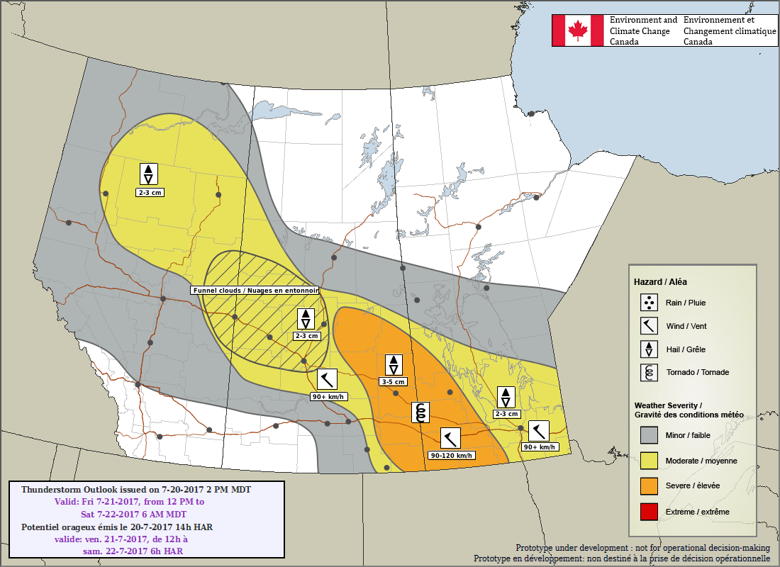
The biggest question is what the extent of this line will be and exactly where it ends up. Some models suggest that the line will move through Parkland Manitoba & the Interlake with a gap through the Trans-Canada corridor and then a second set of storms further south, while others plow the line straight down the Trans-Canada Highway and through Winnipeg and the Red River Valley. The simple reality is that with highly dynamic setups like this, the best we can do is be aware of the hazard potential — primarily large hail and strong winds in the Red River Valley — and then monitor things as they develop and see where that hazard will end up being realized. We’ll be keeping an eye on things and sharing updates on social media, so be sure to give us a follow on Facebook or Twitter if you’d like to stay up to date!
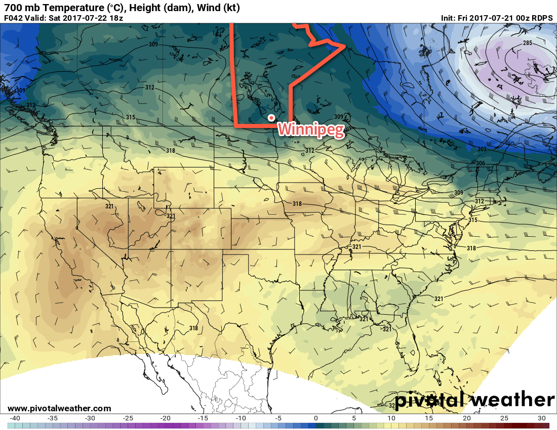
Saturday will be dominated by a cold upper-level low moving through the region. This will keep temperatures a bit cooler than seasonal as breezy northwesterly winds move into the region. There will be a fairly good chance of some showers or thunderstorms in Winnipeg and the Red River Valley by late-morning and through the afternoon. No organized severe weather threat will exist, but some marginally severe hail1 may be possible. Additionally, with the cold upper low moving through, funnel clouds will be possible, although that looks more likely to the north and northeast of Winnipeg. Everything will settle down on Saturday night with clearing skies as temperatures dip to a low near 13°C.
And finally, a quiet and calm Sunday is in store for Winnipeg with clear skies and a near-seasonal high around 25°C. Expect temperatures to drop into the mid-teens on Sunday night.
Long Range
Next week looks quieter with the only weather system of note moving through on Monday night, potentially bringing some scattered showers or thunderstorms to the region. Otherwise we expect near-seasonal temperatures for the remainder of the week with a fair amount of sunshine.
Winnipeg’s seasonal daytime high is currently 26°C while the seasonal overnight low is 13°C.
- Environment & Climate Change Canada defines severe hail as hail with diameter of 20 mm or more. ↩