The start of the work week will stand in stark contrast to the sunny and mild (albeit windy) conditions of the weekend. A low pressure system moving through the region will bring cloudier and much cooler weather.
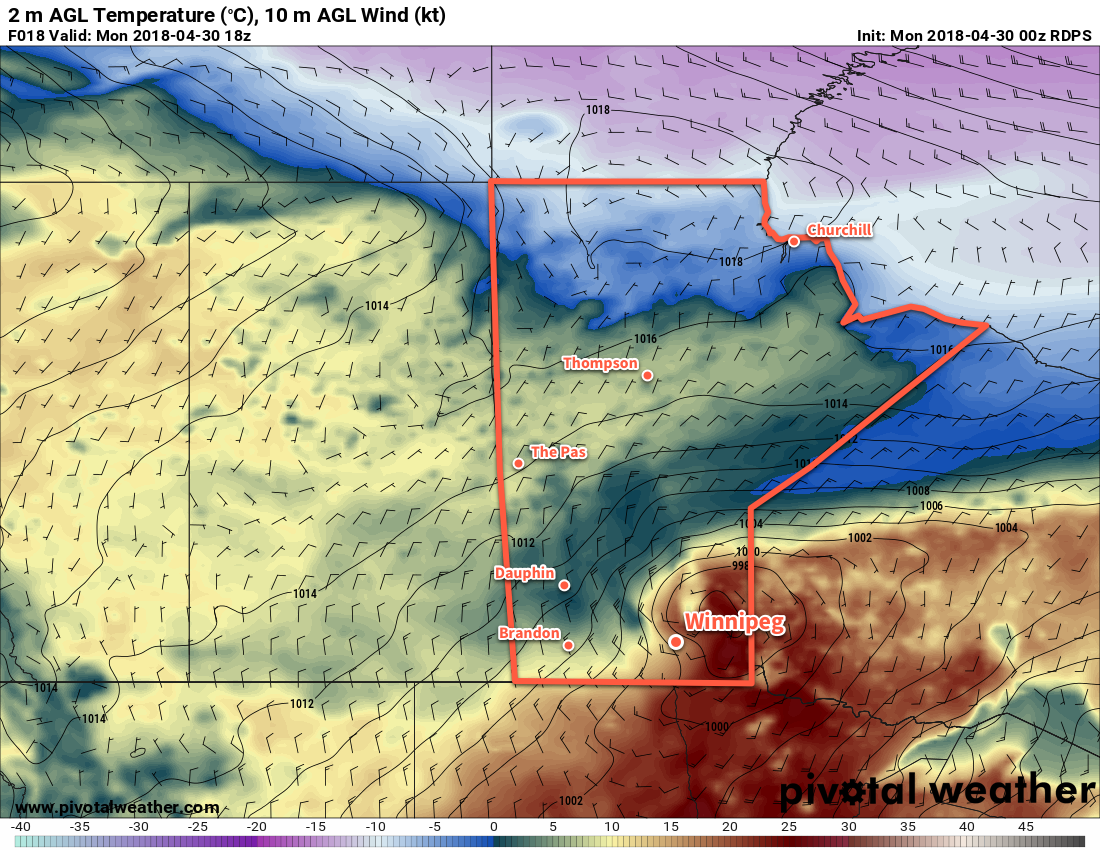
A compact and potent low pressure system moving into the province will be the weather-maker over the next couple days. Skies will remain mostly cloudy today as the system moves into the province, but most of the showers and thunderstorms it generates should remain north of the Red River Valley. Winnipeg will see a slight chance of a passing shower through the morning hours, depending on how much it fills in south of the low overnight. More notable will be the strong northwesterly winds up to 50 gusting 70 km/h that will move into the region behind this system’s cold front. The winds will pick up as the low passes mid-morning, strengthening into the afternoon. Temperatures will fall as the winds usher in cooler air, down to around 9°C by evening.
Skies will remain cloudy overnight with a low near +2°C. The winds will remain out of the northwest at 20 to 30 km/h. Winnipeg and the Red River Valley will see another chance of showers move in late overnight as the region is grazed by a disturbance moving across North Dakota.
Tuesday will continue to bring cloudy skies to Winnipeg and cool temperatures with a high of just 8°C expected in the city. The morning will continue to bring a chance for some light showers, but that should taper off by midday. And for those tired of the breezy winds, they will continue to taper off through the day. The cloud cover will begin to break up overnight as temperatures head to a low near +1 or +2°C.
The sun will finally reappear on Wednesday as Winnipeg sees mixed skies. Temperatures will begin rebounding as highs climb into the upper teens. Winds will be just 10 to 20 km/h and no precipitation is forecast thanks to a ridge of high pressure moving through the region. Skies will remain partly cloudy on Wednesday night with a low near +3°C.
Long-Range Outlook
The latter half of the week looks to return to more unsettled conditions as the next low pressure system moves through the province. At this point it looks like Winnipeg has a good chance of seeing some rain on either Thursday or Friday, but there are indications that this system may have a sizeable convective component, which makes determining areas of rain very difficult this far out.
This low will likely bring mild temperatures to Winnipeg on Thursday, but unpleasant northwesterlies may return on Friday, ushering in another batch of near- to below-seasonal temperatures to start off the weekend.
Winnipeg’s seasonal daytime high is currently 16°C while the seasonal overnight low is 2°C.