A bit of snow moving through the region today will shift Winnipeg and area back into a pattern that will shift temperatures back closer to seasonal values.
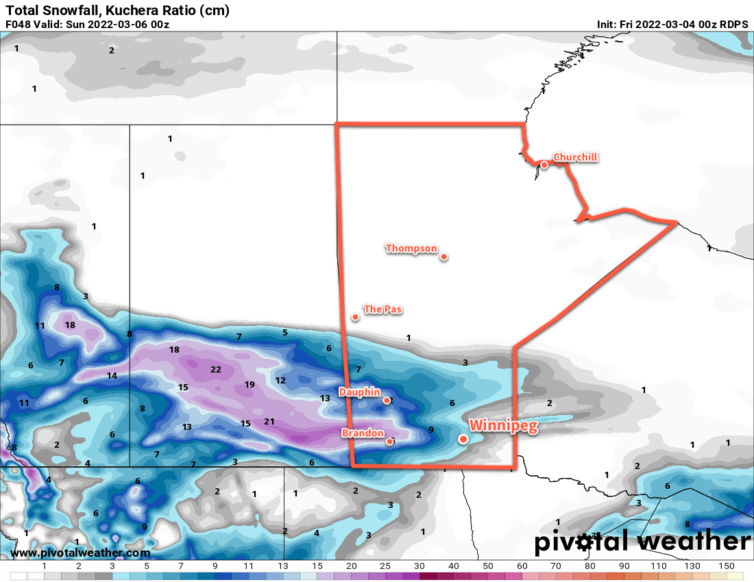
A disturbance moving through the province today will spread snow across the region. The heaviest snow will fall primarily over western portions of the province where 10–20 cm is possible by the time it tapers off on Saturday. Closer to Winnipeg, the snow will mainly fall to the west and north of the Red RIver Valley. In southern portions of the valley, only a trace of snow will be seen early this morning followed by a chance of flurries. Amounts will increase to the north and west; Winnipeg will see around 2 cm of snow followed by some flurries from this system, and amounts will increase closer to 10 cm heading towards Lake Manitoba and the Interlake.
Notably, this system will bring warmer air into the region. Temperatures in Winnipeg will climb into the -5 to -10 °C range today and stay there overnight, a far cry from the -31 °C seen early Thursday morning at the Winnipeg airport!
Conditions will improve on Saturday as the disturbance moves off to the east. To the south, a potent Colorado Low will develop and spread winter storm conditions across South Dakota and Minnesota Saturday night into Sunday. This leaves southern Manitoba in the clear with just a few flurries possible as some cloud lingers through Saturday. It will be a bit breezy with winds out of the north near 30 km/h. Skies will clear on Saturday night with temperatures falling into the -10 to -15 °C range.
More sun will return to the region on Sunday as the winds ease and a ridge of high pressure slumps southwards. Temperatures will again climb back above -10 °C during the day and fall to around -15 °C on Sunday night.
Long Range Outlook
Next week’s weather looks benign with variable cloudiness and more highs in the -5 to -10 °C range. A weak cold front may push through the region for Wednesday, ushering some cooler temperatures back into the region. But with the strengthening March sun, colder weather isn’t likely to stick around for very long.
Today’s seasonal daytime high in Winnipeg is -4 °C while the seasonal overnight low is -15 °C.