After a few days that threatened storms for the Red River Valley, we’re heading out the other side with most communities seeing little to no rain. Steinbach is a notable exception, with over 100mm of rain falling1 through a rather unusual rainfall event early Wednesday morning which produced significant overland flooding2.

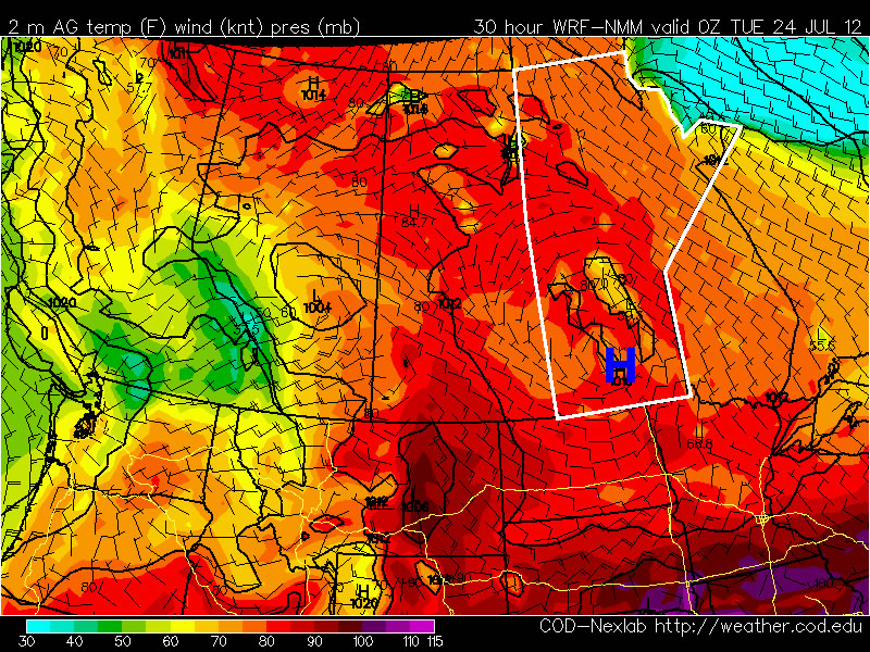
A pleasant start to the weekend is ahead, with no chance of showers until Saturday evening and overnight. Today we’ll see mainly sunny skies as our temperatures rebound from yesterday’s system up to a high near 26°C. The overnight low tonight will be around 15°C. Warmer air pushing in aloft will allow temperatures to climb higher on Saturday and Sunday, with daytime highs close to 30°C expected. Humidity will remain relatively low for Saturday, however things may get a little uncomfortable on Sunday as dewpoints begin to climb closer to the 20°C mark.
On Saturday a disturbance entering the province will generate some showers and thunderstorms over SW Manitoba through the late morning and afternoon hours. The (thunder)showers will spread eastwards through the evening and overnight, however it’s currently looking like the bulk of precipitation will occur through the Interlake. The northern half of the Red River Valley looks to have a decent chance of seeing some sort of precipitation, however the odds look very slim that the southern half will see anything.
We’ll see increasing cloud Sunday afternoon as the back side of this system prepares to swing through Sunday night. As it does, there will again be a chance of showers for Winnipeg and, as it looks now, the eastern RRV. We’ll be sure to provide updates in the comments as this system approaches.
new TWTR.Widget({
version: 2,
type: ‘list’,
rpp: 30,
interval: 30000,
title: ‘July 2nd, 2012’,
subject: ‘AWM Storm Chase’,
width: ‘auto’,
height: 500,
theme: {
shell: {
background: ‘#3c3c3c’,
color: ‘#eeeeee’
},
tweets: {
background: ‘#eeeeee’,
color: ‘#2c2c2c’,
links: ‘#489ce1’
}
},
features: {
scrollbar: true,
loop: false,
live: true,
behavior: ‘all’
}
}).render().setList(‘WeatherInThePeg’, ‘awm-team’).start();