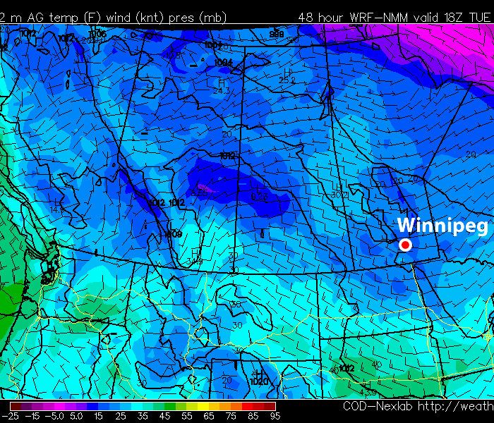
A Colorado Low system will bring the potential for snow over parts of the Red River Valley and South-Eastern Manitoba on Monday and Monday night. This will not be a particularly potent Colorado Low, but it could cause problems nonetheless.
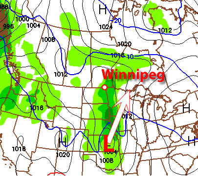
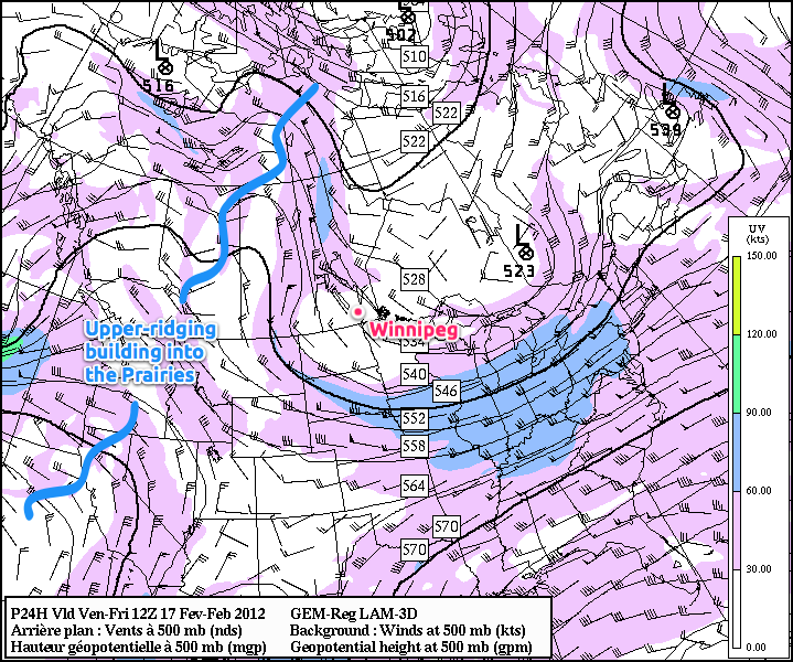
On Monday the Colorado Low system will be slowly moving north from the Central United States. The main low pressure centre will be located near the Nebraska/Kansas border around the noon hour and stall out over that region for the rest of the day. Meanwhile a secondary low pressure centre will be developing over Southern Manitoba or Northern North Dakota. This secondary low pressure centre will proceed to absorb the more Southern low centre on Monday night, creating one low near the Lake of the Woods by early Tuesday morning. Snow will begin in Southern Manitoba on Monday afternoon and the heaviest bands will exit the region on Monday night. Some light wrap-around snow may linger into Tuesday.
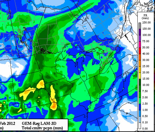
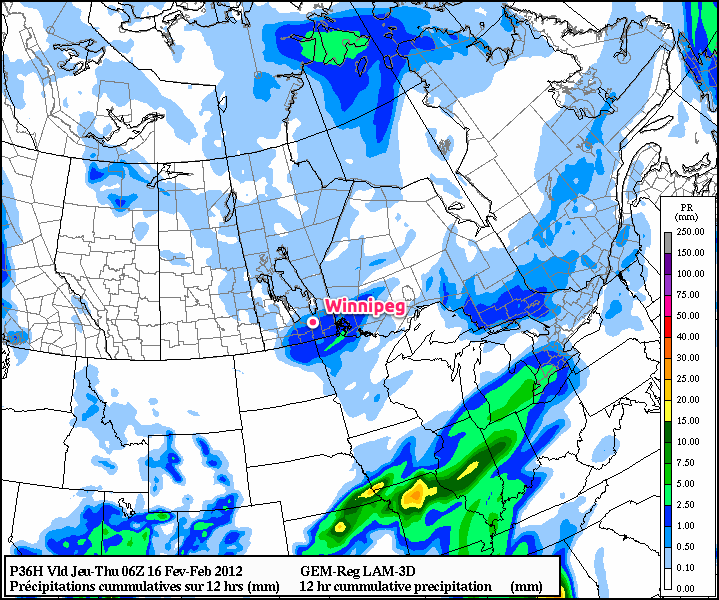
All that information is nice, but that main question for most people is “how much snow will we get”. This is where things get tricky. Some models (such as the GEM-Regional above) are suggesting that South-Eastern Manitoba, including Steinbach, Sprague, and the Whiteshell will get upwards of 10cm of snow. This same model is predicting somewhere around 5 to 10cm for Winnipeg. As you can see in the graphic above, there will be a sharp cut-off in snowfall amounts to our west. This means that areas such as Portage, Morden and Carman will probably see no more than 2cm, if that. The fact that there will be a sharp cut-off in snowfall accumulations makes predicting amounts for given cities very difficult. If the cut-off line moves a little bit further west, then Steinbach and Winnipeg may see 10cm of snow. However, if the cut-off line moves a little further east, then Winnipeg may see very little if any snow, while Steinbach and the Eastern Red River Valley only get a few centimetres. Other models have completely different ideas for snowfall amounts with this system, so don’t assume that the GEM-Regional is correct (in fact we never assume that models are correct!).
Now that I’ve given you the background information on this snowfall event, I will provide my personal predictions. As I have alluded to above, there is still lots of uncertainty in snowfall predictions and as such the below forecasts are simply my best “guesses” given the information available.
- Winnipeg: 2 to 4cm
- Steinbach: 4 to 8cm
- Portage: 0-2cm
- Morden: 1-3cm
- Whiteshell: 5 to 10cm, locally higher amounts near the Ontario border
Once we get through Monday, the weather will turn nice again. Tuesday and Wednesday will be warm with highs just below the zero mark in most parts of Southern Manitoba. Another low pressure system will be passing through our neck of the woods later in the week…but we’ll have more details on that later. Models are hinting at colder weather (i.e. below normal weather) for next weekend. Winter may not be done with us yet!
Elsewhere in Weather News
Giovanna – The Aftermath
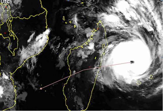
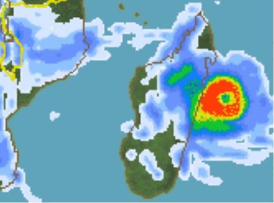
Since reported last week, Giovanna, a cyclone in the western Indian Ocean with category 4 intensity at its peak, reached the central coast of Madagascar and caused considerable damage. The dangerous cyclone left 15 people dead and about 40,000 people homeless, most of them on the eastern coast where the cyclone made landfall and brought with it a significant storm surge and intense rainfall. Thankfully the capital city of Antananarivo (population 1.4 million) managed to avoid the center of the cyclone but the city still experienced widespread blackouts.
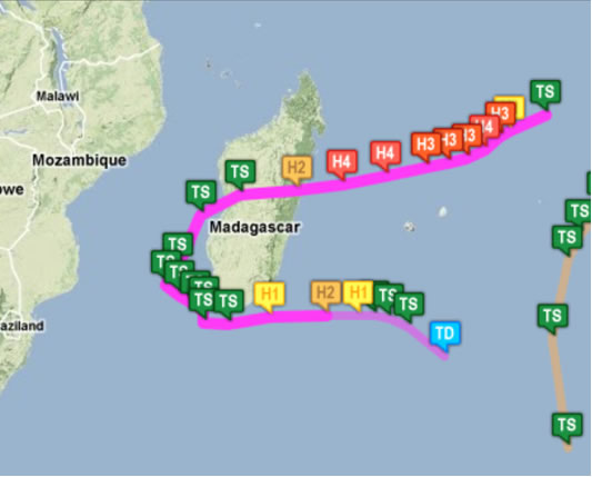
Had the cyclone’s track had been slightly shifted to the north by about 40km, the damage would certainly have been greater in the capital. At its peak (over the western Indian Ocean before making landfall) the storm reached an astonishing 1,000 kilometres in diameter with sustained wind speeds estimated at about 230km/h.
Since heading back out into the Indian Ocean (Mozambique Channel), Giovanna’s track was more favourable to those in the region as it had taken a southerly track then turned easterly, not only avoiding a second landfall in Madagascar, but also completely avoiding Mozambique –the country that was ravaged by disastrous floods this year.
Elsewhere in the world, weather has been relatively quiet compared the last couple weeks. Some other weather news that could possibly make headlines this week is: another winter storm arriving in the UK this past Sunday, strong thunderstorms affecting the southern United States this past weekend, flooding in Peru and Brazil’s recent heat wave.