A Warmer, But Stormier, Week Ahead

After a spell of cool, uneventful weather, things are set to become a little more interesting this week. We’ll see temperatures close to 20°C many days, but it won’t be all sunshine as we’ll have to contend with a more active storm track that will bring multiple storm systems through our region. How rainy will it be, and when can we expect thunderstorms? Read on to find out…

850mb Temperatures for Monday Night

850mb temperatures on Monday night, valid at 09Z May 1st, depicting the sharp warm front aloft present over Southern Manitoba.

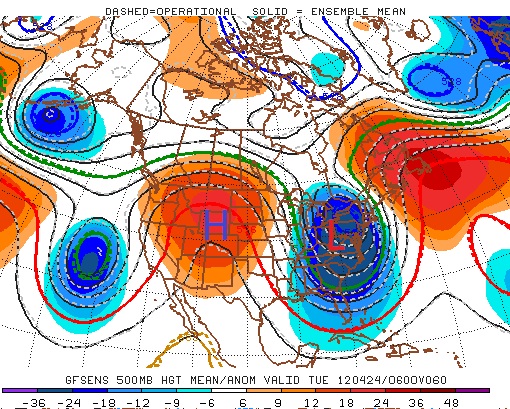
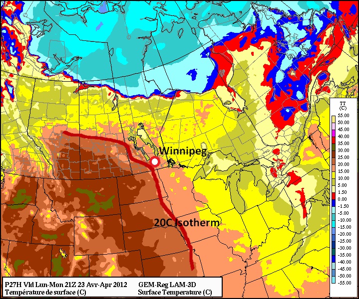
We’ll see a beautiful day today with highs right around 20°C for the RRV and a fair amount of sunshine with some clouds developing in the afternoon due to some lingering instability from yesterday’s system. A low pressure system tracking it’s way into Saskatchewan through the day will be lifting warm air northwards over Southern Manitoba, and by evening, a fairly strong warm front will exist aloft, running W-E through Southern Manitoba, with a cold front draped southwards from SW Manitoba to Wyoming. A 30-40kt LLJ will help thunderstorms trigger near the triple point in North Dakota, where additional lift will aid the jet as it overrides the surface warm front.

The triple point is the location where the warm front and cold front of a system intersect, signalling the location of the surface low or the associated occlusion. Triple points are an important feature in forecasting thunderstorms as they often are areas with enhanced lift and wind shear.

The first storms will likely fire in North Dakota and begin to lift into Southern Manitoba travelling NE with the upper flow, with more developing as they do so. Once more mature, the storms will tap into the convergence present aloft in a trough extending eastwards from the low heading into Saskatchwan and continue their way across Southern Manitoba. By morning, a line of thunderstorms present over Southern Manitoba will merge into a line of rain and showers extending all the way from SE Saskatchewan all the way back to the Rocky Mountains.

Thunderstorm Outlook for Monday Night

Thunderstorm outlook for Monday night (April 30/May 1).

The storms are not expected to be severe, however any regions that may see multiple thunderstorms training over the area could see in excess of 20mm of rain and cool temperatures aloft raise the possiblity of marginally severe hail (which, in Canada, is about the size of a nickel). Current indications are that the greatest risk for hail would be over the south-central RRV and back into the western RRV, from the US Border to near Carmen. Other than that slight risk, no severe weather is expected from the night’s storms.

Things will continue to lift northwards on Tuesday, however we may see some afternoon showers through the RRV as a secondary system tracks through the Dakotas. Temperatures will be warm, though, with daytime highs once again near 20°C despite the cloudy skies.

Wednesday and Thursday look nice, with more sunshine and highs continuing near 20°C with overnight lows in the mid to high single digits. A powerful system is forecast to track into the region on Friday bringing with it showers and thunderstorms. It’s far to early to say with any certainty where it will end up, but we’ll keep a close eye on it through the week and provide updates.


Elsewhere in Weather News

Suspected Tornado in UK Causes Damage

Britain’s dreadful spring continues to be plagued by extreme weather as flooding, very high winds and even a suspected tornado hit the Rugby area on Wednesday, April 25. Investigations are still underway, however, most evidence does point to a tornado. A path of destruction about a mile long through the neighbourhood could be seen – sheds tossed, a roof blown off – evidence that this was a tornado and not straight-line winds. More damage was reported where telephone lines had been snapped or torn down and roof tiles scattered across yards and roads. No injuries or deaths were reported but residents were in shock as only 30 tornadoes are reported yearly across the UK.
A separate incident occurred in Essex County where severe damage was caused to a barn and house, killing the 20 chickens inside. The farmer, who was outside at the time, got picked up off the ground and threw by what he described as a tornado swirling around him. Thankfully, he survived the ordeal.

Large Tree Down

Large tree down in Rugby as a result of the suspected tornado. (Source: Diane Slater)

Roof blown off house

Roof blown off a house in Rugby by suspected tornado. (Source: Sky News)

Destroyed Barn

Barn completely destroyed in Essex. (Source: Huntley/HVC)

Soggy April in UK

Britain’s odd weather doesn’t end there however. This past month, Britain has experienced very wet conditions, a big contrast from the extremely dry conditions experienced the past two winters. As restrictions are in place for water use because of the drought, UK is experiencing one of its wettest Aprils officially recorded. The main reason that they are still experiencing drought as this very soggy month moves on are for a couple reasons:

  • Spring/summer rainfall doesn’t refill aquifers (underground reservoirs of water).
  • Vegetation soaks up a significant amount of the rain that falls.
  • Downpours don’t reach very deep underground due to the hard soil on the surface, causing water to have trouble penetrating the ground and even worse, creating lots of runoff that leads to flooding.
    As of April 25th, the southern half of UK has placed 9th in all-time rainfall for the month of April since records began in 1910. With this being only 40mm off the record, they have a shot surpassing the old record before the end of the month as a strong system came ashore Saturday and is forecast to persist until at least May 1st.

UK Sat Image

On Sunday a very large area of low pressure could be seen off UK’s coast, bringing soggy conditions to most of the region. On Monday the low is expected to move slightly west, bringing another round of rain to the UK, perhaps dumping enough rain to reach the wettest April ever recorded. (Source: SAT24)

Elsewhere in Weather News is provided by Matt

Warm Start to the Week

This week will start out on the warm side as a high pressure ridge edges into Manitoba. Temperatures on Monday and Tuesday are expected to reach or exceed 20C, which will mark the first occurrence of a 20 degree reading since April 6.

A large ridge centred over Western North America will bring warm weather to Southern Manitoba on Monday and Tuesday

A large ridge centred over Western North America will bring warm weather to Southern Manitoba on Monday and Tuesday

Highs on Monday should be around 20C in most of Southern Manitoba. Skies will range from mainly sunny to mainly cloudy, with Winnipeg and the Red River Valley tending to be on the cloudier side and Western Manitoba on the sunnier end. As such South-Western Manitoba will likely be a bit warmer than the rest of Southern Manitoba. Tuesday will feature much the same weather as Monday with temperatures once again climbing up to around the twenty degree mark over Southern Manitoba. Skies on Tuesday will mostly likely be a mixture of sun and cloud, preventing temperatures from climbing much above 20 degrees. Should Monday or Tuesday be sunnier than currently expected you can easily add a couple degrees onto the temperatures listed above.

20 degree temperatures are expected in Southern Manitoba on Monday and Tuesday

20 degree temperatures are expected in Southern Manitoba on Monday and Tuesday

A cold front will slice through Manitoba on Wednesday, dropping our temperatures back down to normal values. Highs on Wednesday are expected to hover in the low teens in Southern Manitoba, while on Thursday temperatures will remain stuck in the single digits. A recovery in temperatures in expected to begin on Friday and stretch into the weekend.

No significant precipitation is expected this week, although some weak shower activity might form as a low pressure system and associated cold front pass through on Tuesday night and Wednesday.


Elsewhere in Weather News

Australian Rains

As Australia’s summer transitions into fall, heavy rains have pummelled its capital, Sydney, and surrounding regions resulting in flash floods throughout the area.

Rainfall map from this past week in NSW, including Sydney’s approximate location. (Source: Bureau of Met.)

Rainfall map from this past week in NSW, including Sydney’s approximate location. (Source: Bureau of Met.)

Between Monday, April 16th and Wednesday, April 18th, the New South Whales (NSW) region was hit hardest from the flooding where some areas received between 150mm-200mm of rain. The flash floods were triggered by a number of towns receiving rainfall of 40mm/h over a couple hours, and the fact that the soil was saturated in those areas due to heavy rainfall that occurred over the past month.

Parking lot swamped by water. (Source: Seven Network)

Parking lot swamped by water. (Source: Seven Network)

Emergency crews were called to assist residents whose cars were overtaken by water and also to help those trapped in their homes as water levels rose in a matter of hours. Utility crews were also busy due to more than a thousand people losing power.

Video of car struggling to cross flooded roads. (Source: mascott1963)

Unfortunately, more rain was forecast to fall this weekend as another slow moving trough/cold front stretched across the whole region. No additional flash flooding was reported with this latest rainfall, however more rainy days are expected to hit the coast this coming week which increases the risk of further flooding in the region where another 15mm-25mm are expected through to Wednesday.

This event comes just two months after the region located north of NSW, Queensland, was hit hard by flooding (brought to you on February 27th post). Australia’s eastern coast has seen its fair share of dangerous flash flooding already this year.

Elsewhere in Weather News has been provided by Matt

Cool Week Ahead; Tornado Alley Hit by Major Outbreak

Cooler weather has settled over Southern Manitoba and while it won’t stay below normal for long, we won’t really be hitting above normal temperatures any time soon, either. The week ahead looks like a middle-of-the-road week with some sun, some cloud, an a chance for some showers.

Tuesday Evening Model Analysis @ 850mb

850mb Analysis of the θe field from the NAM, valid at 00Z Tuesday Evening

Today will bring clear skies to Winnipeg with diminishing winds. Our expected daytime high of 2°C will be a whopping 9°C below our normal daytime high of 11°C for this time of year. Tonight we’ll drop down to a chilly -7°C under clear skies.

Tomorrow will start off sunny and then cloud over in the afternoon as a low pressure system moves across Southern Manitoba. The main shortwave will track through the interlake, bringing in slightly warmer temperatures aloft across Southern Manitoba. The main surface low, however, will track just south of our border, keeping the warmer near-normal, temperatures to our south. Given that Southern Manitoba will have the southern low skirting just south of the International Border and be under the influence of large-scale ascent associated with the shortwave tracking further north, it looks quite likely that an area of showers will blossom as the system moves into Manitoba, and that regions along or just north of the Trans-Canada highway southwards to the U.S. Border will see showers on tomorrow afternoon. As ususal, the exact track will be key, however it’s fairly likely that most communities in the Red River Valley will see some showers tomorrow.

Shortwave vs. Surface Low? A shortwave is the term applied to a troughing disturbance in the upper atmosphere that travels along with the main flow aloft. A surface low is a low pressure system present in the lowest levels of the atmosphere. Each shortwave will often have a surface low pressure system associated with it and the two work in tandem to link the upper and lower atmospheres together. They are not co-located, however, and when compared on a map, can be hundreds of kilometers away from each other.

Things will clear out quickly tomorrow evening and then the rest of the week looks fairly benign, with daytime highs around 7°C and overnight lows around -5°C. Temperatures may jump back to normal on Friday with the approach a more significant low pressure system, but models disagree on it’s exact placement and some keep us on the cooler side of thigns; we’ll have more on that later in the week.

8-14 Day Temperature Anomoly Outlook

8-14 Day Temperature Anomoly Outlook from the NAEFS model from 12Z April 15, 2012.

Temperatures across the Eastern Prairies have been slightly below normal lately due to a persistant upper low anchored near Southampton Island in Hudson Bay. This low has maintained a trough and NW flow aloft over the Eastern Prairies and has been responsible for helping shunt systems further south and keeping us cooler. This large-scale pattern is expected to hold for the next 6-9 days, however signs are pointing to a breakdown of the low and a significant upper ridge to build across the Prairies in the Day 9-12 range. Ensemble models seem to agree with this idea, and as shown above, the NAEFS currently has fairly high confidence for a return to above-normal temperatures next week.


Elsewhere In Weather News

Tornado Alley Hit by Major Outbreak

The major tornado outbreak that occurred in the US Plains on Saturday, April 14th 2012 will be remembered for many years to come. Every single ingredient for long-tracked, damaging tornadoes was present. The storms developed due to a low pressure system centered over the Nebraska/Kansas border which drew in moist air from the gulf and into the Plains –- this spawned extremely strong supercells along its dryline as it slowly moved eastwards.

In anticipating major storms, the SPC had given plenty of warning to the affected areas, issuing a high risk in the 2-day outlook which is a very rare occurrence that has only happened once before. The high risk for tornadoes meant that within a 40km radius there was a 45% chance of an EF-2 to EF-5 tornado in parts of Nebraska and Kansas.

Probabalistic Tornado Graphic issued by the Storm Prediction Center on Saturday, April 14th

Probabalistic Tornado Graphic issued by the Storm Prediction Center on Saturday, April 14th.

Supercells had already exploded in the morning in the state of Kansas but did not produce any tornadoes until about 11:30am when a tornado had been spotted just north-east of North Platte, KS. From then on, tornado sightings were reported every 15 minutes until nightfall as just about every supercell from Nebraska to Oklahoma had a good chance of producing a tornado. Also to be kept in mind is that these supercells produce huge hail, reaching softball size (11.4cm in diameter), and cause significant damage to just about everything as they fall.

Violent tornado near Cherokee, OK

In all, around 100 tornadoes were sighted and luckily, many of them kept populated areas out of harm’s way as they missed villages and major cities. Unfortunately, there was one major city that had not been spared. The city of Woodward, OK (town of 12,000) was directly hit by a tornado, with a preliminary rating of EF-3. Five deaths and 29 injuries occurred in this city as the sirens did not go off, due to the tornado having cut their power. What aided the probability of injury and loss of life was also that the tornado had hit just after midnight, when most residents were asleep and it is extremely difficult to spot a tornado.

Some of the strongest tornadoes produced on Saturday – preliminary ratings:

  • EF-4 that just missed Salina, KS.
  • EF-3 that struck south-east Wichita, KS.
  • EF-3 that killed 5 in Woodward, OK.
  • EF-2 that damaged more than 75% of Creston, IA (town of 250).

Here are a couple of the many breath-taking photos/videos captured yesterday by storm chasers and those affected:

EF-4 tornado that just missed Salina, KS.

A large tree limb punched through the car's side, product of the Wichita tornado. (Source: Cory Mottice)

A large tree limb punched through the car’s side, product of the Wichita tornado. (Source: Cory Mottice)

Home moved off its foundation and destroyed in Wichita, KS. (Source: AP)

Home moved off its foundation and destroyed in Wichita, KS.

Very powerful tornado north of Soloman, KS. (Source: AP)

Very powerful tornado north of Soloman, KS. (Source: AP)

Unfortunately the severe weather threat didn’t end there. More tornadoes were reported in the Upper Mississippi Valley on Sunday associated with the same system. As the system will race east on Monday, tornado probabilities are greatly reduced across the eastern half of the country however, severe thunderstorms are certainly not out of the question as cold air clashes with the warm air situated ahead of the system.

Elsewhere in Weather News is written by Matt

Chilly Start to the Week

We are about to get our first taste of below-normal weather in quite some time. Temperatures on Monday and Tuesday are expected to be several degrees colder than the seasonal average.

GEM model high temperature forecast for Monday

GEM model temperature prediction for 4pm on Monday

High temperatures on Monday are expected to hover around the zero mark in much of Southern Manitoba. Combined with a brisk north-west wind, conditions on Monday will be rather cool. If you consider the wind chill, it will feel closer to -6 on Monday afternoon (calculated using a temperature of 0C and wind speed of 25km/h). Tuesday won’t be much warmer, with highs only expected to creep up in the low single digits. The wind will be lighter on Tuesday, making it feel significantly warmer than Monday…although it will still be chilly. Both Monday and Tuesday are expected to be mainly cloudy, which will also hold our temperature back. If the sun does come out in some areas on a localized basis it will be slightly warmer. In early April the normal high is about 8 degrees in Southern Manitoba, meaning most areas will be between 4 and 8 degrees colder than normal through the first two days of the week. Models show a gradual improvement in temperatures as we move later into the week. By Wednesday we should get up into the high single digits and by Thursday the double digits will become likely.

In the longer range it appears that next weekend could be a bit unsettled. At this time models show a low pressure system moving up into the Northern Plains, spreading rain across a large area, which may include Southern Manitoba. It is too early to say if this system will affect us at all, but it is something to watch.

Looking even further ahead it appears we are in for a period of more normal weather. Longer range guidance is hinting at normal to slightly above normal weather for the next couple weeks. There is also some indication that our weather may remain somewhat unsettled, which is fairly typical for this time of year. Wouldn’t it be something if the first half of April was cooler than the second half of March!


Elsewhere in Weather News

Intense Low Affects Japan

A very powerful low pressure system made landfall in Japan on Tuesday, April 3rd and brought with it incredibly strong winds and much rain. This storm, believed to be the strongest storm to hit Tokyo since 1959, generated 90km/h sustained winds and 150km/h wind gusts at times (highest gust reported in Niigata prefecture, 156.6km/h), in the western part of Japan. Rain rates of over 60mm/h also fell associated with the squall line as it moved across most of Japan’s main island. This caused more than 20,000 homes to lose power, various buildings to collapse and trees to fall – causing 97 injuries and 4 deaths. Flight cancellations and railway closures also had to be taken into mind when traveling, as more than 600 flights were cancelled departing from Japan. The very strong winds resulted in trucks being flipped over on the highways and bridge closures, bringing the traffic to a crawl. Waves of 10m were experienced off the coast, however it was strongly advised to stay inside.

Image of the powerful low centered over the Sea of Japan (East Sea), as and after the squall line passed it produced very high winds. (Source: The Watchers/Japan Meteorological Agency)

Image of the powerful low centered over the Sea of Japan (East Sea), as and after the squall line passed it produced very high winds. (Source: The Watchers/Japan Meteorological Agency)

A high-pressure has since moved into place giving way to sunnier skies with some stronger winds associated with it.

Texas Tornadoes

This past week brought very active weather not only in Japan, but also the US, where violent tornadoes hit populated areas of Texas and caused significant damage. Two supercells dropped tornadoes simultaneously on the afternoon of April 3rd in the Fort Worth and Lancaster areas, causing the most significant damage. Preliminary estimates rate these tornadoes between EF-2 and EF-3, where winds are measured at 177km/h to 266km/h. Tornado warnings had been posted by the National Weather Service well before the storm hit allowing residents to take the necessary precautions; although significant damage was caused to neighbourhoods and industrial parks it could have been much worse. Ten injuries and no deaths were reported, the Dallas mayor called it “miraculous” to see that the numbers weren’t more significant after a big damage path could be seen from aerial view.

Tractor-trailer picked up by the tornado in the Dallas/Fort Worth area. (Source: Reuters/NBC)

Tractor-trailer picked up by the tornado in the Dallas/Fort Worth area. (Source: Reuters/NBC)

Tornadoes had not been the only culprit to cause significant damage that day, as very large hail was also reported with this storm. Hail damage to 100 airplanes at the Dallas airport was reported, with issues ranging from minor inspection needed, to planes being put out of service indefinitely.

Lancaster (just south of Dallas) tornado information, with RADAR captures. (Source: NWS storm reports)

Lancaster (just south of Dallas) tornado information, with RADAR captures. (Source: NWS storm reports)

This week, more storms are expected in Texas and most of the Plains, as the jet stream remains south of the border and systems push through Tornado Alley.

Elswhere in Weather News has been provided by Matt