Significantly above-normal temperatures will once again move into southern Manitoba as an upper-level ridge builds into the Prairies and draws mild Pacific air eastwards across the region.
Temperatures are heading up, up, up as warmer air spreads eastwards across the Prairies, pushed eastwards by a building upper-level ridge that is spreading across the region. The warm weather will peak on Friday with high temperatures near 5°C, some 10-15°C above average for this time of year. Friday’s high temperature may end up challenging the current record high for February 17th of 5.4°C set in 1981.

As with the warm spell in January, more abnormal will be the overnight lows which will be relatively mild, hovering near the freezing mark, thanks to fairly cloudy skies. This will result in overnight lows over 15°C above average for mid-February!
Aside from the warm weather, things will be fairly quiet through the remainder of the work week. Highs climb to around 5°C by Friday, lows up to the freezing mark, winds remain relatively light out of the south to southeast at 15-25 km/h, and skies cloud up tonight for much of the remainder of the week. No precipitation is expected through Friday.
Long Range
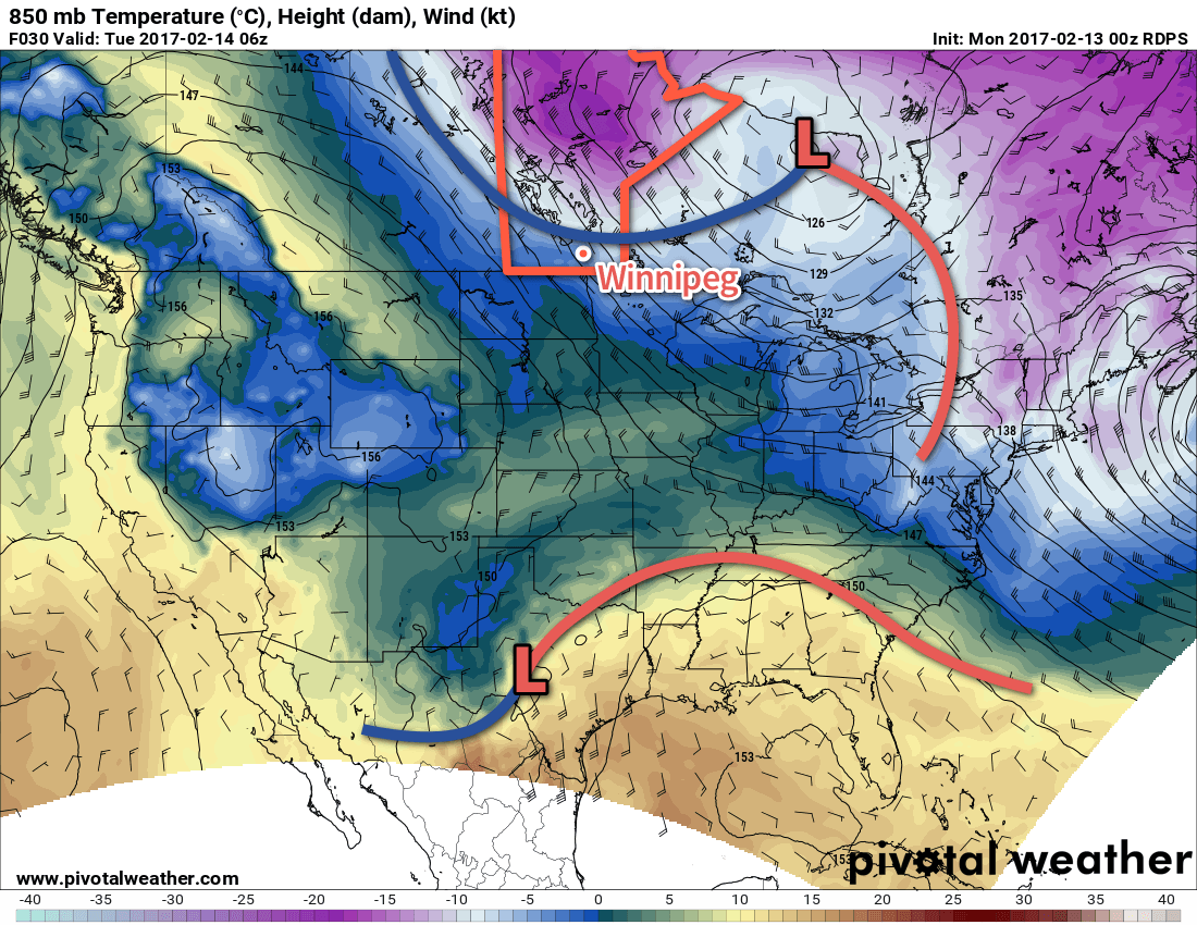
This weekend sees the upper-level ridge collapse, however temperatures will remain mild as a southerly flow is sustained by a developing Colorado Low. This system is forecast to lift northwards and then spread primarily rain through southern Manitoba on Monday and Tuesday.
Behind this system, temperatures will cool towards seasonal values and it appears a more active pattern may develop as the jet stream remains parked over the Northern Plains.
Winnipeg’s seasonal daytime high is currently -8°C while the seasonal overnight low is -18°C.