Cooler Weather Kicks Off An Unsettled Week

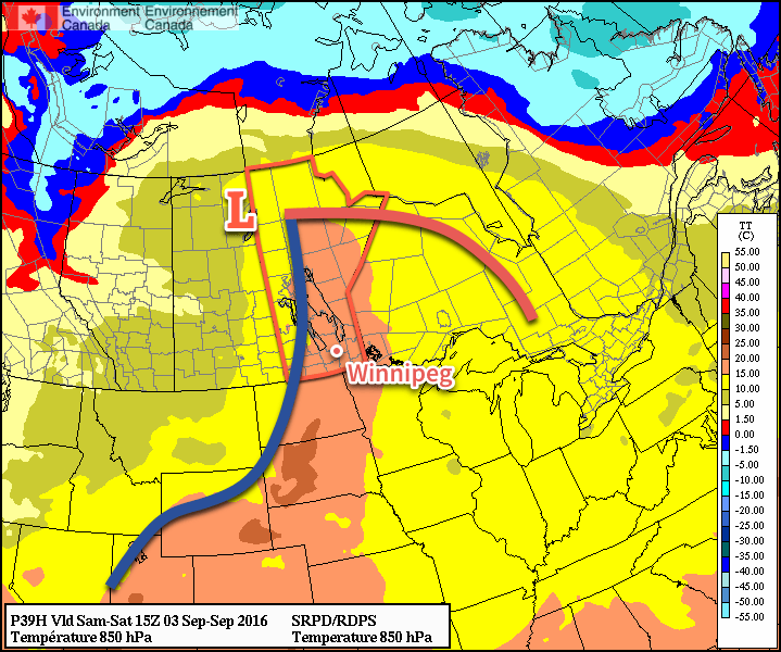
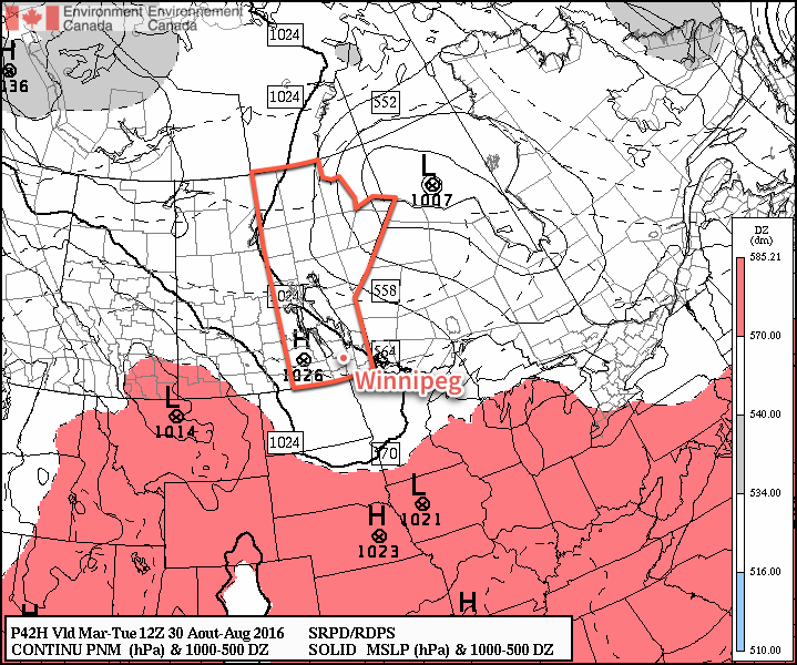
Markedly cooler weather will be in place across Winnipeg & the Red River Valley this week as a stagnant pattern locks the region into a series of disturbances that will bring unsettled weather through the week.

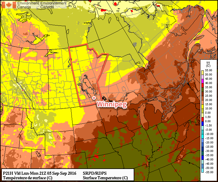
Mainly cloudy skies will be in place for Winnipeg & the Red River Valley today as the region continues to be under the influence of the series of disturbances that brought upwards of 75mm of rain over the weekend to some areas. Daytime highs will be cooler–slightly below seasonal–with the region seeing temperatures climb to about 19°C today.

Cooler weather will prevail across the entire Prairies today, with daytime highs in the 15-20°C range.

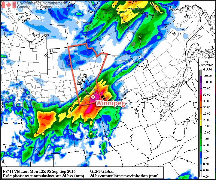
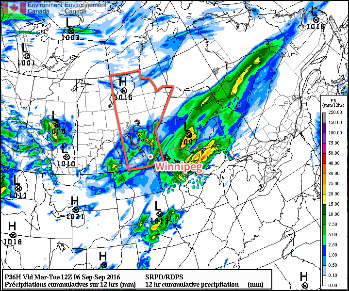
Another low pressure system will move through the region tonight, spreading showers across the province starting in the southwestern corner then spreading east-northeastwards into the Red River Valley and Interlake. Amounts should be fairly low with these showers, with only a few mm expected in the areas that see a little more activity. Temperatures will dip down to around 12°C overnight.

Scattered showers are expected across Southern Manitoba tonight.

The sun will gradually poke out on Tuesday with temperatures once again climbing to around 19°C for a daytime high. Temperatures will drop to around the 8 or 9°C mark on Tuesday night under partly cloudy skies.

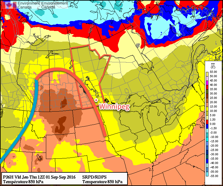
Wednesday will bring more cloud to the region as another disturbance approaches the region from the west. Temperatures will climb to a high near 20°C with much of the cloud building into the region in the afternoon. A chance of showers will build through the evening hours with some accumulating rain likely overnight through the region. Expect a low near 13°C.

Long Range

The cool weather continues through the remainder of the week with daytime highs continuing in the 19-20°C range. At this point, it looks like the chance for rain will taper off early Thursday morning, but another disturbance moving through on Friday will once again bring a chance of rain to the Red River Valley.

Winnipeg’s seasonal daytime high is currently 20°C while the seasonal overnight low is 8°C.

Weather Turns Unsettled For Labour Day Weekend

After a warm but windy day in Winnipeg & the Red River Valley today, the weather will turn unsettled for the weekend as multiple low pressure systems move through the province.

Today will be a warm and windy day over the Red River Valley. Temperatures will climb to a high near 27 or 28°C while strong southerly winds develop over the region ahead of a strengthening low pressure system in Saskatchewan. Winds near 30 km/h this morning will strengthen to 40 gusting 60 km/h by midday. That should be as strong as they get, however there is a slight chance that winds may reach as strong as 50 gusting 70 km/h.1 We should see plenty of sunshine, although by the second half of the afternoon some cloud cover will begin working into the region.

Tonight will be mild with plenty of cloud cover and windy conditions continuing. Winnipeg will see a chance of showers or thunderstorms overnight as the first weak impulse of many moves through. Expect a low near 18°C.

A cold front will push eastwards across the Red River Valley on Saturday.

Saturday will bring fairly cloudy skies, albeit with a few sunny breaks likely in the morning, and a chance of showers or thunderstorms as a cold front pushes into the Red River Valley, slowing down and stalling out through the day. Winds will start out around 30 gusting 50 km/h and then taper off as the front moves into the valley. Temperatures will reach a high near 26 or 27°C.

Any shower or thunderstorm activity will slowly move towards the southeast through the evening, however may only barely make it east of the Red River Valley by morning.

Sunday brings with it some uncertainty, but will likely be a wet day. For the first time in quite a while, we’ll be dealing with a Colorado Low moving through North Dakota and into northwestern Ontario. This system will push the front that passes through on Saturday back to the northwest, developing an area of rain that stretches from South Dakota all the way through Manitoba. How far west the rain will push remains an uncertainty; many models suggest the rain pushing northwest of Winnipeg with anywhere from 20-40 mm likely2 while others keep the entire area of rainfall just to the southeast of Winnipeg.

The GDPS, one of many solutions for Sunday, paints over 50mm of rain through the Red River Valley between Sunday morning and Monday morning.

In either of those outcomes, it’s still quite likely that areas to the south of Winnipeg, particularly in the southern Red River Valley3 will see accumulating rain along with breezy winds out of the northeast.

Temperatures will be cooler on Sunday with a high near 22°C. The rain should taper off by Monday morning with temperatures dipping to a low near 12°C.

Extended Forecast: Labour Day Monday

Monday will be a fairly cloudy day with cool conditions left in the wake of the Colorado Low. Winds will be breezy out of the north as temperatures climb to a high near 19°C. There will likely be a continued chance of showers, but nothing to the extent of what will be seen in places on Sunday. Monday night looks to bring another chance for showers or thunderstorms ahead of yet another disturbance moving into the region.

Winnipeg’s seasonal daytime high is currently 21°C while the seasonal overnight low is 9°C.


  1. Yesterday, numerous places in western North Dakota as well as Estevan, SK saw winds as high as 50G70 km/h. 
  2. Although higher amounts may be seen on a more localized basis. 
  3. Sorry, Letellier. 

Summer Heat Makes A Return

Summer-like warmth is on the way back to Winnipeg and the Red River Valley for the second half of the week as a deep southerly feed draws heat northwards out of the United States.

Today will be another pleasant day with seasonal conditions across the Red River Valley as the ridge of high pressure that brought pleasant days to the region continues its gradual trek across the province. Winds will continue light with daytime highs around 24°C and comfortable humidity. Tonight will see a seasonable 10°C for the overnight low.

A warm front will be pushing eastwards across Manitoba on Thursday.

Thursday will mark the return of hotter weather as a deep southerly flow develops ahead of a strengthening low pressure system in Alberta. Morning will bring a few clouds as a warm front pushes eastwards across the valley, bringing with it a chance for some showers or perhaps even a thundershower. After the warm front pushes through in the morning, winds will pick up out of the southeast through the remainder of the day to around 30 km/h by late afternoon. Those breezy southerly winds will draw warmer air northwards, pushing Thursday’s daytime high up to near the 28°C mark under partly cloudy skies in the afternoon.

Thursday night will be significantly milder than the past few nights as the warmer air in the region combines with breezy winds that persist through the night to keep the overnight low from dipping much below the 17 or 18°C mark. Skies will be mixed overnight, but no precipitation is expected at this point.

A strong pressure gradient in place over Southern Manitoba will bring windy conditions on Friday.

Friday will be a mild and windy day. Southerly winds of 40 gusting to 60 km/h will be in place over the valley for much of the day under partly cloudy to mixed skies as temperatures climb once again to around the 28°C mark. Friday night will be another mild one with an overnight low near 19 or 20°C with breezy southerlies continuing.

Weekend Outlook

This weekend will bring another mild, although likely unsettled, day on Saturday with a surge of humidity ahead of a cold front bringing the chance for some thunderstorm activity. Sunday looks cooler and drier with highs in the low 20’s and mixed skies.

Ridge of High Pressure Brings Seasonal Temperatures & Dry Weather

In the wake of yesterday’s cold front that brought some wild weather to Manitoba yesterday afternoon & evening, conditions will be significantly more benign as a ridge of high pressure moves into the Red River Valley and brings dry weather with seasonal temperatures.

There is not too much to say for today’s forecast post. Mainly sunny skies will dominate the region today as a ridge of high pressure builds in from the northwest behind yesterday’s cold from that moved across the region.

A ridge of high pressure aligned through Saskatchewan into southwestern Manitoba will bring benign weather to the region.

Winds will be breezy at 20-30 km/h first thing this morning, but will fairly quickly taper off into the 15-20 km/h range. Winds will remain light through Wednesday.

Temperatures will be fairly steady with daytime highs around 23-24°C all 3 days. Overnight lows will be cool, in the 9-11°C range on Monday night and Tuesday night, however slightly milder air begins working in on Wednesday night, bumping the overnight low up towards the mid-teens.

No precipitation is expected. Skies will be mainly sunny both today & Tuesday, however a little more cloud is expected on Wednesday, with sunny skies likely giving way to more mixed conditions in the afternoon.

Long Range

The second half of the week looks to bring warmer conditions back into the region with daytime highs climbing back towards the 27 or 28°C mark with variable cloudiness. Friday evening into Saturday looks to be the first chance of any more precipitation, with thunderstorms possible. At this point, it looks most likely that they would occur overnight into Saturday morning.

So a very pleasant week ahead with little precipitation; it’s nice to finally give some good news!

Winnipeg’s seasonal daytime high is currently 22°C while the seasonal overnight low is 9°C.