The Thanksgiving long weekend will end on a nice note, with mild temperatures and sunny skies for holiday Monday.
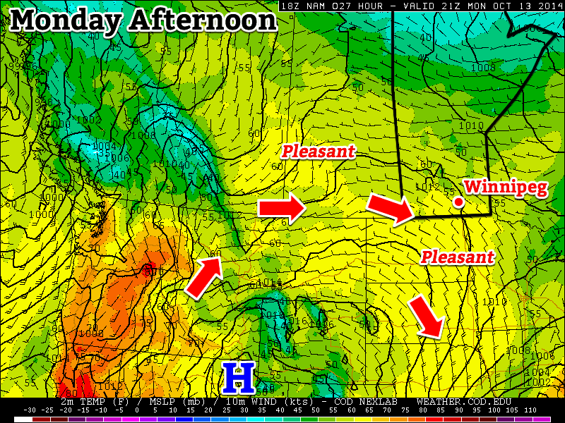
Monday
Today will be very nice in southern Manitoba. Temperatures will be in the mid teens with light winds and sunny skies. This pleasant weather is the result of a ridge of high pressure building over the Prairies, which will continue to bring mild conditions to Manitoba for much of the week.
Tuesday
Tuesday will be another nice day in southern Manitoba as temperatures climb into the upper teens. A gusty south wind will develop by late in the day, but otherwise it should remain quite pleasant. There will be an increase in cloudiness through the day, as some upper-level cloud cover begins to spill into Manitoba from the west.
Wednesday
Wednesday will see a continuation of the warm weather from Monday and Tuesday. However, there will also be a very stiff south wind, making it feel a bit chillier than it would otherwise be. Temperatures will nonetheless be in the upper teens or near 20C, which is of course well above normal for this time of year.
Long Range
A cold front is currently forecast to pass through southern Manitoba on Thursday, ushering in cooler conditions to end the week. However, models have been strongly hinting at a return to above-normal weather by next week, a trend that may last through the end of the month.