Windy Weekend Brings Summer Heat Back to Winnipeg

After a cool end to the week, breezy southerly winds will strengthen this weekend and bring summer temperatures back to the region.

Today will be one last seasonably cool day across the Red River Valley as an Arctic ridge exits the region. Temperatures will top out at only around 19°C with light winds. Winnipeg should see sunny skies, so although it’s cool, the light winds and sunshine should make for a pleasant June day. Temperatures will dip to a low near 8°C tonight with light southeast winds.

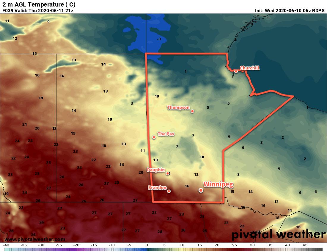
Temperatures will return to seasonal values on Saturday with a high near 23°C under mainly sunny skies. Winds will pick up through the morning into the 30 to 40 km/h range out of the southeast. With seasonal temperatures and a nice breeze keeping the bugs at bay, it will again be a pleasant June day! Temperatures will head to a low near 14°C on Saturday night.

NAM 10m Wind Forecast valid 21Z Sunday June 14, 2020
Moderate southeasterly winds will develop over southern Manitoba this weekend.

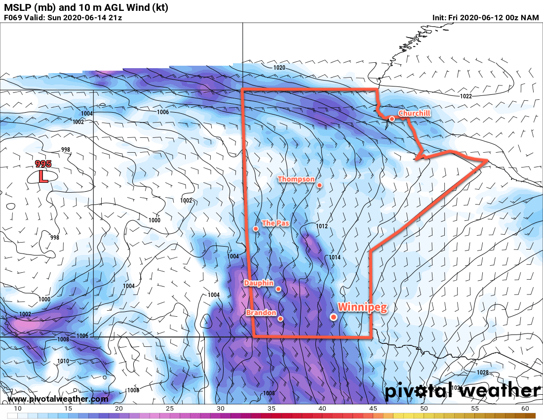
The winds will strengthen on Sunday to 40 gusting 60 km/h with temperatures continuing to climb to a high near 27°C. The city will see partly cloudy skies and no notable humidity will accompany the heat. Winnipeg will see more cloud cover on Sunday night with a chance of showers or thunderstorms. Temperatures will drop to a low near 17°C as the winds continue through the night.

Long Range Outlook

Next week will continue to be seasonably warm with highs in the mid-20s. Some unsettled conditions will develop as a series of low pressure systems move through. As is typical with summer lows here, they will be convectively driven so rainfall patterns will be hit and miss. Early indications are that western Manitoba will see most of the rain next week, providing some relief to flooded regions in the southeastern corner of the province. That said, all areas in southern Manitoba will see a chance of showers or thunderstorms through the first half of the week.

Today’s seasonal daytime high in Winnipeg is 23°C while the seasonal overnight low is 10°C.

Mid-Week Slump: Cool and Unsettled Weather

Winnipeg will see seasonably cool and unsettled conditions in the second half the work wake give way to warmer weather on the weekend.

Today will start off with a few early morning showers, then skies will gradually become mixed for the afternoon. Temperatures should reach a high near 19°C, but winds will stay brisk out of the northwest at 30 gusting 50 km/h. Late in the day, another shower or two is possible but most of the activity should stay to the west of the city. Winds will ease this evening then temperatures will head to a low near 8°C under partly cloudy skies.

Thursday will be a cool June day in the city with a high near 16°C and a north wind again near 30 km/h. The city will again see a mix of sun and cloud with a chance of showers as a cold front pushes through the region. Skies will clear out on Thursday night as winds ease and temperatures head to a low near 6°C.

RDPS 2m Temperature Forecast valid 21Z Thursday June 11, 2020
Much of southern Manitoba will see seasonably cool temperatures on Thursday.

Although cool, Friday will be a comparatively pleasant day in Winnipeg. The city will see a high near 17°C with light winds and partly cloudy skies. Temperatures will dip to a low near 7°C on Friday night.

Long Range Outlook

Warmer weather will push back into the region this weekend with temperatures returning to seasonal values. Saturday should bring mostly sunny conditions, but more cloud cover is possible. By Sunday night, the chance for showers or thunderstorms will return as another surge of warm air pushes towards the region. Next week will bring seasonably warm weather and occasionally unsettled conditions.

Today’s seasonal daytime high in Winnipeg is 23°C while the seasonal overnight low is 10°C.

Humid Monday Gives Way to Cooler Conditions

Winnipeg will see one more warm and humid day before cooler, drier air sweeps into the region.

Winnipeg will see temperatures, and the humidity, climb to start the work week. Skies will mix out this morning as a warm front pushes northwards through the region. Behind the warm front, temperatures will climb to a high near 28°C; with the humidity that arrives today, that will end up feeling more like the mid-30s. A cold front will begin to push across the Red River Valley this afternoon and be the focus for another round of thunderstorms. While a majority of the activity will likely develop over southeastern Manitoba, there is still a slight chance for a few showers or thunderstorms Winnipeg and areas south. Any thunderstorms that develop today will have the potential of producing severe weather with primary threats of large hail and/or damaging wind gusts.

Drier air will push into the region tonight as winds pick up out of the northwest to around 30 km/h overnight and temperatures drop to a low near 12°C. Skies will see increasing cloud through the night.

RDPS 2m Dew Point Forecast valid 21Z Monday June 8, 2020
Humid conditions will develop across the Red River Valley and southeastern Manitoba today.

Tuesday will bring mainly cloudy skies to Winnipeg as an upper trough pushes across the region. Temperatures will climb to a high near 20°C with northwesterly winds of 20 to 30 km/h. Some rain is likely over the southeastern sections of the province, but things should stay dry in Winnipeg. Temperatures will dip to a low near 10°C on Tuesday night with cloudy skies and light winds.

On Wednesday, the city will see mixed skies again as slightly cooler air continues to filter into the region. There may be a slight chance of showers as temperatures climb to a high near 20°C again. Winds will pick up out of the northwest to 30 gusting 50 km/h, making for a bit of a cooler, breezy day. Skies will stay partly cloudy overnight as temperatures dip to a low near 9°C with easing winds.

Long Range Outlook

The rest of the work week will bring seasonably cool temperatures to the city with skies on the sunnier side. For the weekend, seasonal temperatures will return with variable cloudiness.

Today’s seasonal daytime high in Winnipeg is 23°C while the seasonal overnight low is 10°C.

Pleasant Days Ahead With Increasingly Unsettled Nights

Winnipeg will see temperatures begin to climb again as a deep southerly flow begins pushing summer heat back towards the region. With it, though, will come increasingly unsettled overnight conditions.

Today will be a cool but pleasant day in Winnipeg. With partly cloudy skies and breezy northwest winds near 30 gusting 50 km/h, temperatures will climb to a high near 19°C. A ridge of high pressure sliding across the province will ensure the winds drop off quickly in the evening. Temperatures will dip to a low near 8°C.

On Saturday, seasonal temperatures will return to Winnipeg with highs climbing to around 22°C. Southeasterly winds will begin to pick up in the afternoon into the 20 to 30 km/h range. Skies should be mainly sunny as well, making for a great summer Saturday. Conditions will turn heading into the evening, though, as clouds move in ahead of a warm front approaching the region. Overnight, a strong low-level jet will develop, supporting a broad area of showers that will lift northwards through the night. The showers will have limited instability, so while isolated thunderstorms will be possible there won’t be a notable severe weather threat. The showers will exit the region late overnight or early Sunday morning. The southeasterlies will persist right though the night at 30 to 40 km/h and temperatures should dip to a low near 13°C.

NAM Simulated RADAR Reflectivity valid 09Z Sunday June 7, 2020
Showers will move through southern Manitoba on Saturday night.

Sunday will bring mostly cloudy skies to the region with winds gradually easing to 30 gusting 50 km/h. After Saturday night’s showers move out, the day should stay dry. The high temperature will be a bit tricky and highly dependent on how much sunshine the city ends up with. A rather warm and humid summer air mass will be moving into the region. If skies stay overcast, Winnipeg may see a high of only 23 or 24°C. If the sun manages to poke out a bit more, temperatures could reach as high as the upper 20’s. For now, we expect a few sunny breaks but otherwise mainly cloudy skies and a high near 26°C.

NAM 2m Dew Point Forecast valid 00Z Monday June 8, 2020
Humid conditions will move into Southern Manitoba on Sunday afternoon with dew points climbing into the upper teens.

It will be a warm night on Sunday night with a good chance of showers and thunderstorms. The region may see isolated to scattered severe thunderstorms on Sunday night; be sure to check ECCC’s thunderstorm outlook as the weekend progresses in our Bulletin Viewer. Temperatures will reach a low near 18°C on Sunday night with relatively humid conditions.

Long Range Outlook

To start next week, Monday will bring more hot and humid weather with high approaching 30°C and humidex values near 35. Drier westerly winds will move into the region by Monday evening, breaking the humid weather and allowing lows to return to the mid- to low teens. The rest of the work week looks to bring seasonal to slightly cool temperatures and variable cloudiness.

Today’s seasonal daytime high in Winnipeg is 22°C while the seasonal overnight low is 9°C.