NAM 2m Temperature Forecast valid 21Z Saturday November 16, 2019

Mild Temperatures and Cloudy Skies Arrive For The Weekend

After a seasonably cool Friday, milder temperatures and cloud cover will move into southern Manitoba for the weekend.

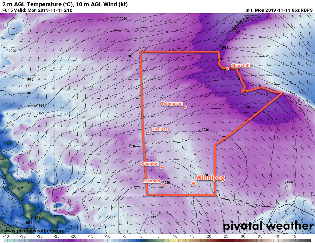
Another Arctic high moving through the province will bring cooler temperatures back to Winnipeg today. Temperatures will climb to a high near -5°C today with light winds gradually increasing out of the southeast to around 30 km/h by the evening. The city will see a mix of sun and cloud today, but a warm front moving into the region will spread overcast skies into the region this evening. The southerly winds will continue tonight with temperatures rising to around -2°C by Saturday morning.

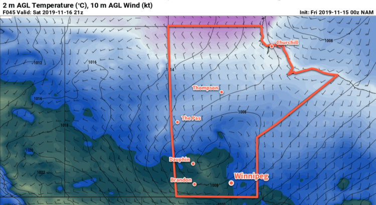
Skies will stay mostly cloudy right through the weekend as a series of low pressure systems works their way across the Prairies. Saturday will bring seasonably mild conditions to the Red River Valley with a high near +2°C in Winnipeg. Winds will taper off on Saturday afternoon, then pick up out of the northwest to around 30 km/h overnight as a weak cold front pushes through. There will be a chance for a few flurries as the front moves through, but no more than a centimetre or two should accumulate. Temperatures will dip to a low near -6°C on Saturday night.

Winds will ease on Sunday with mostly cloudy skies and a slightly cooler [seasonal] high near -2°C. Skies will stay cloudy on Sunday night as another low pushes across the northern Prairies; mild temperatures will persist with a low near -4°C in Winnipeg.

Long Range Outlook

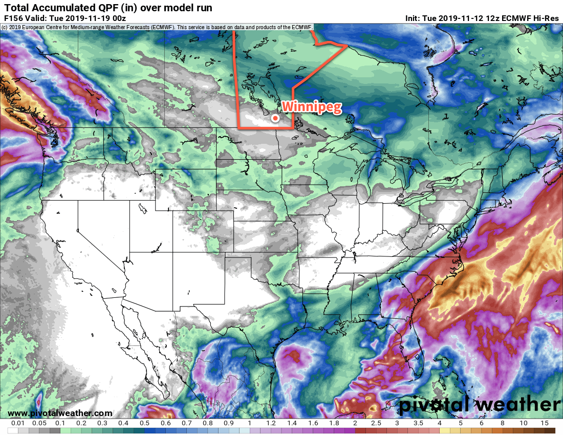
Winnipeg could see a bit of rain or snow on Monday with temperatures likely climbing back above 0°C again. It looks like a cloudy first half of the week is in store for Winnipeg as mild temperatures near freezing sticking around until the later half of the week. Some snow looks possible mid-week as a cold front swings through on Wednesday.

The sun should reappear in the second half of the week as Winnipeg moves into a stretch of near-seasonal temperatures.

Today’s seasonal daytime high in Winnipeg is -2°C while the seasonal overnight low is -9°C.

Temperatures Continue Trend Towards Seasonal

Temperatures in Winnipeg will go on a bit of a roller coaster until a more sustained period of seasonal temperatures arrives this weekend.

Winnipeg’s wobbly trend towards seasonal temperatures continues today as temperatures climb to a high near 6°C. The winds will be breezy later this morning out of the northwest at 20 to 30 km/h, but not as bad as yesterday’s southerlies. The city should see mixed skies today. A weak ridge moving into southern Manitoba tonight will ease the winds, clear the skies, and send temperatures to a low near -15°C.

A push of seasonal temperatures will spread into the Red River Valley on Thursday. The region will see southwest winds near 20 km/h in the morning shift northwesterly in the afternoon as a cold front drops through the region. As it often is with warm air, the city will see some cloudy periods as it moves in. Temperatures will be finally reach seasonal values with a high near -1°C. Another high will move through on Thursday night, clearing the skies, easing the winds, and sending temperatures to a low near -14°C.

RDPS 2m Temperature Forecast valid 21Z Thursday November 14, 2019
Temperatures will climb back to seasonal values across southern Manitoba on Thursday.

Friday will bring cooler temperatures back into the region with highs dropping down to around -8°C. The cool-down will be short-lived, though. Southeast winds of 20 to 30 km/h will develop through the day as warmer air already begins approaching through Saskatchewan. Some sun is possible early in the day, but Winnipeg will likely see mostly cloudy skies through much of the day. Those southerly winds will continue through Friday night with temperatures rising to around -3°C by Saturday morning.

Long Range Outlook

A longer stretch of seasonal to slightly above seasonal temperatures will arrive this weekend. Daytime highs will likely hover at or just above freezing right through into the start of next week.

ECMWF Total Accumulated QPF valid 12Z Tuesday November 12 to 00Z Tuesday November 19, 2019
The Red River Valley will remain fairly dry over the coming week as the storm track shifts into the northern Prairies.

The storm track also looks like it will remain to the north of us, keeping any significant precipitation events out of the region.

Today’s seasonal daytime high in Winnipeg is -1°C while the seasonal overnight low is -9°C.

Seasonably Cold Temperatures Continue

Winnipeg will continue to see seasonably cold temperatures through the first half of the work week.

A persistent north-northwest flow aloft will sustain the cold weather in the region through the upcoming work week. To start the week, an Arctic ridge will move into the province. This will keep temperatures cool in Winnipeg with a high of just -11°C. Skies should stay mainly sunny today with westerly winds near 20 km/h. Temperatures will head to a low near -18°C tonight with clear skies and light winds.

Temperatures will remain cold in southern Manitoba today with daytime highs in the -10 to -15°C. Average overnight lows for the region at this time of year are around -10°C.

Temperatures will warm slightly on Tuesday as the Arctic ridge moves off to the east, but it may end up feeling colder. A moderate southerly wind will develop, increasing to 40 gusting 60 km/h by midday. Skies will become increasingly cloudy later in the day as warmer air grazes the region. Temperatures will climb to a high near -7°C, then fall to a low near -12°C with mostly cloudy skies on Tuesday night. The winds will ease in the evening followed by a chance of flurries overnight.

Wednesday will bring mixed skies to the region as a cooler northwesterly flow develops again. Temperatures will climb to a high near -5°C with northwest winds around 20 km/h. A weak ridge moving through on Wednesday night will bring mainly clear skies and light winds as temperatures drop to a low near -11°C.

Long Range Outlook

A warm-up will begin in the second half of the week as the stagnant upper air pattern begins to break down. Thursday may bring highs back towards the freezing mark, followed by cooler temperatures again on Friday.

Heading into the weekend, a major shift may be in the cards back towards milder temperatures. Highs back near or just above 0°C look likely this weekend and into the first half of next week. That warmth will likely come with more cloud and a chance of a wintery mix of precipitation at some point early next week.

Today’s seasonal daytime high in Winnipeg is -1°C while the seasonal overnight low is -9°C.

GDPS 2m Temperature Forecast valid 06Z Monday November 11, 2019

Light Snow Ushers In Arctic Reinforcements

Southern Manitoba will see more light snow on Friday night and Saturday, ushering in another blast of Arctic air.

A low pressure system moving across the province will bring some milder air into the province alongside more light snow. Winnipeg will see temperatures climb to a high near -3°C today with southeast winds picking up into the 20 to 30 km/h range. Skies will stay mostly cloudy through the day.

As the low centre moves into the Red River Valley this evening, a shot of snow will move through the region. The snow should move through fairly quickly with a couple centimetres possible. The rest of the night should bring light winds and cloudy skies as temperatures dip to a low near -6°C.

Saturday will bring more cloud with highs once again climbing to around -3 or -2°C. There will be a chance for scattered flurries through the day. An Arctic ridge will begin pushing into the region and strengthen northwest winds into the 20 to 30 km/h range. Skies will begin to mix out overnight and the chance for flurries will shift towards streamers coming off of the lakes. Temperatures will dip a degree or two below -10°C on Saturday night as a reinforcing shot of Arctic air pushes southwards.

Temperatures will barely recover on Sunday with the city only seeing a high near -8°C. Northwest winds near picking up to 30 km/h will keep things feeling cold. There should be a bit of sunshine mixed in with the cloud across the region with a chance for some isolated flurries, particularly in the lee of the lakes. Winnipeg should see partly cloudy to mixed skies on Sunday night with a low near -17°C.

Long Range Outlook

Another couple cold days will kick off next week as the Arctic air moves through, but a transition into more seasonal conditions should arrive midweek. No significant snowfall is in the forecast.

Today’s seasonal daytime high in Winnipeg is +1°C while the seasonal overnight low is -7°C.