Warm Front Brings Chance of Snow, Release From Arctic Grip

A low pressure system will bring another chance of snow to Winnipeg on Tuesday. This system will also usher in a Pacific air mass that will finally bring an end to the persistent below-seasonal temperatures.

The Arctic air still wins today, though, and will keep Winnipeg’s high to a seasonably cool -2 °C. The wind will pick up out of the SSW this afternoon into the 30–40 km/h range, making it feel colder with wind chills close to -10. Skies will stay mostly sunny through the day, likely a welcome sight to those feeling the cloudy weather blues.

An approaching low pressure system will spread some cloud into the region by evening, giving partly cloudy skies to the city tonight. The winds will ease to around 20 km/h with temperatures dipping to a low near -8 °C.

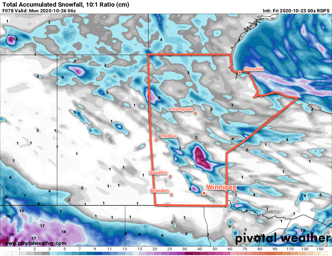
On Tuesday, a low pressure system crossing the Prairies will move into Manitoba. Skies will stay cloudy ahead of the low with southerly winds picking back up to 30 gusting 50 km/h. Temperatures will climb through the afternoon to +1 or +2 °C by the evening. Snow will spread into southern Manitoba from the northwest through the day. Winnipeg will see the best chance for any snow mid- to late-afternoon into the evening. Once the chance for snow passes, winds will shift southwesterly and ease to around 20 km/h. Temperatures will hover near or just above freezing through the night under cloudy skies. Relief from the Arctic chill arrives.

RDPS 2m Temperature Forecast valid 03Z Wednesday October 28, 2020
A warm front will push across southern Manitoba on Tuesday evening, finally bringing an end to the Arctic grip that’s been over the region for the past 12 days.

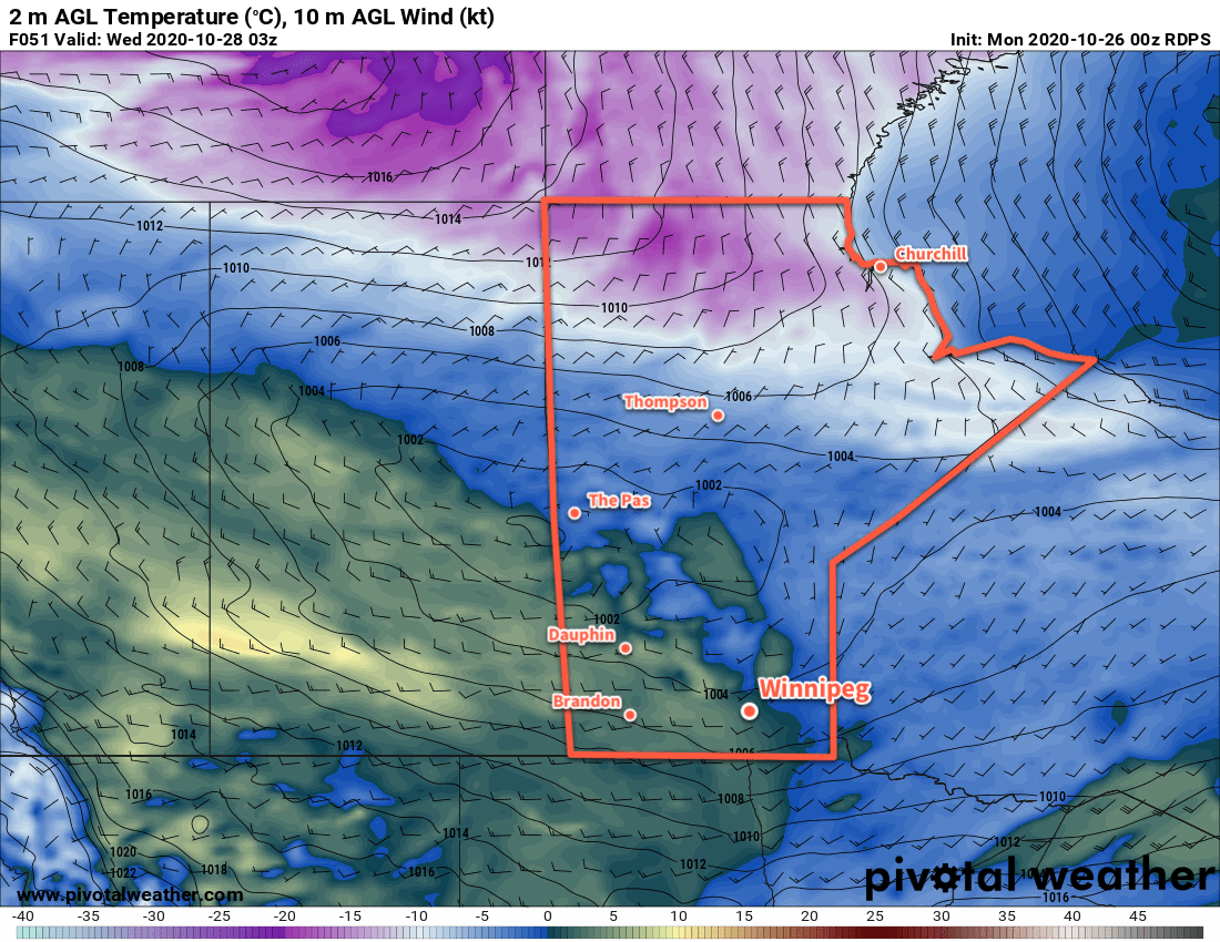
On Wednesday, Winnipeg will see mainly cloudy skies with a high near 4 °C. Westerly winds near 20 km/h will turn northwest later in the day as a cold front slumps southwards through the region. Skies should stay mixed on Wednesday night with temperatures dipping to a low near -6 °C.

Long Range Outlook

Looking ahead to the second half of the week, Winnipeg will see a continued return to more seasonal conditions. Little to no precipitation is in the forecast with daily highs returning to 7–10 °C by the end of the work week. These warmer temperatures will continue right through the weekend!

Today’s seasonal daytime high in Winnipeg is 6 °C while the seasonal overnight low is -3 °C.

More Cloud and Cool Weather Ahead

Winnipeg will see more cloud with a chance of flurries over the next few days as northwest winds stream lake-effect cloud into the Red River Valley.

Cool weather continues in Winnipeg and will persist right through the weekend. Daytime highs over the coming days of 0 to -2 °C will be some 7 to 10 °C below seasonal values. These cool temperatures will combine with west-northwest winds to generate a fair amount of lake-effect cloud. Overnight lows will also dip well below seasonal values, generally into the -5 to -10 °C range.

Today, the west-northwest wind will pick up into the 20–30 km/h range this morning. This wind will support lake-effect cloud and snow that will move off Lake Manitoba and towards Winnipeg. The wind will ease off tonight and turn more westwards, which will weaken the lake effect snow and bring some clear patches into the city.

On Saturday, winds will turn back northwesterly, but be lighter than Friday. As a result, Winnipeg will likely see a mix of sun and cloud, but flurries are unlikely for the day. Skies will stay mixed to mostly cloudy on Saturday night.

RDPS Total Accumulated Snowfall Forecast (at 10:1 SLR) valid 00Z Friday October 23 to 06Z Monday October 26, 2020
The Manitoba lakes will produce plenty of snow through the weekend as cool west-northwest winds power several bouts of lake-effect squalls.

On Sunday, Winnipeg will see mostly cloudy skies with another chance of flurries off Lake Manitoba as west-northwest winds once again pick up into the 15–25 km/h range. Winds will shift west-southwest on Sunday night and clear things out.

Long Range Outlook

Monday should bring sunshine to the region, but then cloudier conditions will return as a much more unsettled pattern develops over the region. While temperatures will continue with highs near the freezing mark, there will likely be several chances of widespread snow events through the week.

Today’s seasonal daytime high in Winnipeg is 7 °C while the seasonal overnight low is -2 °C.

Cool, Cloudy Weather Continues

Winnipeg will continue to see seasonably cool conditions with skies staying on the cloudier side.

The city will see a chance for some early morning light snow as the disturbance that brought snow to the region yesterday pushes off to the east. After that, Winnipeg will see mostly cloudy skies with a few afternoon sunny breaks possible. Temperatures will climb to a high near +2 °C with light west-northwest winds. Skies will cloud back over tonight as another disturbance movs towards the region. Temperatures will head to a low near -5 °C.

Thursday will bring cloudy skies to the city with a chance of light snow. Snow will push into the province from North Dakota as the day progresses; it may reach Winnipeg as far north as Winnipeg, but will mainly impact areas south and southeast. Temperatures will reach a high near +1 °C and winds will pick up out of the north into the 20–30 km/h range.

As those northerly winds pick up, they will support the development of more lake-effect snow from the Manitoba Lakes. The winds are forecast to shift northwesterly overnight, which will rotate the Lake Manitoba band towards Winnipeg. The city will see a chance of flurries overnight as temperatures dip to -5 °C again.

RDPS Forecast 24 hr. Snowfall Totals valid 12Z Friday October 23, 2020
Snow will graze across southern Manitoba on Thursday, followed by the development of more lake-effect flurries.

The cloud cover will finally break up on Friday, but persistent cloud cover form Lake Manitoba will keep skies mixed. The city will continue to see a chance of flurries as west-northwest winds of 20–30 km/h continue to bring a chance of flurries from Lake Manitoba. Temperatures will be a tad cooler with a high near +1 °C. The winds will turn westerly and ease on Friday evening with clearing skies. As long as those skies clear, then temperatures will head to a low near -12 °C.

Long Range Outlook

The weekend will bring a fair amount of sunshine with highs near the freezing mark and overnight lows in the -5 to -10 °C range. In fact…it’s much more of the same right through next week. Highs of -2 to 0 °C and overnight lows in the -5 to -10 °C range with variable cloudiness.

The only thing that could put a wrench in plans is if the lake-effect snow continues off Lake Manitoba into the weekend. If so, it won’t affect temperatures too much but the city could end up seeing some cloudy periods with a chance of light snow as well.

Today’s seasonal daytime high in Winnipeg is 8 °C while the seasonal overnight low is -2 °C.

Continuing Cool With Some Light Snow

Seasonably cool temperatures will continue in Winnipeg through the week with some light snow likely on Tuesday.

A persistent vortex over Hudson Bay continues to push Arctic air southwards across the Prairies. With little forecasted change in the long-wave pattern, below-normal temperatures will be the norm right into next week. Winnipeg will see highs climb just above freezing over the coming few days with overnight lows varying between around -3 or -4 °C and near -10 °C.

Today will bring partly cloudy skies to Winnipeg with a small chance of light snow from passing lake-effect clouds. Skies should clear out tonight as a ridge moves through, allowing temperatures to drop to a low close to -10 °C.

On Tuesday, a disturbance moving into the region will spread cloud into Winnipeg through the day. Light snow will spread through the province, reaching Winnipeg sometime mid- to late-afternoon. The city should see light snow through the night with a few centimetres accumulation possible.

24 hr. Forecast Snowfall Accumulation at 10:1 SLR valid 15Z Wednesday October 21, 2020
Light snow will spread across southern Manitoba on Tuesday into Wednesday.

The snow will ease up on Wednesday morning, followed by a few sunny breaks through the day.

Long Range Outlook

The city will continue to see variable cloudiness with the occasional chance for some passing light snow. With little change to the long-wave pattern expected in the coming week, don’t expect any significant changes in our day to day weather either.

Today’s seasonal daytime high in Winnipeg is 9 °C while the seasonal overnight low is -2 °C.