A series of high pressure systems tracking through Manitoba will bring dry weather with seasonal temperatures to the region over the next couple days.
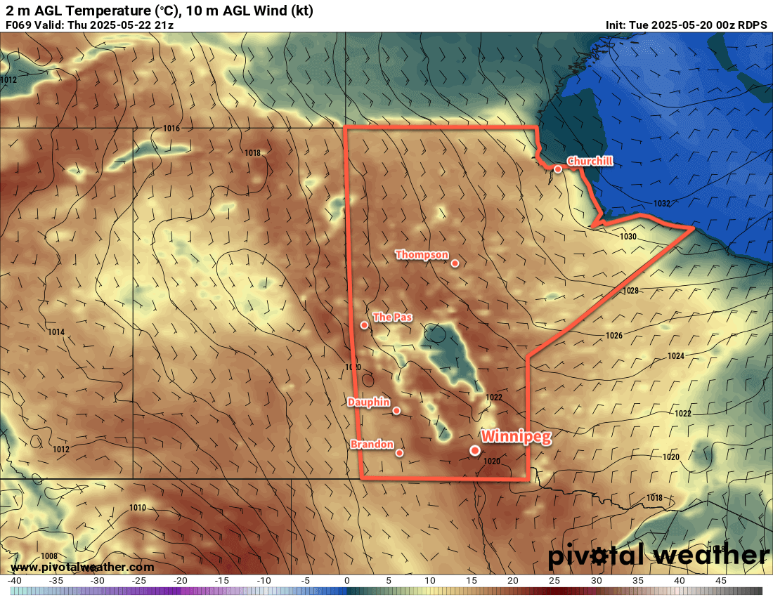
A weak upper-level ridge over the Prairies will keep persistent high pressure over Manitoba for a couple more days. Daytime highs today and tomorrow will sit in the mid-20s while overnight lows will likely dip into the low teens. Winds both days should sit out of the southeast in the 10 to 25 km/h range. Fortunately, these winds will help keep the air smoke-free. The days should bring plenty of sunshine with afternoon clouds possible.
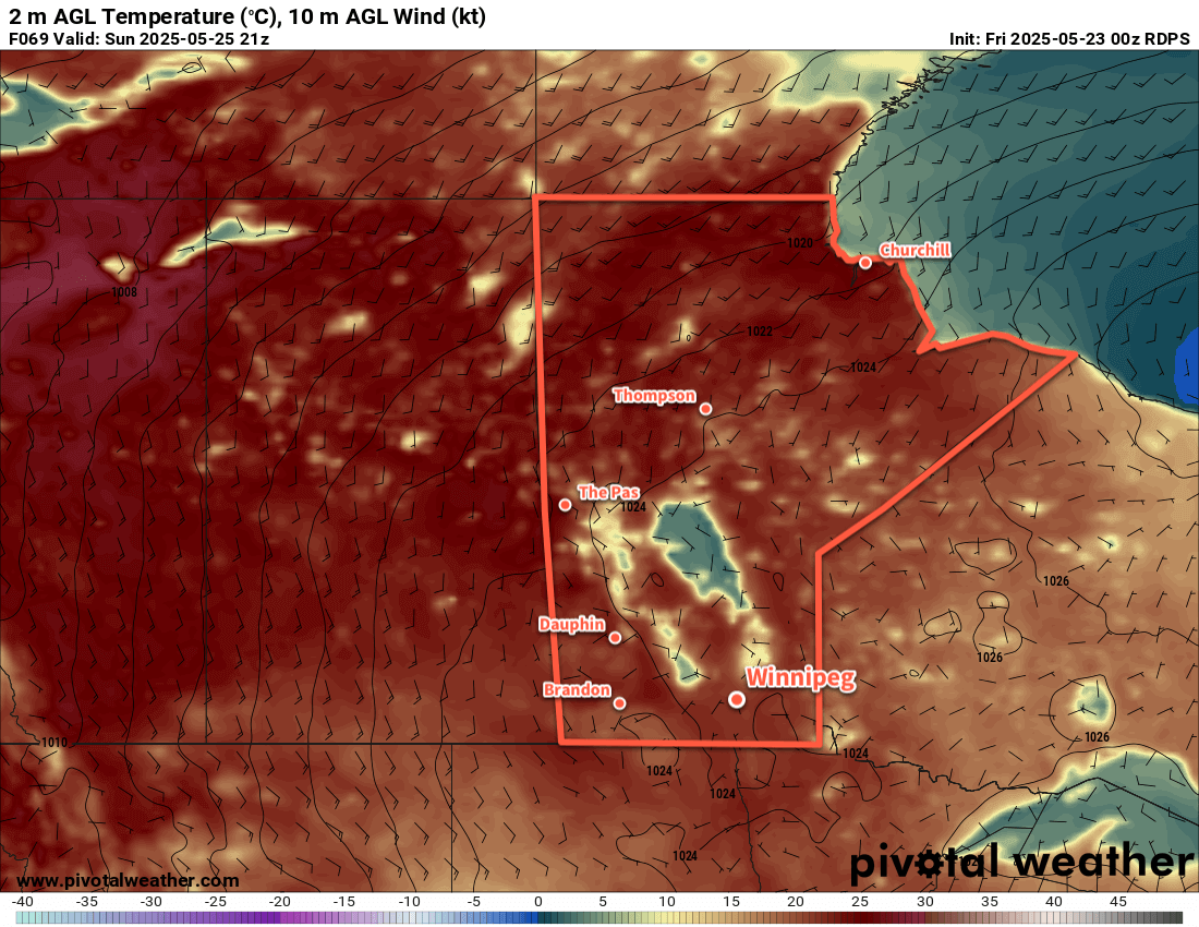
On Sunday, a low pressure system will push into central Manitoba. Southwest winds will push temperatures into the upper 20s with dew points climbing into the mid-teens. It’s been dry much of this spring and while it won’t be “humid,” you’ll be much more likely to notice the humidity out there on Sunday afternoon. There will be a slight chance of showers or thunderstorms on Sunday evening. Temperatures will head down to a low in the 15 to 20 °C range on Sunday night with winds easing to light northerly.
Long Range Outlook
Monday will likely bring more unsettled weather as the influence of the departing low gradually wanes.
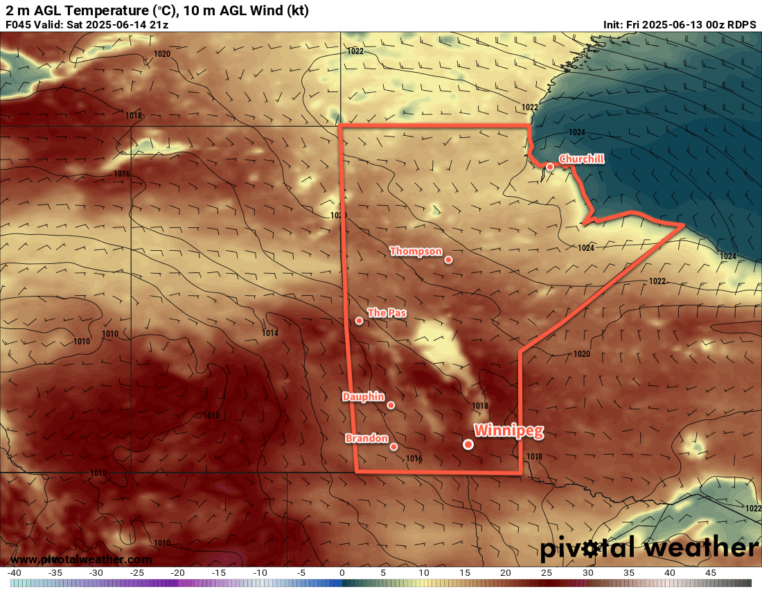
It looks warmer next week with daytime highs in the mid- to upper-20s through much of the week and overnight lows in the mid- to upper teens. With that, there will be more chances for showers or thunderstorms as a few systems move through in the course of the week.
The more active pattern could bode well for the fires over central Saskatchewan and Manitoba with accumulating rain possible across those areas.
Today’s seasonal daytime high in Winnipeg is 23 °C while the seasonal overnight low is 10 °C.